From Noulette to Aix via the greenway

This walk is a great way to get some fresh air with the family or friends

Details

67184042
Creation:
Last update:
Last review:
  • Walking
    Activity: Walking
  • ↔
    Distance: 4.00 mi
  • ◔
    Average duration: 2h 00 
  • ▲
    Difficulty: Easy

  • ⚐
    Back to start: Yes
  • ↗
    Ascent: + 167 ft
  • ↘
    Descent: - 167 ft

  • ▲
    Highest point: 423 ft
  • ▼
    Lowest point: 259 ft

Photos

Description of the walk

Start from the car park at the end of Rue du Pré.

(S/E) Leave the car park and turn left onto Rue du Pré. Carry on straight ahead along Rue de la Chapelle.

(1) Go past it and carry on to the first lane on the left. Go past it to reach a Fork in the road.

(2) Turn left twice to reach Allée des Jonquilles, then stay on the path to the right to enter the Espace Garandel.

(3) Keep to the right and carry on straight ahead. Pass the care home on your left to reach Rue Notre-Dame-de-Lorette.

(4) Carry on to the left and straight ahead until you reach the Y-junction.

(5) Turn right and carry on straight ahead until you reach a 90° left-hand bend.

(6) Stay on the track and follow it to the end on Chemin des Vingt.

(7) Pass the junction with the path leading to the military cemetery.

(8) Turn left, then right onto Chemin de Lorette and carry on straight ahead until you reach the second junction.

(9) Turn right and carry on straight ahead until you reach the Chemin du Roi d’Angleterre.

(10) Turn left, then take the first left to reach the car park (S/E).

Waypoints

  1. S/E : mi 0 - alt. 328 ft - Car park, Rue du Pré
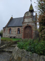
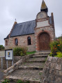
  2. 1 : mi 0.37 - alt. 312 ft - Chapel
  3. 2 : mi 0.69 - alt. 315 ft - Fork in the road towards Allée des Jonquilles
  4. 3 : mi 0.95 - alt. 325 ft - Garandel area
  5. 4 : mi 1.23 - alt. 259 ft - Rue Notre-Dame-de-Lorette
  6. 5 : mi 1.67 - alt. 354 ft - Y-junction
  7. 6 : mi 2.13 - alt. 420 ft - Left-hand bend
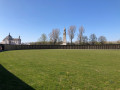
  8. 7 : mi 2.49 - alt. 377 ft - Cimetière militaire britanique (Aix-Noulette)
  9. 8 : mi 2.62 - alt. 384 ft - Chemin des Vingt. Path towards the - Cimetière National de Notre-Dame de Lorette
  10. 9 : mi 3.19 - alt. 354 ft - Crossroads
  11. 10 : mi 3.54 - alt. 361 ft - Chemin du Roi d’Angleterre
  12. S/E : mi 4 - alt. 328 ft - Car park, Rue du Pré

Notes

No water source.

Worth a visit

Chapel.

Reviews and comments

4.8 / 5
Based on 2 reviews

Reliability of the description
5 / 5
Ease of following the route
4.5 / 5
Route interest
5 / 5
souchez rando
souchez rando

Thank you for your feedback. We wish you all the best on your hikes.

Machine-translated

Thierry DEBEE
Thierry DEBEE

Overall rating : 4.7 / 5

Date of your route : Apr 27, 2026
Reliability of the description : ★★★★★ Very good
Ease of following the route : ★★★★☆ Good
Route interest : ★★★★★ Very good
Very busy route : No

A really good route; everything was clear

Machine-translated

souchez rando
souchez rando

Thank you for your feedback. I hope you’ll enjoy other walks in the area.

Machine-translated

Nelou
Nelou

Overall rating : 5 / 5

Date of your route : Mar 03, 2025
Reliability of the description : ★★★★★ Very good
Ease of following the route : ★★★★★ Very good
Route interest : ★★★★★ Very good
Very busy route : Yes

A pleasant walk suitable for everyone.
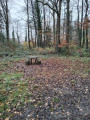
A section of the route through woodland should be avoided after a few days of rain.
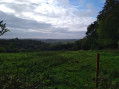
The rest of the route follows a tarmac footpath through the fields.
A real breath of fresh air!

Machine-translated

Other walks in the area

For more walks, use our search engine .

The GPS track and description are the property of this route's author. Please do not copy them without permission.