Country:
 City:
City:


Start from the Pyramide car park, Rue Carnot.
(S/E) Head uphill towards the cemetery, take the street on the right and carry on straight ahead until you reach a four-way junction before the power line.
(1) Carry on straight ahead, then continue to the crossroads at the top of the hill.
(2) Take the path leading down to the right and continue straight on until you reach the D58.
(3) Cross it carefully and follow it to the right, then take the path on the left and carry on straight ahead until it ends.
(4) Turn right onto the road, walk past the buildings on your left and continue to a Fork in the road.
(5) Turn left and carry on straight ahead to the village of Ablain-Saint-Nazaire.
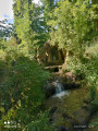
(6) Keep to the right, cross the road, then turn left and carry on straight ahead, following the River Souchez – first on your left, then on your right – until you reach Rue du 8 Mai.
(7) Cross it and follow the Souchez on your left. Cut across Rue Ponthiers and follow it to the end.
(8) Turn right and then right again at the end before continuing straight on to Rue de la Blanche Voie.
(9) Head up to the left and, a little further on, take the path opposite for a few metres, before turning right again to reach Rue de Lens.
(10) Turn left onto this street and carry on straight ahead. Pass under the high-voltage power line and you’ll soon reach Chemin Vert.
(11) Head down it to the right and continue straight on, cutting across a street and then rejoining it further down. Follow it to where it ends at Rue Péri Brossolette.
(12) Turn left onto this street, cross the road and the square, head straight across to Rue Raoul Briquet and continue along this street until you reach the last houses in Souchez at a junction.
(13) Turn right and carry on straight ahead. Then follow the road to the right, cross to the opposite side at the next junction and you’ll come to a bend.
(14) Head down to the right towards the spring, carry on straight ahead, cross Rue Victor Hugo and Rue Carnot, and reach the car park (S/E).


 Association / Club / Walk leader

 Visorando Member
 Easy
Easy