Le Champ des Saints depuis Vimy

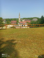
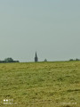
Venez découvrir les villages de l'Artois par Farbus, Willerval et Vimy. Randonnée entre bois et plaine avec vue sur les terrils de Loos-en-Gohelle

Details

64003017
Creation:
Last update:
Last review:
  • Walking
    Activity: Walking
  • ↔
    Distance: 7.95 mi
  • ◔
    Average duration: 3h 55 
  • ▲
    Difficulty: Moderate

  • ⚐
    Back to start: Yes
  • ↗
    Ascent: + 289 ft
  • ↘
    Descent: - 308 ft

  • ▲
    Highest point: 453 ft
  • ▼
    Lowest point: 223 ft
  • ⚐ Country: France
  • ⚐ City: Vimy (62580)
  • ⚑
    Start/End: N 50.373054° / E 2.810001°
  • ❏
    IGN map(s): Ref. 2406E
  • Hour-by-hour weather

Photos

Description of the walk

Start at Place de la République

(S/E) Leave the car park. Turn your back on the town hall and take Rue du 11 Novembre. At the bottom, turn left onto Rue Gambetta, then right onto Rue des Croix, and continue to the junction with Rue Jean Moulin.

(1) Turn left here. At the end of the street, turn right onto the steeply ascending path and continue straight on until you reach the Bonval junction.

(2) Keep left, then left again, then right, then left again, and carry on straight ahead until you reach a junction at a place called Dessus le Bois.

(3) Carry on to the left; at the end, turn right onto Rue de la République, then turn right at the bend onto Rue du 8 mai 1945, and carry on straight ahead until you reach Rue du 19 mars 1962 (D50).

(4) Cross the road with care and head straight across to Rue des Queuettes, then continue along this road until you reach a right-angle bend.

(5) Turn left, then carry on straight ahead. At the end, near the railway line, turn left onto Chemin de Bailleul and carry on straight ahead until you reach the junction.

(6) Turn right onto Rue Lamartine and continue straight ahead. After the level crossing, take the second right until you reach the crossroads.

(7) Keep left. At the end, turn left, then carry on straight ahead, passing the church on your left. At the end, keep left, then turn right, then left again, and carry on straight ahead until you reach the railway line.

(8) Turn right and walk alongside the railway line. At the end, keep to the left as you pass under the railway line and carry on straight ahead until you reach a junction.

(9) Cross carefully and head straight ahead, then turn right just before the house. Walk past the Saint-Ranulphe spring and carry on straight ahead until you reach the junction with a cross.

(10) Turn right, then immediately right onto Rue Faidherbe, and carry on straight ahead until you reach a path on the left.

(11) Follow this path and, at the end, turn right to reach the car park (S/E).

Waypoints

  1. S/E : mi 0 - alt. 259 ft - Place de la République car park
  2. 1 : mi 0.57 - alt. 289 ft - Rue Jean Moulin
  3. 2 : mi 1.14 - alt. 449 ft - Bonval
  4. 3 : mi 2.23 - alt. 413 ft - Above the Wood
  5. 4 : mi 2.92 - alt. 322 ft - Rue des Queuettes
  6. 5 : mi 3.32 - alt. 358 ft - Bend
  7. 6 : mi 4.07 - alt. 272 ft - Rue Lamartine
  8. 7 : mi 4.62 - alt. 236 ft - Junction
  9. 8 : mi 5.87 - alt. 246 ft - Railway line
  10. 9 : mi 6.56 - alt. 272 ft - Junction
  11. 10 : mi 7.43 - alt. 269 ft - Junction with Rue Faidherbe
  12. 11 : mi 7.7 - alt. 249 ft - Path on the left
  13. S/E : mi 7.95 - alt. 259 ft - Place de la République car park

Notes

Pas de point d'eau

Worth a visit

Farbus Church
Willerval Church and Town Hall
St Ranulphe Spring

Reviews and comments

5 / 5
Based on 1 review

Reliability of the description
5 / 5
Ease of following the route
5 / 5
Route interest
5 / 5
Syned 26
Syned 26

You can check my account or go directly to Visorando

Machine-translated

Baptiste62
Baptiste62

We’d love to – thank you very much. We’re looking for walks around Vimy, Arras, Ablain-Saint-Nazaire and so on, with very few towns, as we’re lucky enough to have beautiful countryside in this area, with paths, woods, fields and lovely little villages to pass through, such as Mont-Saint-Eloi, Acq, Ecoivres and so on.

Machine-translated

Syned 26
Syned 26

Thank you for your feedback. We are a hiking club and aim to help people discover our region through walks of varying lengths. I’ll continue to share them.

Machine-translated

Baptiste62
Baptiste62

Overall rating : 5 / 5

Date of your route : Dec 15, 2024
Reliability of the description : ★★★★★ Very good
Ease of following the route : ★★★★★ Very good
Route interest : ★★★★★ Very good
Very busy route : No

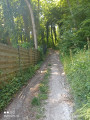
A lovely walk through fields and woods. Very few built-up areas, and some lovely scenery. It’s also an excellent route for trail running training.

Machine-translated

Other walks in the area

For more walks, use our search engine .

The GPS track and description are the property of this route's author. Please do not copy them without permission.