Le terril 52 à Bully-les-Mines

Belle randonnée, à faire en famille, entre ville et campagne, plus découverte du parcours du disc golf.

Details

61245680
Creation:
Last update:
Last review:
  • Walking
    Activity: Walking
  • ↔
    Distance: 4.40 mi
  • ◔
    Average duration: 2h 05 
  • ▲
    Difficulty: Easy

  • ⚐
    Back to start: Yes
  • ↗
    Ascent: + 30 ft
  • ↘
    Descent: - 30 ft

  • ▲
    Highest point: 187 ft
  • ▼
    Lowest point: 128 ft

Photos

Description of the walk

Start at Place Victor Hugo, Rue Voltaire (note: market on Thursday and Saturday mornings until 1 pm).

(S/E) With your back to the square, turn left and walk up Rue Voltaire until you reach the second four-way junction (Rue Saint Exupéry).

(1) Turn left, then left again at the end onto Rue Coste et Bellonte, then right onto Rue Casimir Beugnet, and continue straight on until you reach the two bridges.

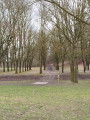
(2) After the second bridge, turn left onto the footbridge (wooden walkway); at the end, cross the road and enter Terril 52.

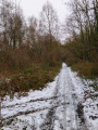
(3) Take the path on the right, which slopes down slightly, and follow the road on the right. Carry on straight ahead to go round the slag heap, and return to its entrance.

(3) There, turn right, go under the bridge and, immediately on the right, take Rue des 4 Vents. Carry on straight ahead until you reach the second road, by a housing estate.

(4) Cross the road carefully and head opposite to walk through the housing estate along Rue Wisla until you reach Rue Jean Bart.

(5) Turn right and, at the end, turn right twice to take Rue des Champs, then carry on straight ahead to the park.

(6) Cross the road to the opposite side, into the park, and follow the path until you reach a street.

(7) Turn right onto Rue Jean Merle (concrete bollards), then left, and at the end, turn right. Before the roundabout, turn left to return to the car park (S/E).


Waypoints

  1. S/E : mi 0 - alt. 157 ft - Place Victor Hugo
  2. 1 : mi 0.23 - alt. 174 ft - Rue Saint Exupéry
  3. 2 : mi 0.79 - alt. 144 ft - Two bridges and an overpass
  4. 3 : mi 1.2 - alt. 148 ft - Entrance to the slag heap
  5. 4 : mi 2.79 - alt. 148 ft - Residential area
  6. 5 : mi 3.27 - alt. 164 ft - Rue Jean Bart
  7. 6 : mi 3.85 - alt. 180 ft - Park
  8. 7 : mi 4.09 - alt. 167 ft - Rue Jean Merle
  9. S/E : mi 4.4 - alt. 157 ft - Place Victor Hugo

Notes

Pas de point d'eau

Worth a visit

Disc golf course (played with frisbees).
Railway embankment (former railway line for transporting coal).

Reviews and comments

4.3 / 5
Based on 2 reviews

Reliability of the description
5 / 5
Ease of following the route
4.5 / 5
Route interest
3.5 / 5
souchez rando
souchez rando
• Edited:

Thank you for your feedback. Unfortunately, sometimes we don’t have a choice. Have a lovely day.

Machine-translated

Laetitia62
Laetitia62

Overall rating : 4.3 / 5

Date of your route : Mar 31, 2025
Reliability of the description : ★★★★★ Very good
Ease of following the route : ★★★★★ Very good
Route interest : ★★★☆☆ Average
Very busy route : Yes

A lovely walk – the only slight downside was the bit through the town streets. A bit long for my liking

Machine-translated

Syned 26
Syned 26

That’s great, but it’s a walk we did with some older people – thank you for your positive feedback

Machine-translated

MF MARCQ Auchy-les-mines

Overall rating : 4.3 / 5

Date of your route : Oct 07, 2024
Reliability of the description : ★★★★★ Very good
Ease of following the route : ★★★★☆ Good
Route interest : ★★★★☆ Good
Very busy route : No

A lovely walk. To make it a bit longer (7.6 km), we headed up to walk round the track a little further up. This gave us the chance to enjoy a beautiful view.

Machine-translated

Other walks in the area

For more walks, use our search engine .

The GPS track and description are the property of this route's author. Please do not copy them without permission.