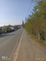
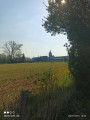
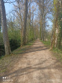
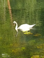
Lacs et marais depuis Roeux

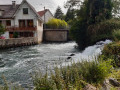
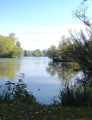
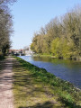
Boucle par Roeux et Biache-Saint-Vaast, entre lacs et marais.

Details

69539852
Creation:
Last update:
Last review:
  • Walking
    Activity: Walking
  • ↔
    Distance: 8.18 mi
  • ◔
    Average duration: 3h 50 
  • ▲
    Difficulty: Moderate

  • ⚐
    Back to start: Yes
  • ↗
    Ascent: + 66 ft
  • ↘
    Descent: - 66 ft

  • ▲
    Highest point: 230 ft
  • ▼
    Lowest point: 144 ft
  • ⚐ Country: France
  • ⚐ City: Rœux (62118)
  • ⚑
    Start/End: N 50.294458° / E 2.898414°
  • ❏
    IGN map(s): Ref. 2506O
  • Hour-by-hour weather

Photos

Description of the walk

Start from the car park by the village hall, next to the church.

(S/E) With your back to the church, turn left onto Rue du 19 Mars 1962 and continue straight on until you reach a Fork in the road with Rue Henri Robert.

(1) Turn right, then at the Y-junction, turn right onto Rue du Marais and carry on straight ahead. You’ll reach the Plouvain Quarry. Go past the bridge on your right and the Fork in the road to reach the path leading into the quarry.

(2) Turn left, take the path on the left, and walk round the lake on the left-hand side. Then continue, keeping to the left, until you reach the D46, Rue Henri Robert.

(3) Turn right, then take the side lane, and keep to the left. Return to the entrance to the quarry.

(2) Keep to the left and go under the motorway.

(4) Carry on and, at the end, turn right onto Chemin des Étangs, continuing until you reach a Fork in the road near a campsite.

(5) Turn right, walk alongside the campsite, and carry on straight ahead until you reach a four-way junction, after a bend.

(6) Turn left, then, just after the right-hand bend, take the Chemin du Marais on the left and carry on straight ahead until you reach the first houses.

(7) Follow the street, cross one junction, and carry on until you reach Rue Raymond Poincaré.

(8) Turn right, then, before the bend, head straight ahead. At the end, turn left, then right onto Rue Maréchal Foch. Cross the lock bridge.

(9) Take the second right, then carry on straight ahead alongside the River Scarpe. Continue until you reach a Y-junction.

(10) Turn left, then, after the motorway bridge, turn right and carry on straight ahead until you reach numbers 14 and 16 on the street.

(11) Follow the path that starts between these two numbers, then head towards the Scarpe

(12) Turn left, then carry on straight ahead, following the river, until you reach Rue du Pont.

(13) Cross over the Scarpe and head for the car park (S/E).

Waypoints

  1. S/E : mi 0 - alt. 164 ft - Village hall car park
  2. 1 : mi 0.25 - alt. 157 ft - Rue Henri Robert
  3. 2 : mi 1.05 - alt. 154 ft - Quarry
  4. 3 : mi 1.68 - alt. 180 ft - Rue Henri Robert
  5. 4 : mi 3.06 - alt. 151 ft - Motorway
  6. 5 : mi 3.39 - alt. 148 ft - Camping
  7. 6 : mi 3.62 - alt. 148 ft - Fork
  8. 7 : mi 4.43 - alt. 144 ft - Houses
  9. 8 : mi 4.74 - alt. 148 ft - Raymond Poincaré Street
  10. 9 : mi 5.03 - alt. 161 ft - Lock Bridge - Scarpe (rivière)
  11. 10 : mi 5.94 - alt. 161 ft - Y-junction - Scarpe (rivière)
  12. 11 : mi 7.04 - alt. 154 ft - Path between nos. 14 and 16
  13. 12 : mi 7.19 - alt. 154 ft - Scarpe (rivière)
  14. 13 : mi 8.02 - alt. 154 ft - Rue du Pont - Scarpe (rivière)
  15. S/E : mi 8.18 - alt. 164 ft - Village hall car park

Notes

No water source.

An alternative route is possible from point (2): go directly to point (4).

Worth a visit

Biodiversité

attention site du lac bleu fermé du 01/06 au 15/09

Reviews and comments

4 / 5
Based on 1 review

Reliability of the description
4 / 5
Ease of following the route
4 / 5
Route interest
4 / 5
souchez rando
souchez rando

Hello, thank you for your feedback. It’s not always easy to go on hikes, but it’s always nice when people are happy.

Machine-translated

Reneton
Reneton

Overall rating : 4 / 5

Date of your route : Apr 21, 2025
Reliability of the description : ★★★★☆ Good
Ease of following the route : ★★★★☆ Good
Route interest : ★★★★☆ Good
Very busy route : Yes

A long drive along the canal
But all in all, it was fine

Machine-translated

Other walks in the area

For more walks, use our search engine .

The GPS track and description are the property of this route's author. Please do not copy them without permission.