Claudine’s walk from Carency

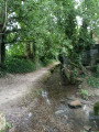
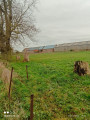
This walk, starting from the old Carency railway station, will take you through the surrounding countryside along good paths, with views of Notre-Dame de Lorette and Mont Saint-Éloi, not to mention the Anneau de la Mémoire.

Details

101193797
Creation:
Last update:
Last review:
  • Walking
    Activity: Walking
  • ↔
    Distance: 4.47 mi
  • ◔
    Average duration: 2h 20 
  • ▲
    Difficulty: Easy

  • ⚐
    Back to start: Yes
  • ↗
    Ascent: + 276 ft
  • ↘
    Descent: - 262 ft

  • ▲
    Highest point: 453 ft
  • ▼
    Lowest point: 276 ft
  • ⚐ Country: France
  • ⚐ City: Carency (62144)
  • ⚑
    Start/End: N 50.380322° / E 2.703241°
  • ❏
    IGN map(s): Ref. 2406E
  • Hour-by-hour weather

Photos

Description of the walk

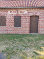
Start from the old station on Rue du Quai

(S/E) Leave the car park, head right towards Rue du Moulin, which you should turn right onto. At the end, turn right onto Rue Pasteur.

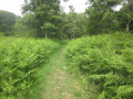
(1) Take the grassy path on the left, then first turn right then left and carry on straight ahead. At the end, continue along the track until you reach a Fork in the road.

(2) Turn left and carry on straight ahead.

(3) Turn left again, then cross Rue Castelane and head straight on until you reach a junction of paths.

(4) Turn left at the junction and join Rue Pasteur.

(5) Turn right then left, carefully cross the D58, then cross the Carency.

(6) Turn left then right, cross a road and carry on straight ahead.

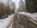
(7) Turn left onto Chemin du Bois Piéton and carry on straight ahead. Follow the track to the end.

(8) Turn left at the bottom, continue left onto Rue du Moulin, then right onto Rue Juliot Curie and head for the car park (S/E).

Waypoints

  1. S/E : mi 0 - alt. 299 ft - Rue du Quai - Église Saint-Aignan (Carency)
  2. 1 : mi 0.29 - alt. 354 ft - Grassy track
  3. 2 : mi 0.71 - alt. 433 ft - Fork
  4. 3 : mi 1.31 - alt. 394 ft - Junction
  5. 4 : mi 2.01 - alt. 446 ft - Crossroads
  6. 5 : mi 2.44 - alt. 312 ft - Rue Pasteur
  7. 6 : mi 2.75 - alt. 302 ft - Route - Carency (ruisseau) - Affluent du Souchez
  8. 7 : mi 3.19 - alt. 341 ft - Chemin du Bois Piéton
  9. 8 : mi 3.92 - alt. 449 ft - End of the track
  10. S/E : mi 4.47 - alt. 299 ft - Rue du Quai - Église Saint-Aignan (Carency)

Notes

No water points.

Other walks in the area

For more walks, use our search engine .

The GPS track and description are the property of this route's author. Please do not copy them without permission.