Country:
 City:
City:


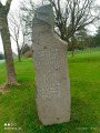
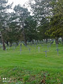
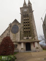
Starting point: church square: parking spaces available nearby.
(S/E) With your back to the church, turn right then immediately left onto Rue du 8 Mai 1945, and continue along this street until the second bend.
(1) Turn left and go straight on until you reach the road.
(2) Carry on to the right along the path running parallel to the road until you reach the junction.
(3) Turn right onto the track, then right again, and carry on to the junction with the Chemin de Croupil.
(4) Turn left and walk alongside the German cemetery to join the D937.
(5) Turn right, then left after the Maison Blanche farm. Carry on to the T-junction.
(6) Turn right at a 90° angle and cross the D55 (Chemin de Marœuil)
(7) Carry on straight ahead to join the D49. You’ll pass close to the National Necropolis on your right.
(8) Cross the D49 and carry on to the next junction.
(9) Make a first turn left then right and follow the track, which further on bends left and then right. You’ll rejoin the D937.
(10) Make another left-right turn and carry on straight ahead to the end of the track.
(11) Turn left, then right, and carry on until you’ve passed the Zouaves’ cemetery.
(12) Turn right, running alongside the A26, and carry on straight ahead until the road leaves the motorway and reaches a Fork in the road.
(13) Carry on straight ahead until you reach a fork near some farm buildings.
(14) Turn left onto Rue Verte, then right onto Rue de derrière les Haies.
(15) At the end of the road, turn left onto Rue de Gazois and continue until you reach Rue du Carlin (D49). Turn left and head for the car park (S/E).
 Visorando Member
 Easy
Easy 

 Difficult
  Association / Club / Walk leader