From Lac Bleu to the Plouvain Marsh

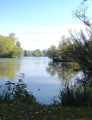
A peaceful, shaded walk around Lac Bleu, along the River Scarpe and through the Plouvain Marshes. Easily accessible and suitable for all seasons.

Details

8516066
Creation:
Last update:
Last review:
  • Walking
    Activity: Walking
  • ↔
    Distance: 3.42 mi
  • ◔
    Average duration: 1h 35 
  • ▲
    Difficulty: Easy

  • ⚐
    Back to start: Yes
  • ↗
    Ascent: + 59 ft
  • ↘
    Descent: - 59 ft

  • ▲
    Highest point: 230 ft
  • ▼
    Lowest point: 144 ft
  • ⚐ Country: France
  • ⚐ City: Rœux (62118)
  • ⚑
    Start/End: N 50.299223° / E 2.911929°
  • ❏
    IGN map(s): Ref. 2506O
  • Hour-by-hour weather

Description of the walk

Start from the Lac Bleu car park.

(S/E) Take the path branching off to the right as you face the lake.

(1) Turn right at the second wide path (the first leads to a locked gate) and leave the park through the wooden gate. Turn right, then left, to continue along the wide path towards the canal.

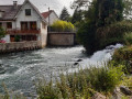
(2) Optional: walk to and from the quay at the turning point on the canalised Scarpe, then follow the canal eastwards with the current, passing under the motorway.

(3) At the red-and-white striped metal barrier, turn left onto the tarmac path, cross the junction and follow the path alongside the first marsh. You can take a shortcut via the small path that runs between the two marshes to join the path running alongside the bungalows.

(4) At the end of the path there is a metal barrier. Go round it and take the narrow path that runs along the banks of the marsh (often muddy). At the end, turn right.

(5) When you reach the tarmac path, turn left, go under the motorway viaduct and head for the park entrance.

(1) At the junction, turn right and follow the path uphill until it runs alongside the road between Roeux and Plouvain (D46).

(6) Leave the path through the wooden gate and walk alongside the road to return to the car park entrance (S/E).

Waypoints

  1. S/E : mi 0 - alt. 171 ft - Lac Bleu car park
  2. 1 : mi 0.48 - alt. 161 ft - Crossroads at the end of the circular loop
  3. 2 : mi 0.6 - alt. 157 ft - Towards the Bateaux railway station
  4. 3 : mi 1.38 - alt. 154 ft - Metal gate
  5. 4 : mi 1.84 - alt. 148 ft - End of the trail
  6. 5 : mi 2 - alt. 151 ft - Passage under the motorway
  7. 6 : mi 3.05 - alt. 230 ft - Wooden gate
  8. S/E : mi 3.42 - alt. 171 ft - Lac Bleu car park

Notes

This walk requires no special equipment apart from walking shoes, due to the damp section along the banks of the marsh.

Worth a visit

Lac Bleu is a Sensitive Natural Area managed by the Pas-de-Calais Department (EDEN 62).

Reviews and comments

5 / 5
Based on 2 reviews

Reliability of the description
5 / 5
Ease of following the route
5 / 5
Route interest
5 / 5
maumau
maumau

The circuit is closed from June to September. Perhaps this should be mentioned.

Machine-translated

frimousse59
frimousse59
• Edited:

Overall rating : 5 / 5

Date of your route : May 10, 2024
Reliability of the description : ★★★★★ Very good
Ease of following the route : ★★★★★ Very good
Route interest : ★★★★★ Very good
Very busy route : No

A lovely little walk around the Blue Lake and the Plouvain marshes. A shaded, relatively quiet walk combining woodland, marshes and the Scarpe Canal. I recommend it.

Machine-translated

dorz
dorz

Overall rating : 5 / 5

Date of your route : Mar 11, 2024
Reliability of the description : ★★★★★ Very good
Ease of following the route : ★★★★★ Very good
Route interest : ★★★★★ Very good
Very busy route : No

A lovely walk – just be careful, as the ground was slippery in places.
I’ll be going back there.

Machine-translated

Other walks in the area

For more walks, use our search engine .

The GPS track and description are the property of this route's author. Please do not copy them without permission.