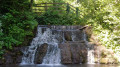
The Valley of the Zouaves in Souchez

A walk around and through Souchez, taking in Cassin Park and the Bois de Carieul, not forgetting the waterfall.

Details

n°63702783
Creation:
Last update:
Last review:
  • Walking
    Activity: Walking
  • ↔
    Distance: 4.70 mi
  • ◔
    Average duration: 2h 20 
  • ▲
    Difficulty: Easy

  • ⚐
    Back to start: Yes
  • ↗
    Ascent: + 197 ft
  • ↘
    Descent: - 197 ft

  • ▲
    Highest point: 417 ft
  • ▼
    Lowest point: 226 ft
  • ⚐ Country: France
  • ⚐ City: Souchez (62153)
  • ⚑
    Start/End: N 50.386274° / E 2.743716°
  • ❏
    IGN map(s): Ref. 2406E
  • Hour-by-hour weather

Photos

Description of the walk

Start from the car park by the pyramid on Rue Carnot, next to the cemetery.

(S/E) Walk up towards the cemetery then turn left. Cross Rue Carnot at the pedestrian crossing, turn right and carry on straight ahead (caution: busy road – stay on the pavement). Follow the bend in the D937 until you reach a path.

(1) Turn left and follow it until you reach the third path on the left.

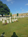
(2) Follow it towards Zouaves Valley Cemetery until you reach a cross-path.

(3) Turn left and continue straight on until the next junction.

(4) Follow the path to the right, passing through the gates (be careful – some steps and sections may be slippery). At the end, go straight ahead, then ignore a path on the left. Take the next dirt track on the left and continue straight on until you reach Rue Raoul Briquet.

(5) Turn left, then turn right onto Rue Voltaire and follow it to where it ends at Rue Jean Jaurès.

(6) Turn right and cross the road at the pedestrian crossing. Walk past the village hall and then turn left into Parc René Cassin.

(7) Walk through the park and, at the exit, turn left, then cross Rue Pasteur (at the pedestrian crossing) and head straight ahead to Rue Rice Oxley.

(8) Turn left, then left again at the bottom. Keep to the right at the town hall car park and, at the end, enter the Bois de Carieul.

(9) Walk round it on the right-hand side until you return to this point.

(9) Continue to the right and, on exiting, head straight ahead. Turn right onto Rue Carnot and walk back up tothe car park (take care when crossing Rue Guislain Philippe Morel – keep to the left and use the pedestrian crossing) (S/E).

Waypoints

  1. S/E : mi 0 - alt. 308 ft - Pyramid car park
  2. 1 : mi 0.21 - alt. 335 ft - Path
  3. 2 : mi 0.87 - alt. 417 ft - Path on the left
  4. 3 : mi 1.15 - alt. 364 ft - Cimetière militaire britanique de la Vallée des Zouaves (Souchez)
  5. 4 : mi 1.95 - alt. 272 ft - Path to the right and gate
  6. 5 : mi 2.4 - alt. 249 ft - Rue Raoul Briquet
  7. 6 : mi 2.9 - alt. 243 ft - Rue Jean Jaurès, after the - Sochez (rivière) - Canal de Lens
  8. 7 : mi 3.06 - alt. 243 ft - René Cassin Park
  9. 8 : mi 3.35 - alt. 289 ft - Rue Rice Oxley
  10. 9 : mi 3.64 - alt. 246 ft - Bois de Carieul
  11. S/E : mi 4.7 - alt. 308 ft - Pyramid car park

Notes

No drinking water available

Worth a visit

René Cassin Park
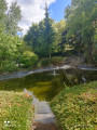
Bois de Carieul and its statue of the Virgin
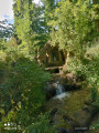
Waterfall from Rue Carnot
Nearby: Notre-Dame-de-Lorette Memorial

Reviews and comments

5 / 5
Based on 1 review

Reliability of the description
5 / 5
Ease of following the route
5 / 5
Route interest
5 / 5
AUDETHOMAS
AUDETHOMAS

Overall rating : 5 / 5

Date of your route : Nov 18, 2024
Reliability of the description : ★★★★★ Very good
Ease of following the route : ★★★★★ Very good
Route interest : ★★★★★ Very good
Very busy route : No

Machine-translated

Other walks in the area

For more walks, use our search engine .

The GPS track and description are the property of this route's author. Please do not copy them without permission.