Bois de Mont trail starting from Notre-Dame de Lorette

This circular loop, steeped in history, will allow you to experience first-hand the horrors of war, pay tribute to those who saved us, and reflect on the vital need to maintain peace between nations.

Details

17270392
Creation:
Last update:
Last review:
  • Walking
    Activity: Walking
  • ↔
    Distance: 5.17 mi
  • ◔
    Average duration: 2h 40 
  • ▲
    Difficulty: Moderate

  • ⚐
    Back to start: Yes
  • ↗
    Ascent: + 312 ft
  • ↘
    Descent: - 312 ft

  • ▲
    Highest point: 617 ft
  • ▼
    Lowest point: 272 ft

Photos

Description of the walk

To reach the starting point, head towards Souchez (62153). Leave the village towards Aix-Noulette/Béthune on the D937. Turn left, following the signs for “Anneau de la mémoire – Notre-Dame de Lorette”. Drive carefully to the car park (narrow road and buses may be passing).

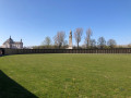
(S/E) Depending on where you have parked, walk alongside the historic cemetery until you reach the Notre-Dame de Lorette National Necropolis.

(1) Opposite the necropolis, turn right onto the small path leading downhill, following the signs for “Le bois de Mont/Le Saint-Nazaire” (yellow markings). Cross the Route du Mont de Lorette and continue almost directly opposite, heading south.

(2) Turn eastwards, cross the Vallée de l’Église to reach the junction with Rue de Lens. Continue to the right, then turn left into Rue de la Blanche Voie.

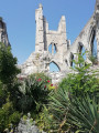
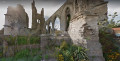
(3) Walk past the ruins of the old Catholic church in Ablain-Saint-Nazaire and carry on to the junction with Rue Marcel Lancino, where you turn right. After the left-hand bend, at the sign for the Saint-Nazaire stream, head right onto the narrow path that runs alongside the stream for about 600 metres. Cross three streets in succession.

(4) Leave the stream behind and continue to the right along the uphill path that runs alongside the football pitch. At the T-junction, continue to the left towards the west, taking care to follow the yellow markings. Keep in this direction for about 800 m, until you reach the first houses on Rue de la Vallée du Chauffour. Continue on to Rue Marcel Lancino.

(5) Turn right, heading north-west, until you reach the bend. Keep heading north-west,
keeping to the right on the wide path marked in yellow, which you should follow straight on for about 900 m.

(6) Keep to the right and continue northwards along the path between the Bois de Vert Mont and the Bois l’Abbé. Continue in this direction for over a kilometre to reach the junction with theGR®127andGR®145.

(7) Turn right towards the east-south-east. Walk in this direction for 800 m until you reach a Fork in the road.

(8) Continue left onto theGR® 145 for a further 1.2 km until you find yourself facing the necropolis.

(1) Turn left to return to the car park (S/E).

Waypoints

  1. S/E : mi 0 - alt. 584 ft - Cimetière National de Notre-Dame de Lorette
  2. 1 : mi 0.11 - alt. 574 ft - Junction of the circular loop
  3. 2 : mi 0.54 - alt. 417 ft - Junction
  4. 3 : mi 1.02 - alt. 285 ft - Ruins of the old church
  5. 4 : mi 1.49 - alt. 282 ft - T-junction – Football pitch
  6. 5 : mi 2.14 - alt. 322 ft - Rue Marcel Lancino
  7. 6 : mi 2.88 - alt. 358 ft - Turn right at the fork
  8. 7 : mi 3.71 - alt. 597 ft - GR junction °°®°°
  9. 8 : mi 4.27 - alt. 584 ft - Fork in the road
  10. S/E : mi 5.17 - alt. 584 ft - Notre-Dame de Lorette - Cimetière National de Notre-Dame de Lorette

Notes

Please note: in wet weather, the paths are muddy and slippery.

Avoid doing this circular walk on Remembrance Day (11 November). Access and parking may be difficult.

There are no drinking fountains or picnic tables.

See car parks

Worth a visit

Always be cautious and plan ahead when you're outdoors. Visorando and the author of this route cannot be held responsible for any accidents occurring on this route.

The GR® and PR® markings are the intellectual property of the Fédération Française de Randonnée Pédestre.

Reviews and comments

4.6 / 5
Based on 3 reviews

Reliability of the description
4.3 / 5
Ease of following the route
4.7 / 5
Route interest
4.7 / 5
Tullier
Tullier

Overall rating : 5 / 5

Date of your route : May 13, 2024
Reliability of the description : ★★★★★ Very good
Ease of following the route : ★★★★★ Very good
Route interest : ★★★★★ Very good
Very busy route : No

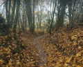
A superb walk, a visit to the basilica and the necropolis – a historic site well worth exploring. The walk is marvellous: you head down the steps, following the yellow markings, and as you follow the path, the adventure begins – open countryside, streams, woodland – a real treat.

Machine-translated

An LOUIS
An LOUIS

Overall rating : 4.3 / 5

Date of your route : Jun 11, 2023
Reliability of the description : ★★★★☆ Good
Ease of following the route : ★★★★☆ Good
Route interest : ★★★★★ Very good
Very busy route : Yes

A lovely, varied walk that we did on Sunday 11 June – a very hot day! As the vast majority of the walk was in the shade of the trees, it was very pleasant (indeed, compared to the previous review, we could well imagine how muddy certain sections must get, or even become almost impassable in wet weather!). Walking alongside the ‘Le Saint-Nazaire’ stream also gave us a chance to cool off! We’ll be recommending this walk to others! Thank you for this route.

Machine-translated

Arnaud59
Arnaud59

Overall rating : 4.3 / 5

Date of your route : Feb 12, 2022
Reliability of the description : ★★★★☆ Good
Ease of following the route : ★★★★★ Very good
Route interest : ★★★★☆ Good
Very busy route : No

Beautiful scenery and a lovely walk, but watch out for very muddy sections along much of the route in wet weather (at the moment, the dirt tracks and forest paths have been rutted by forestry machinery) – there are plenty of ruts… Watch out for the barbed wire marking the boundaries of private land
We’ll be back this summer to do this walk again in dry weather and enjoy it a bit more by looking up without having to watch where we’re putting our feet all the time.

Machine-translated

Other walks in the area

For more walks, use our search engine .

The GPS track and description are the property of this route's author. Please do not copy them without permission.