


Refine your search for walks in Goncelin
Goncelin walks


 Circular route via the hamlets of Sollières and Ruche
 Visorando Member
 4.42 mi
 +981 ft
 -974 ft
 2h 55
2h 55
 Easy
Easy
 Departure from Goncelin (Isère)
A circular route in a secluded area, passing through two pretty hamlets. Two-thirds of the route is on tarmac roads, but there is very little traffic as they are dead-ends.
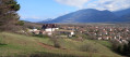
From the fortified house of La Frette to the Château du Touvet, a circular route
 4.66 mi
+938 ft
-928 ft
2h 55
4.66 mi
+938 ft
-928 ft
2h 55
 Moderate
Departure from Le Touvet (Isère)
Moderate
Departure from Le Touvet (Isère)
An easy route in the hills above Le Touvet, from one castle to another, with the first part in the forest and the return via the hamlets on the road, including 250 m on the D29, but without any danger.
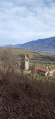
Circular route from Château du Touvet to Château du Montalieu
 4.11 mi
+807 ft
-797 ft
2h 35
Easy
Departure from Le Touvet (Isère)
4.11 mi
+807 ft
-797 ft
2h 35
Easy
Departure from Le Touvet (Isère)
An easy circular route, half through woodland and half along small tarmac roads, from one castle to another. This circular route can be combined with another circular route, from the fortified house of La Frette to Château du Touvet.
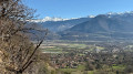
Circular of the Alloix waterfalls and return via Bellechambre
 5.82 mi
+1,818 ft
-1,811 ft
4h 15
Moderate
Departure from Saint-Vincent-de-Mercuze (Isère)
5.82 mi
+1,818 ft
-1,811 ft
4h 15
Moderate
Departure from Saint-Vincent-de-Mercuze (Isère)
From Saint-Vincent-de-Mercuze, this is a varied, beautiful and enjoyable hike, accessible to children in dry weather. Please note that the climb up the Ruisseau l'Alloix can be very slippery in wet weather. Most of the route is under trees. It is pleasant to do in hot weather, with a short stop halfway to eat at Moulin Tardy (picnic table) and the possibility of swimming in the Alloix. It is best to do this in spring when there is plenty of water and the waterfalls are magnificent.
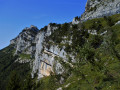
The Pas de l’Écharasson round trip
 6.17 mi
+2,569 ft
-2,572 ft
5h 05
6.17 mi
+2,569 ft
-2,572 ft
5h 05
 Extremely difficult
Departure from Saint-Bernard (Isère) (Isère)
Extremely difficult
Departure from Saint-Bernard (Isère) (Isère)
Starting from the Col de Marcieu, this hike to the Pas de l’Écharasson begins with a walk through the forest before continuing along a path that leads to the foot of the Crête de l’Alpette at a scree slope. After negotiating its narrow gap and climbing two rocky outcrops, you’ll discover a magnificent cirque in a breathtaking setting. The route continues along a ledge sheltered by rock; climbing through a gap, then over a small, cable-secured rock barrier and finally along a ridge takes you to the crest and its magnificent viewpoint.
L’Aulp du Seuil
 4.99 mi
+2,648 ft
-2,644 ft
4h 35
Moderate
Departure from Saint-Bernard (Isère) (Isère)
4.99 mi
+2,648 ft
-2,644 ft
4h 35
Moderate
Departure from Saint-Bernard (Isère) (Isère)
Please note: the route is closed from 15 August until the end of September 2026.
The Aulp du Seuil crossing: this hike ranks among the most beautiful in the Chartreuse.
Tour de la Villette between Theys and the Col du Barioz
5.83 mi
+1,073 ft
-1,076 ft
3h 35
Moderate
Departure from Theys (Isère)
Circular route through the beautiful valley between Theys and the Col du Barioz, ideal for a sunny winter’s afternoon. Yellow signposts mark the route, as do wooden ‘Tour de la Villette’ signs.Note: half of the route is on tarmac roads (narrow and with little traffic).
Alloix waterfalls from Montalieu
 3.15 mi
+1,234 ft
-1,234 ft
2h 30
Moderate
Departure from Saint-Vincent-de-Mercuze (Isère)
3.15 mi
+1,234 ft
-1,234 ft
2h 30
Moderate
Departure from Saint-Vincent-de-Mercuze (Isère)
This is a short, unusual walk that follows the Alloix torrent. Curious walkers will spend more time admiring the work of the water than walking. This walk can end with a leisurely stroll through the narrow streets of the old village or, as the locals say, "on the paths of yesteryear", where local markings will guide you.
Not Charassons and Arche Miracle
 8.16 mi
+4,783 ft
-4,780 ft
6 hrs
Extremely difficult
Departure from Saint-Bernard (Isère) (Isère)
8.16 mi
+4,783 ft
-4,780 ft
6 hrs
Extremely difficult
Departure from Saint-Bernard (Isère) (Isère)
A breathtaking circular route linking together numerous wonders: the rugged Pas des Charassons, the scenic Crête de l’Alpette, the magnificent Écaille du Pas de Ragris, the famous Tour Percée, the precarious Arche Miracle and the beautiful Aup du Seuil pass.
This hike, covering less than 13km with 1,500m of elevation gain, requires a good sense of direction and sure-footedness (short sections of grade 3c climbing). Please note: the IGN topographic map is completely unreliable here!
An agreement has been signed between the department and the owner of the 800 hectares in the Hauts de Chartreuse nature reserve to allow free access to the two paths that run across the Marcieu plateau. The exit at Pas des Charassons, which leads back onto the plateau, joins one of these paths within a few metres. You may request permission to pass from the landowner, although there are no visible prohibition signs on the ground.
Circuit of the Northern Waterfalls of the Petites Roches
 15.71 mi
+6,549 ft
-6,532 ft
10 hrs
15.71 mi
+6,549 ft
-6,532 ft
10 hrs
 Very difficult
Departure from Saint-Vincent-de-Mercuze (Isère)
Very difficult
Departure from Saint-Vincent-de-Mercuze (Isère)
Numerous streams flow down from the Petites Roches plateau into the Isère valley, creating several spectacular waterfalls. This route allows you to explore those at the northern end of the Petites Roches plateau, which are not part of the ‘Tour des Petites Roches’GR® de pays route, which runs further south. If the full hike is too long, you can use this as inspiration for easier alternatives.
Hanging gardens of Les Charassons
 6.09 mi
+3,389 ft
-3,383 ft
5h 45
Extremely difficult
Departure from Saint-Bernard (Isère) (Isère)
6.09 mi
+3,389 ft
-3,383 ft
5h 45
Extremely difficult
Departure from Saint-Bernard (Isère) (Isère)
Spectacular hike to the hanging gardens of Charassons with two magnificent arches to discover.As the Marcieu valley is entirely private, the hike never passes through it and always remains on authorised terrain.
This hike is extremely difficult, beyond what is usual on Visorando, and requires climbing a short 3c section (a single move). An ice axe is recommended even (especially) in summer to tackle the steep slopes of the hanging gardens without stress. Most of the hike takes place on unmarked and (very) poorly marked paths. See Practical Information.
This hike takes place largely at the foot of cliffs. Geolocation (GPS, etc.) is therefore approximate, with errors exceeding 40 m. You must therefore use your brain and critical thinking skills and act according to the terrain.
As is often the case, this hike is a variation on a theme by Pascal Sombardier.
 The Grand Rocher and the Crêt du Poulet
 5.32 mi
+1,627 ft
-1,604 ft
6 hrs
Moderate
Departure from Theys (Isère)
5.32 mi
+1,627 ft
-1,604 ft
6 hrs
Moderate
Departure from Theys (Isère)
A stone's throw from town and you're high in the mountains. But pay attention to the risks.
Crêt du Poulet, Crêt Luisard
 4.60 mi
+1,224 ft
-1,214 ft
3h 10
Moderate
Departure from Theys (Isère)
4.60 mi
+1,224 ft
-1,214 ft
3h 10
Moderate
Departure from Theys (Isère)
A family walk through forests and meadows in the Belledonne Massif with superb panoramic views of the Grande Chartreuse Massif on one side and the Vanoise and Sept-Laux on the other.
Crêt du Poulet via the Chalet Pierre Roubet
 3.74 mi
+1,004 ft
-1,004 ft
2h 35
Moderate
Departure from Theys (Isère)
3.74 mi
+1,004 ft
-1,004 ft
2h 35
Moderate
Departure from Theys (Isère)
Short hike to the Crêt du Poulet orientation tables via the Chalet Pierre Roubet.
Le Grand Rocher via the Crêt du Poulet refuge
 7.63 mi
+1,657 ft
-1,670 ft
4h 55
Moderate
Departure from Saint-Pierre-d'Allevard (Isère)
7.63 mi
+1,657 ft
-1,670 ft
4h 55
Moderate
Departure from Saint-Pierre-d'Allevard (Isère)
An easy hiking version of this climb to the Grand Rocher. Once past the refuge, the route follows the Crêt Luisard ridge, where the view is breathtaking in all directions, and you can even see Mont Blanc from the summit.
Crêt du Poulet, Grand Rocher and Col du Merdaret circular loop
 9.59 mi
+1,982 ft
-1,988 ft
6h 10
Moderate
Departure from Theys (Isère)
9.59 mi
+1,982 ft
-1,988 ft
6h 10
Moderate
Departure from Theys (Isère)
A beautiful circular route on the ridge of the Grand Rocher, which acts as a balcony with a superb panorama of the Haut-Bréda valley, the Allevard massif and the Sept Laux massif. Easy access from the Barioz cross-country ski centre and an easy route to do in mid-spring when the peaks are still snow-covered.
Crêt du Poulet in winter
 3.38 mi
+1,047 ft
-1,030 ft
3 hrs
Moderate
Departure from Theys (Isère)
3.38 mi
+1,047 ft
-1,030 ft
3 hrs
Moderate
Departure from Theys (Isère)
A lovely snowshoe hike above Grésivaudan through forests and meadows, offering beautiful panoramic views of the surrounding mountains. The route is easy and ends at the Crêt du Poulet refuge, where you can enjoy a glass of mulled wine.
Circular route between La Chapelle Saint-Christophe and Saint-Pierre-d'Allevard
4.81 mi
+1,683 ft
-1,677 ft
3h 40
Moderate
Departure from Saint-Pierre-d'Allevard (Isère)
A pleasant walk, with a bit of an uphill climb but a lovely atmosphere as you pass through hamlets, heading towards a chapel that apparently doesn’t exist. The views are lovely in any case, and the hamlets are pretty too. A very pleasant change of scenery.
Circular route around Sainte-Marie-du-Mont
5.27 mi
+1,050 ft
-1,033 ft
3h 20
Moderate
Departure from Sainte-Marie-du-Mont (Isère)
A route offering stunning views of the Chartreuse, Belledonne, Maurienne and, time and again, Mont Blanc (especially when the trees have no leaves or have shed them).
Numerous streams and torrents create a lovely atmosphere, but require good footwear, unless you fancy having wet feet.
Unfortunately, my route description seems to be causing problems, so I strongly recommend using GPS and the map on your phone!
Col du Merdaret
 5.43 mi
+2,142 ft
-2,110 ft
4h 20
Moderate
Departure from Theys (Isère)
5.43 mi
+2,142 ft
-2,110 ft
4h 20
Moderate
Departure from Theys (Isère)
A very pretty walk above Theys, with a climb towards Belledonne and fantastic views. Between forest and mountain pastures, with the chance to take in the peaks.
From the Bassin du Flumet to Montouvrard
4.42 mi
+1,270 ft
-1,296 ft
3h 10
Moderate
Departure from Saint-Pierre-d'Allevard (Isère)
This is a half-day hike. A steady climb takes you to the village of Montouvrard, where you can enjoy beautiful views of Belledonne.
The yellow markings are a little faded.
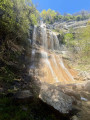
The Teppes Cochon Waterfall and the Sentier du Facteur circular loop
 5.10 mi
+2,316 ft
-2,333 ft
4h 20
5.10 mi
+2,316 ft
-2,333 ft
4h 20
 Difficult
Departure from La Flachère (Isère)
Difficult
Departure from La Flachère (Isère)
A low-altitude circular route that is demanding, rising first to the beautiful Teppes Cochon waterfall, then climbing up to the Plateau des Petites Roches via the well-marked Pierre-Plate path, before crossing along the hillside towards Les Prés, and then descending back down to Grésivaudan via the tricky Pas du Facteur.
Aulp du Seuil Hut – Pravouta Hut
6.81 mi
+2,815 ft
-3,009 ft
8 hrs
Very difficult
Departure from Saint-Bernard (Isère) (Isère)
Day2 of this trip via the Col de Bellefont to reach the Dent de Crolles plateau.Descent via the pass above the Trou du Glaz, then down to the Col des Ayes and up the Roc d’Arguille to the Col de Pravouta and the hut of the same name.
⚠️ 27/11/2025: Route modified following a rockfall. It is no longer possible to take the path via the Trou du Glaz (5). The area remains particularly dangerous due to the high risk of further rockfall and falling boulders. Following this incident, the municipality of Saint-Pierre de Chartreuse has issued a by-law to close several hiking trails (for walking, snowshoeing and ski touring). For an ascent of the Dent de Crolles, it is possible to take the route via the Pas de l’Oeille.
You can also go via the Guiers waterfalls to reach (E).
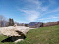
Short walk around Bel aux Airs
 3.43 mi
+600 ft
-587 ft
2h 05
Easy
Departure from Les Adrets (Isère)
3.43 mi
+600 ft
-587 ft
2h 05
Easy
Departure from Les Adrets (Isère)
Starting from the Col d'Hurtières, you’ll enjoy varied scenery. Let yourself be surprised by the views. This walk is enjoyable in both summer and winter.
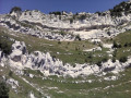
A circular route via the Pas de Montbrun and Pas de Rocheplane, starting from Les Massards
 5.57 mi
+3,383 ft
-3,383 ft
5h 30
Difficult
Departure from Saint-Hilaire (Isère) (Isère)
5.57 mi
+3,383 ft
-3,383 ft
5h 30
Difficult
Departure from Saint-Hilaire (Isère) (Isère)
A hike to explore the secluded Pas de Montbrun, which leads to the ridge of the Rochers de Bellefont via a route of moderate exposure and without any major difficulty, apart from finding your way in the upper section. From Les Massards, the path heads towards the Source du Sanglier and then the Col de Marcieu, leaving it opposite the Pas de Montbrun. A narrow track climbs up a scree slope and, via a few short scrambling sections, reaches the ridge leading to the Pas de Rocheplane. A well-marked path crosses a few rocky outcrops and, after a section through the forest, returns to the car park.
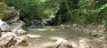
From Montfort Castle to the Crolles Waterfall
 3.88 mi
+974 ft
-965 ft
2h 40
Moderate
Departure from Crolles (Isère)
3.88 mi
+974 ft
-965 ft
2h 40
Moderate
Departure from Crolles (Isère)
A 25-minute drive from Grenoble, this is a family-friendly walk starting from the Saint-Hilaire-du-Touvet funicular station, beneath the paragliders, to the path leading to the Crolles waterfall. There is little elevation gain and it can be done in all weathers.
Le Pal de Fer
1.43 mi
+2,001 ft
-0 ft
2h 25
Moderate
Departure from Crolles (Isère)
An original outing that allows you to discover the superb work carried out here for the construction of the Touvet funicular railway. The ascent is on foot and the descent, to relieve the knees, is by funicular.
(Please note): This route is currently closed. See explanations here
(Comment from a hiker) dated 18 June 2023: small difficult section: crossing the scree slope where you need to use two ropes to reach the path in the forest.
Les Dioux Waterfall and the Porte Traine Mill
 3.17 mi
+528 ft
-528 ft
1h 55
Easy
Departure from Saint-Hilaire (Isère) (Isère)
3.17 mi
+528 ft
-528 ft
1h 55
Easy
Departure from Saint-Hilaire (Isère) (Isère)
On the Saint-Hilaire du Touvet plateau, this is a circular loop of 2 to 3 hours that is suitable for young children.
Very shady and close to the Saint-Hilaire paragliding training slopes (FFVL South take-off point), it also gives children a fun opportunity to watch the sails inflate.
Climb up to Les Petites Roches and take flight
 3.58 mi
+617 ft
-587 ft
2h 10
Easy
Departure from Saint-Hilaire (Isère) (Isère)
3.58 mi
+617 ft
-587 ft
2h 10
Easy
Departure from Saint-Hilaire (Isère) (Isère)
Whether you're a paraglider or hang glider, Saint-Hilaire-du-Touvet is paradise. From the valley, the funicular takes paragliders and walkers alike to the Petites Roches plateau, where everyone can take off into the air or walk on the edge of the void.
For hikers, this route at the foot of the Dent de Crolles offers a viewpoint over the valley before entering the forest in search of the remains of the Moulin de Porte-Traîne mill.
Griffes de l’Ours circular loop and Belles Ombres trails
 5.36 mi
+2,369 ft
-2,352 ft
4 hrs
Extremely difficult
Departure from Sainte-Marie-du-Mont (Isère)
5.36 mi
+2,369 ft
-2,352 ft
4 hrs
Extremely difficult
Departure from Sainte-Marie-du-Mont (Isère)
A circular loop exploring the Griffes de l’Ours and emerging onto the Belles Ombres ridge after a short stretch along the eponymous ‘sangle’.
The Griffes de l’Ours are usually tackled by returning via the same path as the outward journey. Our route allows you to climb up onto the ridge via a few rocky sections, enabling you to admire the Griffes de l’Ours from every angle.
Lower and upper ‘sangles’ and the ridge of the Rochers de Belles Ombres
 5.69 mi
+2,303 ft
-2,303 ft
4h 35
Difficult
Departure from Sainte-Marie-du-Mont (Isère)
5.69 mi
+2,303 ft
-2,303 ft
4h 35
Difficult
Departure from Sainte-Marie-du-Mont (Isère)
This circular loop, which takes you off the beaten track, allows you to explore the distinctive rocks of the lower Belles Ombres ridge, then climb up to the upper ridge to walk through its impressive cirques, before ascending to the ridge and returning via the Rochers de Belles Ombres to the pass of the same name.
Grand Manti via the Pas du Fourneau and back via the Pas de la Rousse
 Tourism professional
 7.01 mi
+3,005 ft
-3,241 ft
5h 50
Extremely difficult
Departure from Sainte-Marie-du-Mont (Isère)
7.01 mi
+3,005 ft
-3,241 ft
5h 50
Extremely difficult
Departure from Sainte-Marie-du-Mont (Isère)
This hike takes in two of the most challenging passes in the Chartreuse, where sure-footedness is essential; take great care on the descent from the Pas de la Rousse. Its highest point is very close to the Tunnel du Trèfle and, if you look carefully from the tunnel, you can catch a glimpse of the inaccessible Arche de la Morille.
Sangle des Belles Ombres and Porte de l'Alpette
 7.44 mi
+3,432 ft
-3,419 ft
6h 25
Difficult
Departure from Sainte-Marie-du-Mont (Isère)
7.44 mi
+3,432 ft
-3,419 ft
6h 25
Difficult
Departure from Sainte-Marie-du-Mont (Isère)
A wild and off-the-beaten-track hike linking the high-altitude ridge of Les Belles Ombres, where chamois frolic all year round, with the bucolic meadows of L’Alpette, where marmots abound.
This route is mainly off-trail and requires sure-footedness and a good sense of direction. It is unlikely that you will encounter other walkers, except at the Croix de l’Alpe and on the section of path leading there.
Col de l'Alpe via Sainte-Marie-du-Mont
3.34 mi
+1,365 ft
-1,352 ft
2h 45
Moderate
Departure from Sainte-Marie-du-Mont (Isère)
This short hike leads to the Col de l'Alpe via the path used by cows going up and down from the mountain pasture.
Dent de Crolles via the Terreaux and Rocheplane steps
 8.23 mi
+3,937 ft
-3,940 ft
6 hrs
Very difficult
Departure from Saint-Hilaire (Isère) (Isère)
8.23 mi
+3,937 ft
-3,940 ft
6 hrs
Very difficult
Departure from Saint-Hilaire (Isère) (Isère)
A splendid but little-used circular, starting from Saint-Hilaire du Touvet and passing through the Pas des Terreaux, the Dent de Crolles, the Cheminée du Paradis and the Pas de Rocheplane.
Much of the hike is on poorly marked paths on steep slopes. The Cheminée du Paradis is a small climbing step, which explains the level of difficulty.
It is possible to extend this hike in a pleasant way, either during the hike itself or nearby.
From the Pas de la Rousse to the Col de Belles Ombres via the Croix de l'Alpe
 4.34 mi
+2,333 ft
-2,320 ft
4h 00
Difficult
Departure from Sainte-Marie-du-Mont (Isère)
4.34 mi
+2,333 ft
-2,320 ft
4h 00
Difficult
Departure from Sainte-Marie-du-Mont (Isère)
A circular route along the eastern ridge of the Hauts de Chartreuse, combining a variety of terrain (rocks, forests, mountain pastures) with stunning views across the Alps. Can be completed in half a day, preferably in the morning.
Please note: read the information regarding the difficulties in the ‘Practical Information’ section carefully.
Montouvrard, starting from Allevard
 4.20 mi
+1,414 ft
-1,414 ft
3h 10
Moderate
Departure from Allevard (Isère)
4.20 mi
+1,414 ft
-1,414 ft
3h 10
Moderate
Departure from Allevard (Isère)
A three-hour walk starting from the village centre.
Cirque de Saint-Même: Waterfalls and Cave via the Pas Ruat
 2.62 mi
+1,056 ft
-1,030 ft
3 hrs
Very difficult
Departure from Saint-Pierre-d'Entremont (Savoie) (Savoie)
2.62 mi
+1,056 ft
-1,030 ft
3 hrs
Very difficult
Departure from Saint-Pierre-d'Entremont (Savoie) (Savoie)
The Cirque de Saint-Même is very busy in summer, with most visitors content to have a picnic on the meadows or follow the signposted route through the waterfalls. The short circular loop suggested here extends this route by taking in an additional waterfall and the Source du Guiers Vif, via the steep Pas Ruat pass with its astonishing passage beneath the rock face emerging in front of the Grotte du Guiers Vif.
⚠️ This route is partly unmarked, unmaintained and presents significant risks. Hikers undertake this route at their own risk. Please refer to the official marked trails.
⚠️ The footbridge leading to the Grotte du Guiers Vif (4) was damaged by a rockslide in July 2023: a mayoral order currently prohibits access.
Le Grand Manti, the Trèfle tunnel and Alpettaz via Pas de la Mort
 6.02 mi
+3,855 ft
-3,862 ft
6h 05
Difficult
Departure from Saint-Pierre-d'Entremont (Savoie) (Savoie)
6.02 mi
+3,855 ft
-3,862 ft
6h 05
Difficult
Departure from Saint-Pierre-d'Entremont (Savoie) (Savoie)
Hike to discover the sources of the Guiers Vif and the Crêtes du Grand Manti, among waterfalls, caves, cliffs and mountain pastures.
Please note that this hike is vertiginous in some areas (Pas de la Mort) and is not recommended for people who are prone to vertigo or in wet weather.
Cirque de Saint-Même: a bit of an adrenaline rush
 4.44 mi
+2,651 ft
-2,664 ft
4h 20
Difficult
Departure from Saint-Pierre-d'Entremont (Savoie) (Savoie)
4.44 mi
+2,651 ft
-2,664 ft
4h 20
Difficult
Departure from Saint-Pierre-d'Entremont (Savoie) (Savoie)
A superb circular walk featuring waterfalls, a natural tunnel, a cave, climbing sections, an exposed ledge and a mountain pasture, topped off with some stunning views throughout the route.
⚠️ Part of this route is unmarked, unmaintained and presents significant risks. Hikers undertake this route at their own risk. Please refer to the officially marked trails.
⚠️ The ‘Pas de la Mort’ between (5) and (9) is classified as dangerous and is strongly discouraged. See practical information.
On all vertical sections, do not rely on the GPS track but follow the route description.
Cirque de Saint Même - Guiers Vif waterfalls
 1.77 mi
+676 ft
-669 ft
1h 25
Difficult
Departure from Saint-Pierre-d'Entremont (Savoie) (Savoie)
1.77 mi
+676 ft
-669 ft
1h 25
Difficult
Departure from Saint-Pierre-d'Entremont (Savoie) (Savoie)
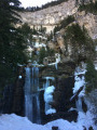
Short hike in the forest to discover the waterfalls of the Guiers Vif.
Around the Cirque de Saint-Même
 8.20 mi
+3,970 ft
-3,983 ft
7h 15
Difficult
Departure from Saint-Pierre-d'Entremont (Savoie) (Savoie)
8.20 mi
+3,970 ft
-3,983 ft
7h 15
Difficult
Departure from Saint-Pierre-d'Entremont (Savoie) (Savoie)
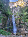
From the Cirque de Saint-Même and its waterfalls, across the Hauts de Chartreuse plateaus via 3 Pas to the Croix de l’Alpe (1,821 m).Stunning views.
⚠️ This route is partly unmarked, unmaintained and presents significant risks. Hikers undertake this route at their own risk. Please follow the official marked trails.
Montagne de Tigneux
4.18 mi
+2,910 ft
-2,910 ft
4h 25
Moderate
Departure from La Ferrière (Isère) (Isère)
A good hike that can be done from spring to autumn when snow conditions prevent you from going higher. However, you will be close to 2000 m.
Combe and lakes of the Grande Valloire
 8.41 mi
+5,072 ft
-5,046 ft
8h 15
Difficult
Departure from La Ferrière (Isère) (Isère)
8.41 mi
+5,072 ft
-5,046 ft
8h 15
Difficult
Departure from La Ferrière (Isère) (Isère)
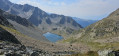
A very pretty hike in the Belledonne massif. A forest to climb in the cool, mountain pastures offering unobstructed views of the surrounding area and very pretty lakes that reward the effort it takes to get there. Raspberries and blueberries along the way in season, which is a nice bonus!
The Bois de Chavot loop
4.98 mi
+2,887 ft
-2,877 ft
4h 50
Moderate
Departure from La Ferrière (Isère) (Isère)
The Bois de Chavot route is merely a pretext for a lovely route in the Belledonne massif. In this part of Belledonne, the chalets are numbered: the first chalet of this, the second chalet of that...This route is accessible for quite a long time during the season due to its moderate altitude of 1,860 m.The route is signposted, with a large section following theGRP®® “Tour du Pays d’Allevard”.
In the footsteps of the bearded vulture around Pipay
 4.25 mi
+1,280 ft
-1,280 ft
3h 05
Moderate
Departure from Les Adrets (Isère)
4.25 mi
+1,280 ft
-1,280 ft
3h 05
Moderate
Departure from Les Adrets (Isère)
Loop between Prapoutel and Pipay, from the forest to the Balcon des Sept Laux trail, offering breathtaking views of the Chartreuse Massif and birds flying across the Belledonne sky. With a bit of luck, you may spot a bearded vulture, one of only four species of vulture in France, which is currently being reintroduced in the Alps.
Route from Barraux to Saint-Georges and Saint-Marcel
 6.15 mi
+2,028 ft
-2,011 ft
4h 35
Moderate
Departure from Barraux (Isère)
6.15 mi
+2,028 ft
-2,011 ft
4h 35
Moderate
Departure from Barraux (Isère)
Circular walk around the foothills of the Chartreuse with a beautiful view of Belledonne and a walk past the Furet Waterfall.
The Teppes Cochon waterfall
 6.47 mi
+2,559 ft
-2,543 ft
5h 10
Moderate
Departure from Barraux (Isère)
6.47 mi
+2,559 ft
-2,543 ft
5h 10
Moderate
Departure from Barraux (Isère)
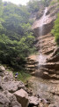
The first part of the walk is a bit of a slog, but the rest is fairly easy. It’s best to do this walk after a spell of rain to get the most out of the waterfalls.
The lakes and the Refuge des Sept Laux from Le Pleynet
 8.38 mi
+3,209 ft
-3,235 ft
6h 40
Difficult
Departure from La Ferrière (Isère) (Isère)
8.38 mi
+3,209 ft
-3,235 ft
6h 40
Difficult
Departure from La Ferrière (Isère) (Isère)
A hike that takes you to the Plateau des Lacs des Sept Laux from Le Pleynet.Accommodation available at the refuge.
⚠️15/06/2026: a notice indicates a rockfall at Cul de la Vieille between 4 and 5, making it impossible to follow this route. You must take the GR®738 between 5 and 7. Please let us know in the comments if you have any information regarding the lifting of this notice.
The Pont de la Betta and the Cascade des Avoux via Prabert
 8.14 mi
+1,621 ft
-1,608 ft
5h 10
Moderate
Departure from Les Adrets (Isère)
8.14 mi
+1,621 ft
-1,608 ft
5h 10
Moderate
Departure from Les Adrets (Isère)
A forest loop allows you to reach the Pont de la Betta, the starting point for a multitude of other hikes, while discovering the charming hamlet of Prabert and the magnificent Cascade des Avoux waterfall.
Loop in the forest around Prapoutel
 4.55 mi
+1,322 ft
-1,316 ft
3h 15
Moderate
Departure from Les Adrets (Isère)
4.55 mi
+1,322 ft
-1,316 ft
3h 15
Moderate
Departure from Les Adrets (Isère)
This is a beautiful, very easy walk through the forests surrounding Prapoutel, passing through various places such as the Pré de l'Arc and its holiday camp, the Gros Caillou, and the Chalet des Cortillets with its panoramic view of the Chartreuse Mountains and the Grésivaudan Valley.
Route to the Sept Laux
 7.12 mi
+3,524 ft
-3,524 ft
6h 20
Difficult
Departure from La Ferrière (Isère) (Isère)
7.12 mi
+3,524 ft
-3,524 ft
6h 20
Difficult
Departure from La Ferrière (Isère) (Isère)
A beautiful hike which, after leaving the forest, leads to some superb lakes through a rather rocky landscape.
⚠️15/06/2026: a notice indicates a rockslide at Cul de la Vieille between points 4 and 8, making it impossible to follow this route. You must take the GR®738 between points 3 and 4. Please let us know in the comments if you have any information regarding the lifting of this notice.
Le Crêt du Boeuf
 8.33 mi
+3,051 ft
-3,048 ft
6h 30
Moderate
Departure from La Ferrière (Isère) (Isère)
8.33 mi
+3,051 ft
-3,048 ft
6h 30
Moderate
Departure from La Ferrière (Isère) (Isère)
This is a lovely walk which, although it occasionally passes close to ski lifts, is full of beautiful scenery. The views of the Pic de la Belle Etoile range are fabulous. And for those who enjoy downhill skiing in winter in the Sept Laux massif, it is great fun to see landscapes usually covered in a blanket of snow completely free of any trace of snow.
The footbridge walk and Pré de l'Arc from Prapoutel station
 4.44 mi
+630 ft
-643 ft
2h 35
Easy
Departure from Les Adrets (Isère)
4.44 mi
+630 ft
-643 ft
2h 35
Easy
Departure from Les Adrets (Isère)
A beautiful family walk in the heart of the Belledonne forest, starting from the Prapoutel resort (Les Sept Laux). This easy walk can be done via several routes and paths, all leading to Pré de l'Arc, where it is impossible to get lost thanks to the clear signposting.
Puy Gris
 8.84 mi
+5,745 ft
-5,764 ft
8 hrs
Very difficult
Departure from La Ferrière (Isère) (Isère)
8.84 mi
+5,745 ft
-5,764 ft
8 hrs
Very difficult
Departure from La Ferrière (Isère) (Isère)
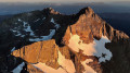
The title of this hike should be “Bivouac at Puy Gris”, as this viewpoint offers a unique experience to anyone spending a night there under the stars: splendid sunsets and sunrises against a magnificent panorama, the finest in Belledonne. Magnificent lakes dot the route and alpine wildlife is a regular sight.
Any difficult hike requires preparation, and this very difficult hike demands careful planning beforehand.
Selle du Puy Gris via the Gleyzin and Grande Valloire valleys
 11.37 mi
+6,972 ft
-6,955 ft
10 hrs
Very difficult
Departure from La Ferrière (Isère) (Isère)
11.37 mi
+6,972 ft
-6,955 ft
10 hrs
Very difficult
Departure from La Ferrière (Isère) (Isère)
A circular walk through a rocky landscape shaped by glaciers and dotted with mirror-like lakes. After the peaceful mountain pastures of Lac Léat above the Haut Bréda valley and then the Combe Grasse, the walk takes you to the passes and peaks surrounding Puy Gris before descending towards the scenic setting formed by the lakes of Grande Valloire.
The hike can be done with an overnight stay in a mountain hut and can be combined with the easy ascent of Puy Gris: see the ‘During the hike’ section.
Pic de la Petite Valloire, starting from Grand Thiervoz
 8.94 mi
+5,407 ft
-5,407 ft
8h 50
Very difficult
Departure from La Ferrière (Isère) (Isère)
8.94 mi
+5,407 ft
-5,407 ft
8h 50
Very difficult
Departure from La Ferrière (Isère) (Isère)
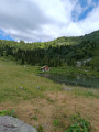
The Pic de la Petite Valloire is part of the Pointes de la Porte d’Eglise. This hike is long and demanding. From Montagne de Tigneux to the Refuge de l’Oule, you won’t come across anyone. The Passage de Tigneux is far from straightforward; it is steep and slippery. Afterwards, you’ll need to find your own route along the ridge, but what a beautiful, wild hike, punctuated by magnificent scenery.
Circular route on the Sept Laux lakes plateau
 11.13 mi
+3,963 ft
-3,937 ft
8h 35
Difficult
Departure from La Ferrière (Isère) (Isère)
11.13 mi
+3,963 ft
-3,937 ft
8h 35
Difficult
Departure from La Ferrière (Isère) (Isère)
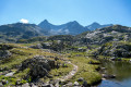
This fairly strenuous circular route offers a taste of the best of Belledonne (forest, rocks, lakes, peaks) to those who take it on. The route is well signposted, though obvious, with an unmistakable trail on the ground all the way. There are no technical difficulties, but it’s best to wear sturdy footwear as the rocky sections on the ascent are challenging.
⚠️ 15/06/2026: a notice indicates a rockfall at Cul de la Vieille between points 4 and 9, making it impossible to follow this route. You must bypass this section between points 3 and 4 via the GR®738. Please let us know in the comments if you have any information regarding the lifting of this notice.
Combe Madame refuge and Pissou waterfall
 6.17 mi
+2,598 ft
-2,569 ft
5h 05
Easy
Departure from La Ferrière (Isère) (Isère)
6.17 mi
+2,598 ft
-2,569 ft
5h 05
Easy
Departure from La Ferrière (Isère) (Isère)
A good hike in the crystalline Belledonne massif; the Combe Madame mountain hut isn’t perched very high up, but it provides access to areas suited to experienced and resilient mountaineers.Water is everywhere, the lakes are not far away, wildlife abounds on the vertiginous slopes, and walkers are treated to a feast for the eyes.
The Sept Laux from Fond-de-France
 7.63 mi
+3,484 ft
-3,468 ft
6h 35
Difficult
Departure from La Ferrière (Isère) (Isère)
7.63 mi
+3,484 ft
-3,468 ft
6h 35
Difficult
Departure from La Ferrière (Isère) (Isère)
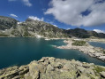
Hike between lakes and mountains around the Refuge des Sept Laux.
⚠️15/06/2026: a notice indicates a rockfall at Cul de la Vieille between 7 and 3, making it impossible to follow this route. You must take the GR®738 between 7 and 4. Please let us know in the comments if you have any information regarding the lifting of this notice.
Circular route starting from the Tour d'Avalon
5.57 mi
+1,119 ft
-1,138 ft
3h 30
Moderate
Departure from Saint-Maximin (Isère) (Isère)
A lovely start from the beautiful Tour d'Avalon, followed by a fairly varied circular route through forests and villages.This route is difficult to describe due to the numerous roads and paths in this area, so a GPS and an online map (for example, downloaded via the Visorando app) are recommended. The Tour d’Avalon serves as a good landmark.
From the Lodge de la Martinette to the Refuge de l’Oule via Lac du Léat
8.13 mi
+4,619 ft
-2,129 ft
7h 45
Very difficult
Departure from La Ferrière (Isère) (Isère)
A very physically demanding day, with very steep slopes right from the start that give you almost no respite until you reach the refuge. But from the Refuge de la Grande Valloire onwards, the views are magnificent.
Brame-Farine ridges
 7.42 mi
+2,762 ft
-2,762 ft
5h 50
Difficult
Departure from Saint-Maximin (Isère) (Isère)
7.42 mi
+2,762 ft
-2,762 ft
5h 50
Difficult
Departure from Saint-Maximin (Isère) (Isère)
Hike starting from a small village in Isère (on the border with Savoie) to reach the summit that separates it from its neighbour Allevard-les-Bains. From the ridge, a superb panorama allows you to discover the latter at the foot of the massif of the same name.This hike is more athletic than recreational, with a long and fairly steep climb, mainly through sometimes damp undergrowth, which can make the descent quite slippery.
The Cross on the Alp
 6.30 mi
+2,838 ft
-2,822 ft
6 hrs
Difficult
Departure from Saint-Pierre-d'Entremont (Savoie) (Savoie)
6.30 mi
+2,838 ft
-2,822 ft
6 hrs
Difficult
Departure from Saint-Pierre-d'Entremont (Savoie) (Savoie)
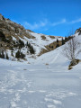
A lovely with snowshoes, with a beautiful view of the Alpine peaks at its height. Note that this hike can be done in all seasons.
Sangles de Fouda Blanc and Pinet circular
 8.99 mi
+3,609 ft
-3,579 ft
8 hrs
Very difficult
Departure from Saint-Pierre-d'Entremont (Savoie) (Savoie)
8.99 mi
+3,609 ft
-3,579 ft
8 hrs
Very difficult
Departure from Saint-Pierre-d'Entremont (Savoie) (Savoie)
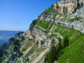
This circular allows you to take the longest route in the massif, linking the Sangle du Fouda Blanc and the Sangle du Pinet. The proposed return route allows you to visit the characteristic sites of the Pinet, which are its mushroom rocks and the arch of its sinkhole.
Please note that this is a challenging route: you will be between two cliffs for about two hours, where missteps are not an option. Dry terrain is essential.
Le Grand Manti
 5.81 mi
+2,812 ft
-2,782 ft
5h 05
Moderate
Departure from Saint-Pierre-d'Entremont (Savoie) (Savoie)
5.81 mi
+2,812 ft
-2,782 ft
5h 05
Moderate
Departure from Saint-Pierre-d'Entremont (Savoie) (Savoie)
A pleasant walk in the Hauts de Chartreuse nature reserve.
Lost in the mountain pastures, the old boundary markers between Savoie and Dauphiné still look beautiful.
The Belles Ombres and Fouda Blanc route via the Grotte de l’Ours
 15.04 mi
+6,699 ft
-6,699 ft
10 hrs
Extremely difficult
Departure from Saint-Pierre-d'Entremont (Savoie) (Savoie)
15.04 mi
+6,699 ft
-6,699 ft
10 hrs
Extremely difficult
Departure from Saint-Pierre-d'Entremont (Savoie) (Savoie)
A hike of superlatives, combining the most beautiful landscapes of the Northern Chartreuse with four little-visited arches, as well as magnificent limestone formations including the Dromadaire, the Griffes and the Grotte de l’Ours.
The route alternates between barely marked, idyllic paths, vertiginous ridges and vast sharp limestone pavements, and runs largely off the beaten track.
This hike requires a good level of fitness; please read the warning in the practical information carefully.
The sangles of Fouda Blanc and Le Pinet and finally the Grotte à l'Échelle
 7.22 mi
+3,986 ft
-3,960 ft
7 hrs
Extremely difficult
Departure from Saint-Pierre-d'Entremont (Savoie) (Savoie)
7.22 mi
+3,986 ft
-3,960 ft
7 hrs
Extremely difficult
Departure from Saint-Pierre-d'Entremont (Savoie) (Savoie)
Please note that this exposed route is not suitable for people who are prone to vertigo and have no experience of aerial crossings and climbing steps. It should not be attempted in wet weather due to the risk of slipping.This circular hike crosses the very aerial sangles of Fouda Blanc and Le Pinet, which, at over 3 km, is the longest in the Chartreuse. The Fouda Blanc sangle is slightly less exposed and busier than the Pinet. The latter is narrower, often grassy, slippery in wet weather, and has a few unstable earthy passages that must be crossed with caution. Access to this crossing is via the Varvats trail at Pas de l'Échelle. At the end of the ridges, you reach the summit of Pinet, also known as Truc, then the ridge trail joins Pas de Fouda Blanc, which you descend before crossing the Grotte à l'Échelle. The descent down a scree slope and then through the woods takes you back to the return path.GPX track required.
Le Pinet via the Fouda Blanc strap
 7.07 mi
+3,753 ft
-3,760 ft
6 hrs
Extremely difficult
Departure from Saint-Pierre-d'Entremont (Savoie) (Savoie)
7.07 mi
+3,753 ft
-3,760 ft
6 hrs
Extremely difficult
Departure from Saint-Pierre-d'Entremont (Savoie) (Savoie)
Here is the guidebook for the longest ledge in Chartreuse and, in my opinion, one of the most beautiful. It is a loop circuit that forms a figure 8. The west, slightly north-west orientation of this ledge leads me to recommend that you set off at the end of the morning and in this direction so that you can enjoy the most beautiful landscapes at the end of the afternoon.
A much more complete description can be found in Pascal Sombardier's book "Les Randonnées du Vertige" (Vertigo Hikes).
Montfallet Tower and Col du Lautaret
 6.11 mi
+1,319 ft
-1,342 ft
4h 00
Moderate
Departure from Laval (Isère)
6.11 mi
+1,319 ft
-1,342 ft
4h 00
Moderate
Departure from Laval (Isère)
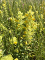
An ideal walk for mid-season and for exploring Belledonne from a moderate altitude.
Lac de la Jasse and Col de Bédina
 4.20 mi
+410 ft
-2,562 ft
2h 15
Moderate
Departure from Les Adrets (Isère)
4.20 mi
+410 ft
-2,562 ft
2h 15
Moderate
Departure from Les Adrets (Isère)
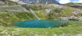
A beautiful high-altitude lake accessible by chairlift from Prapoutel. Descent via the wilder side of the resort. Passes by Gros Caillou, a popular spot for climbers.
From Lac de la Jasse to Prapoutel via Gros Cailloux
 3.08 mi
+2,241 ft
-2,684 ft
3h 20
Moderate
Departure from Les Adrets (Isère)
3.08 mi
+2,241 ft
-2,684 ft
3h 20
Moderate
Departure from Les Adrets (Isère)
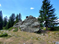
This is a magnificent, easy walk that takes you through many beautiful natural sites, with breathtaking views of the Grésivaudan valley and the Chartreuse mountains.
Mont Granier via the Pas des Barres and the Balme à Colon
 7.02 mi
+2,956 ft
-2,979 ft
6 hrs
Very difficult
Departure from Entremont-le-Vieux (Savoie)
7.02 mi
+2,956 ft
-2,979 ft
6 hrs
Very difficult
Departure from Entremont-le-Vieux (Savoie)
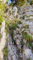
A beautiful loop in the northern Chartreuse with magnificent 360° views of the Alps.
Le Mont Granier en boucle par le Pas des Barres et celui de Tencovaz
8.79 mi
+3,369 ft
-3,383 ft
7h 00
Very difficult
Departure from Entremont-le-Vieux (Savoie)
La montée emprunte le parcours le plus fréquenté de l'accès au Granier, celui par le Col de l'Alpette et le Pas des Barres. La descente par le Pas de Tancovaz reste beaucoup plus secrète, la désescalade de deux étroitures nécessitant une certaine agilité doublée d'un bon sens d'orientation dans la descente hors sentier d'un pierrier pentu. Mais ces difficultés font tout le charme de ce retour atypique.
Le Pinet or Truc from La Plagne
 6.15 mi
+2,802 ft
-2,802 ft
5h 15
Moderate
Departure from Entremont-le-Vieux (Savoie)
6.15 mi
+2,802 ft
-2,802 ft
5h 15
Moderate
Departure from Entremont-le-Vieux (Savoie)
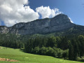
Le Pinet is a viewpoint overlooking Les Entremonts. Less frequented than its neighbour, Le Granier, it is just as much a part of the Hauts de Chartreuse Nature Reserve and its access via the normal route is well suited to families, with a few variations possible.
From La Plagne to the Chalet de l'Alpe or Habert Saint-Vincent
6.65 mi
+2,073 ft
-2,041 ft
7 hrs
Moderate
Departure from Entremont-le-Vieux (Savoie)
This is a snowshoe hike with no specific markings for this activity; however, theGR® 9 markings do exist, though they are less visible in winter conditions
The appeal of this hike lies not in the markings but rather in the atmosphere you experience along the route across the plateau.
Col de l'Alpette
 2.22 mi
+1,470 ft
-1,470 ft
2h 20
Moderate
Departure from Entremont-le-Vieux (Savoie)
2.22 mi
+1,470 ft
-1,470 ft
2h 20
Moderate
Departure from Entremont-le-Vieux (Savoie)
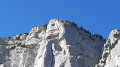
Very pretty hike in the foothills of Granier. At the summit, there is a large plateau ideal for picnics, with views of the surrounding peaks and Mont Blanc in good weather.
An easy family walk, done with a 3½-year-old girl who is used to walking, as it is quite steep.
The summit of Mont Granier
 Tourist office5.42 mi
+3,235 ft
-3,222 ft
5h 20
Difficult
Departure from Entremont-le-Vieux (Savoie)
Tourist office5.42 mi
+3,235 ft
-3,222 ft
5h 20
Difficult
Departure from Entremont-le-Vieux (Savoie)
In the heart of the Hauts de Chartreuse Nature Reserve, the majestic Mont Granier welcomes you. Although the cross is inaccessible for safety reasons, this hike reveals astonishing geology and remarkable biodiversity.
Le Pinet then La Croix de l'Alpe
 8.70 mi
+3,360 ft
-3,360 ft
6h 55
Difficult
Departure from Entremont-le-Vieux (Savoie)
8.70 mi
+3,360 ft
-3,360 ft
6h 55
Difficult
Departure from Entremont-le-Vieux (Savoie)
From the small hamlet of La Plagne, summit of Le Pinet (1,867m), beautiful view to the west, then summit of La Croix de l'Alpe (1,821m) via the Chalets de l'Alpe.
From Chapelle-du-Bard to Pont du Diable via Beauvoir
6.13 mi
+1,601 ft
-1,591 ft
4h 15
Moderate
Departure from La Chapelle-du-Bard (Isère)
A lovely hike with beautiful views and scenery, quite varied, a little bit of tarmac but not much, with good signposting. Doable almost all year round, except in muddy conditions after rain, of course. At the Pont du Diable, you will cross the Dauphiné-Savoie border, with its pretty, colourful boundary stone. By whom?
The Government Castle
 7.26 mi
+1,775 ft
-1,798 ft
4h 55
Moderate
Departure from Saint-Pierre-d'Entremont (Savoie) (Savoie)
7.26 mi
+1,775 ft
-1,798 ft
4h 55
Moderate
Departure from Saint-Pierre-d'Entremont (Savoie) (Savoie)
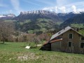
Around the two communes of Saint-Pierre d'Entremont, this walk covers the two departments of Savoie and Isère, exploring the architectural heritage and Carthusian landscapes. The most beautiful panorama can be seen from the esplanade of the Château du Gouvernement in Saint-Pierre d'Entremont (Isère).
Sept Laux J2
 10.35 mi
+2,408 ft
-5,026 ft
6h 50
Difficult
Departure from La Ferrière (Isère) (Isère)
10.35 mi
+2,408 ft
-5,026 ft
6h 50
Difficult
Departure from La Ferrière (Isère) (Isère)
The second stage of this circular route in the Belledonne Massif, sometimes along a balcony trail, sometimes through wild valleys, takes you around the Allevard Massif.
⚠️15/06/2026: a notice indicates a rockfall at Cul de la Vieille between 2 and 3, making it impossible to follow this route. You must take the GR®738 as a detour. Please let us know in the comments if you have any information regarding the lifting of this notice.
Refuge des Sept Laux – Rivier d’Allemond
 5.19 mi
+407 ft
-3,248 ft
2h 45
Moderate
Departure from La Ferrière (Isère) (Isère)
5.19 mi
+407 ft
-3,248 ft
2h 45
Moderate
Departure from La Ferrière (Isère) (Isère)
A classic, well-known hike in the area to explore the Lacs des 7 Laux. Here, only the descent is described and used to complete this traverse, as it is not possible to continue easily on to the Refuge de l’Oule.
Route from Les Gandy
4.99 mi
+1,362 ft
-1,355 ft
4 hrs
Easy
Departure from Entremont-le-Vieux (Savoie)
Snowshoe route on a sunny slope in the Entremont valley.
This route combines well-marked sections with others that are a little more open.
In winter, this route is normally done on snowshoes. This was a snowshoe outing, but given the lack of snow at the end of January 2014, the snowshoes remained attached to our rucksacks.