Circuit of the Northern Waterfalls of the Petites Roches

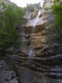
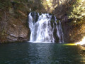
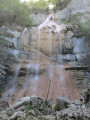
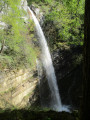
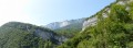
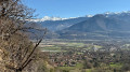
Numerous streams flow down from the Petites Roches plateau into the Isère valley, creating several spectacular waterfalls. This route allows you to explore those at the northern end of the Petites Roches plateau, which are not part of the ‘Tour des Petites Roches’GR® de pays route, which runs further south. If the full hike is too long, you can use this as inspiration for easier alternatives.

Details

2025722
Creation:
Last update:
Last review:
  • Walking
    Activity: Walking
  • ↔
    Distance: 15.71 mi
  • ◔
    Duration according to the author: 10 hrs 
  • ▲
    Difficulty: Very difficult

  • ⚐
    Back to start: Yes
  • ↗
    Ascent: + 6,549 ft
  • ↘
    Descent: - 6,532 ft

  • ▲
    Highest point: 4,623 ft
  • ▼
    Lowest point: 1,309 ft

Photos

Description of the walk

The walk starts in Montalieu (in the commune of Saint-Vincent-de-Mercuze), at the car park on Impasse des Cassardes.

(S/E) From the car park, walk back down a few metres to the end of the cul-de-sac and turn right onto Rue de la Gorge. Continue along the road until you reach a right-hand hairpin bend, where a path branches off to the left, leading in a few minutes to the Waterfall de la Gouille Michel.

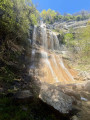
(1) A footbridge crosses the river, then a fairly steep climb leads up to the Grande waterfall of Alloix.

(2) The path then turns right and passes under the waterfall. Carry on straight ahead at the next junction (a sign points towards “Le Devin”) until you reach the D282, then turn left onto it.

(3) A few bends further on, turn right onto a path signposted “Sentier de la route antique”. The path cuts across a few hairpin bends in the road and passes through a sheep enclosure (make sure to close the gates properly) to reach the hamlets of La Vieille Église and then La Chapelle. Continue on towards Les Prés.

(4) At the end of the path, turn left, cross the D282 in the hamlet of Les Prés, then take the first street on the right. After about 150 m, as you leave the hamlet, take the path that climbs to the left towards Pré Orcel (yellow markings). The path crosses three larger cross-trails; follow the markings carefully to continue climbing straight ahead.

(5) Atthe fourth junction with a wide track, just below the Pré Orcel car park, take this track to the right (this time, there’s no need to follow the markings, as they lead you up and down unnecessarily). Continue along the track to the end.

(6) At the end of the track, turn right, then take the first path on the left. Continue to the source of the Cernon along this path, which winds downwards, ignoring other paths branching off to the right.

(7) Cross the Cernon, bearing in mind that the signpost in the middle of the stream does not necessarily indicate the easiest place to cross. Then keep to the right at two junctions (towards Saint-Marcel d’en Haut) until you reach a wide track at the small Cernon dam.

(8) A short round trip of a few metres to the dam offers a view of a small waterfall. Continue along the track, then take the first path on the right, which soon joins the Cernon.

(9) When you reach the bank of the stream, the path becomes unclear and the markings are barely visible. Follow the penstock upstream to support number 13, then turn left to cross at a large rock where a few trees are growing. A yellow marker is visible a little further up, on a section of the penstock stuck in the middle of the stream. On the other side of the boulder, look out for a cairn marking the spot where the path resumes on the opposite bank. The path itself is barely visible, hidden by fallen trees. Once on the opposite bank, after the first cairn, the path becomes clearer. It begins by climbing the bank of the Cernon valley, still marked by a few cairns, then continues through the forest and becomes a forest track.

(10) At a place called La Tivolière, the path becomes a road: at this point, turn left towards Saint-Marcel d’en Bas, cross the D285 and then turn right at the first junction. Continue for a short while until you reach a junction signposted for the Furet waterfall. A short but steep round trip takes you to the waterfall.

(11) On your return from the waterfall, continue along the previous path towards Barraux until you reach the next junction.

(12) At this junction signposted ‘Champ Brisson’, take the path that climbs to the right towards Saint-Georges. At the top of the climb, the path opens out onto a meadow and continues along its left-hand side. The path is fairly cluttered with wood-cutting debris, but is still clearly visible. A little further on, you reach another meadow; the path also runs along its left-hand side, staying right on the edge of the forest.

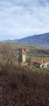
(13) The path crosses a wider track: follow it to the left for a few dozen metres to reach a telecoms tower with a lovely view over the valley and the little Château du Fayet just below. Then return to the previous path towards Saint-Georges. It soon joins a small street: follow it to the left, then immediately take the first street on the right to reach the main road (D282). Follow it to the left for 150 metres until you reach a small bridge.

(14) At the bridge, turn left onto a path that follows the Rif Mort and keep to the right at the next junction. Carry on for a short while until you spot a crossroads on the right marked by two cairns and a discreet ‘waterfall’ sign on a tree: this is the path leading to the Teppes-Cochon waterfall.

(15) Again, this is a short, steep round trip. On your return from the waterfall, continue along the previous path to the right. Turn right at the next junction and carry on until you reach a small bridge over the Ruisseau des Granges. Cross the stream via the bridge.

(16) Immediately take a forest track that climbs to the right. The track bends to the right, then takes a wide bend to the left: carry on, ignoring several tracks branching off to the right. After the bend to the left, the track appears to end and begins to be overgrown, but it actually continues as a narrow path that runs straight ahead through the undergrowth. Carry on along this path until you reach another one (the ‘Chemin du Pas du facteur’) and take it to the left.

(17) After a few dozen metres along this path, look out for the start of another path leading uphill to the right. This path is rather inconspicuous as it is heavily overgrown for the first few metres, but it improves thereafter. Follow this path to the end, where it joins the D282 at a hairpin bend.

(18) Turn left onto the road. Go straight on at the next junction, then turn left onto a track after about 200 metres. Turn right 100 metres further on: this track leads straight back to the Montalieu car park (S/E).

Waypoints

  1. S/E : mi 0 - alt. 1,329 ft - Montalieu car park, Impasse des Cassardes.
  2. 1 : mi 0.55 - alt. 1,558 ft - Gouille Michel Waterfall
  3. 2 : mi 0.85 - alt. 2,028 ft - Alloix Waterfall
  4. 3 : mi 1.34 - alt. 2,448 ft - The Ancient Road Trail
  5. 4 : mi 2.43 - alt. 3,048 ft - Les Prés, on the left
  6. 5 : mi 3.65 - alt. 4,488 ft - Below Pré Orcel, take the track on the right
  7. 6 : mi 5.83 - alt. 4,354 ft - End of the track, turn right
  8. 7 : mi 6.71 - alt. 3,816 ft - Crossing the Cernon
  9. 8 : mi 7.3 - alt. 3,159 ft - Return walk to the Cernon dam
  10. 9 : mi 7.53 - alt. 3,084 ft - Cernon Ford - Cernon (cours d'eau) - Affluent du Ruisseau du Bon de Loge
  11. 10 : mi 8.61 - alt. 2,772 ft - La Tivolière, on the left
  12. 11 : mi 9.51 - alt. 2,087 ft - Furet Waterfall Trail
  13. 12 : mi 10.11 - alt. 1,624 ft - Champ Brisson
  14. 13 : mi 11.43 - alt. 3,081 ft - Round trip to the viewpoint
  15. 14 : mi 12.04 - alt. 3,081 ft - Saint-Georges
  16. 15 : mi 13.14 - alt. 2,031 ft - Teppes-Cochon Waterfall round trip
  17. 16 : mi 13.99 - alt. 1,572 ft - Ruisseau des Granges
  18. 17 : mi 14.45 - alt. 1,801 ft - Path on the right
  19. 18 : mi 14.99 - alt. 1,913 ft - D282 to the left
  20. S/E : mi 15.7 - alt. 1,332 ft - Montalieu car park, Impasse des Cassardes.

Notes

Spring is the best time of year for this walk: it’s an ideal route when snow still blocks access to the peaks and the melting snow feeds the plateau’s streams abundantly! In summer, most of the streams may be dry or nearly so, which makes the walk less interesting.

The IGN base map is inaccurate between (16) and (18): no path appears on the IGN map, even though one does exist. The OpenStreetMap base map is correct.

There are no particularly difficult sections on this walk: the climbs are sometimes steep but never very long. The challenge lies in the total distance and the cumulative elevation gain, which ends up being significant. So, with the help of the map, you can easily find easier alternatives that follow only part of the route.

This route passes through a protected area, which may be subject to special regulations:

Worth a visit

At (18), instead of heading straight onto the road, you can turn left for a few metres: a bench situated at the top of a cliff, which is quite unexpected in this spot, offers a chance to enjoy one last beautiful panoramic view.

At the Grande waterfall of Alloix (2), there is a via ferrata.

Always be cautious and plan ahead when you're outdoors. Visorando and the author of this route cannot be held responsible for any accidents occurring on this route.

The GR® and PR® markings are the intellectual property of the Fédération Française de Randonnée Pédestre.

Reviews and comments

4.2 / 5
Based on 3 reviews

Reliability of the description
4.3 / 5
Ease of following the route
4 / 5
Route interest
4.3 / 5
User 17554223
• Edited:

Overall rating : 4.3 / 5

Date of your route : Aug 17, 2025
Reliability of the description : ★★★★★ Very good
Ease of following the route : ★★★★☆ Good
Route interest : ★★★★☆ Good
Very busy route : No

We did this hike over two days because it was too difficult for us. Even over two days, we were exhausted. We're a bit out of shape.
We camped near point 10, keeping a low profile as it's private land.

The hike:
The big plus is that 95% of the walk is in the woods during this hot period.
The big downside of this time of year is that the first waterfall is the municipal swimming pool on the Plateau des Petites Roches and all the others are dry or almost dry!
Best to go in June when it's hot!
The end of the hike is less interesting as there are no waterfalls.

Please note:
- at the start, parking in the village is no longer allowed and is "reserved for residents" (I doubt this, as we didn't see any signs; it may be a bluff by the residents, but I understand). We were recommended the shaded car park at the old campsite and, in addition to useful amenities (including fresh water), the climb starts at the water's edge, which is nice.
- the trail is easy to follow, especially with the explanations. This includes the Cernon lookout, which had caused problems before.
- some of the less frequented paths are a bit overgrown, which slows you down and makes the walk less enjoyable. This is particularly true at the end, between 16 and 18. I can imagine those who set out to do the whole thing in one day... the end is tough!
- the recent logging between 9 and 10 also makes the walk unpleasant, with paths destroyed by machinery (be careful at the less visible crossroads) and an atmosphere reminiscent of trench warfare
- Finally, the springs are dry in August and in three successive villages where we planned to refill our water bottles at the indicated fountains, everything was closed. No water, even with taps. Tip: the mayor of St Georges, who lives next to the fountain, showed us the manhole right next to it where you just have to open the valve! Everything was closed by the Crolles community of municipalities. But in fact, there is water in the village fountains! In this August heatwave, it's almost irresponsible! As soon as it was opened, lots of walkers came to refill their bottles and water their dogs! In short, beware of water in summer!

Machine-translated

gbenouville
gbenouville

I did the route again today, and it’s true that the signposting and visibility of the path leave something to be desired at the Cernon ford. I’ve updated the description with more details.

Machine-translated

MarcDubief
MarcDubief

Overall rating : 3.7 / 5

Date of your route : Aug 17, 2023
Reliability of the description : ★★★★☆ Good
Ease of following the route : ★★★☆☆ Average
Route interest : ★★★★☆ Good
Very busy route : No

A lovely walk that is both technical (trekking poles essential) and challenging, with long, steep climbs. The first part of the route is more enjoyable than the second, which is mostly through woodland. On 15 August, the fountains were running, so we were able to top up our water supplies. In the village of Les Pré, the first fountain was dirty and the second had no water. Not all the waterfalls were flowing.
We encountered a small rockfall whilst crossing the source of the Cernon: take care.
We had trouble finding the path at point 8, below the EDF dam on the Cernon. The route isn’t clearly marked; you need to follow the yellow markings to the end of the track, look out for a section of penstock stuck in the middle of the stream with a yellow mark, then follow the cairns. The path is clearly shown on the OpenMap base map; the GPS track is incorrect.
This hike is best done over two days with a bivouac (no fires allowed in the Chartreuse).

Machine-translated

Abramowitch
Abramowitch

Overall rating : 4.7 / 5

Date of your route : Aug 18, 2019
Reliability of the description : ★★★★☆ Good
Ease of following the route : ★★★★★ Very good
Route interest : ★★★★★ Very good

A superb walk. However, on this Sunday in mid-August, all the waterfalls – apart from the Gouille Michel and the one above the Cernon dam – were completely dry!! In particular, the Grande Cascade d’Alloix didn’t have a single drop of water. A bit of a shame. It’s nobody’s fault.
On the other hand, the IGN map’s omissions regarding the paths are regrettable. In particular, finding the way under the Cernon dam is a bit of a guessing game. A compass, or even better a GPS, seems essential to me in many parts of the route.

Machine-translated

Other walks in the area

For more walks, use our search engine .

The GPS track and description are the property of this route's author. Please do not copy them without permission.