


 Country:

 City:
City:


Warning: the classic hike to the Griffes de l’Ours is traditionally completed by retracing one’s steps from the Griffes (3), along a path that would only warrant a ‘Difficult’ rating if one were not going any further. Our circular route climbs up at (6) onto the Sangle de Belles Ombres, which justifies a ‘Very Difficult’ rating (very steep clay slope). The exit onto the ridge above (9) raises the rating to ‘Extremely Difficult’. See the nearby variants for alternatives of varying levels of difficulty, as you prefer.
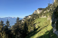
(Start/Finish) From the car park, take the yellow-marked path which climbs northwards (signpost indicating the path and the Alpe cross). This path quickly emerges from the fir trees and, after three hairpin bends, joins a wide track at the Cabane de l’Allier, which will serve as a landmark on the return journey. Turn left onto this track and head south-south-west along a gentle slope for about 600 metres.
(1) In a small hollow, a small cairn marks the start of the Col des Belles Ombres path (the main path heads under a rocky overhang at the exit of this hollow; turn back if you have gone that far). Climb this steep path, which begins with a few hairpin bends and heads generally west-north-west.
(2) When the path veers further north, a spruce tree (see visual landmarks) marks the point where you leave the Col de Belles Ombres path to take the lower traverse northwards towards the Griffes de l’Ours.
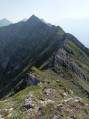
Continue north-north-west along this very easy ridge path. As you go, take note of a beautiful, jagged limestone formation a little further down the slope from the ridge path (a short detour from the GPS track). The ridge path then passes through a cirque bordered to the north by a broad promontory (detour via the promontory to the east on the GPS track). Les Griffes soon come into view and are reached after passing a small grassy cirque.
(3) Cross the shoulder of Les Griffes along the ridge and immediately turn right (east) to reach the summit via its northern side. Retrace your steps back across the shoulder onto the ridge and turn right onto it to continue northwards. From here, the ridge becomes slightly more challenging.
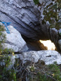
After a slightly denser copse of deciduous trees, look out for an ascending track on the left which marks the starting point of the exit (6) towards the upper Belles Ombres ridge path. Continue, however, along the lower ridge path, still heading north, to end up beneath a rocky overhang and reach the tip of the promontory marking the end of the cirque.
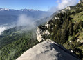
(4) Turn round to look at the slopes rising towards the cliff to the west (see landmarks). In the nearest valley, look out for a cave (landmark) before retracing your steps along the path in the opposite direction to head towards the foot of the cave. Climb up to the cave to explore it.
(5) From the cave, descend (eastwards) towards the lower traverse a few metres below (see alternative routes for exiting via the top). Turn right onto the traverse to follow it southwards and round the spur where the cave is situated.
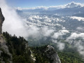
(6) In the deciduous woodland you spotted on the way up, follow the very steep track ascending to the right (west). This leads to a sheep pasture directly beneath the ridge cliff and joins the Sangle de Belles Ombres. Turn right onto the path to climb north-east towards a spur jutting out from the cliff. Turn right onto this shoulder (east) to visit the promontory which directly overlooks the one visited in (4); this promontory offers a spectacular view of the Sangle, the cliffs and the valley.
(7) Turn back to rejoin the path, heading broadly southwards. Pass through the sheep pasture again and go round the large cliff overlooking it. Shortly afterwards, Red Discs begin to mark the path (these come from an exit route from the Griffes de l’Ours used by climbers).
(8) Follow the path, keeping an eye out for the red markings, and after about a hundred metres, just as the path is about to go round a small rocky outcrop, note that the red markings diverge and point upwards to the right.
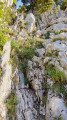
(9) Leave the sling heading east to follow this red-marked trail (an orange arrow topped with an ‘A’ indicates the same direction), climbing steadily up the rocks and scree. Two fixed ropes in poor condition hang along this route; it is better to use your ice axe in the scree and brace yourself against the rocks to make progress. Once past the steepest section, the trail veers left (south-west) and winds its way up towards the ridge along a rocky outcrop (marked by a red line and arrow, then a double fluorescent orange arrow on this outcrop). Do not take this path straight away, but instead head up over scree to the north-west towards what quickly becomes apparent as the beautiful Belles Ombres arch. Return to the path along the rocky outcrop and resume the ascent to the south-west.
Emerge onto this ridge and turn left (south-west) to follow its line (the track shows a slight detour towards the neighbouring summit). Stay as close as possible to this ridge, always favouring it over the path set back a little lower down. Continue along this open ridge, leaving it only to bypass sharp limestone pavement and karstic caves. Once you reach the forest, return to the clearly visible path to cross a small network of sharp limestone pavements and reach the Col de Belles Ombres. At the very flat pass, head left due east towards the rock (visual landmark) bordered by a wire fence. Cross the fence and turn immediately right to join the path heading south-east at the foot of the cliff.
After a right-hand bend onto a grassy shoulder, the path splits into an upper section on a rocky ledge and a lower path running through the grass 2 metres below. Unless you fancy walking on all fours, take the lower path to continue southwards until you pass a shepherd’s shelter beneath the rocks and reach the Alpe path. A short detour through the Alpe labyrinth allows you to see its well-hidden arches; see the alternative routes. Otherwise, turn left onto this path to descend a few wide hairpin bends and return to the junction you passed on the way out.
(1) From there, follow the same route as on the way up to reach the car park (S/E).



 Visorando Member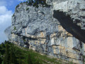
 Difficult
 Tourism professional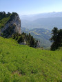
 Moderate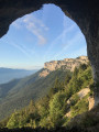
 Very difficult
