


 Country:

 City:
City:


Start from the Pré Orcel car park (1,410 m), at the end of a gravelled, motorable forest track leading from Sainte-Marie-du-Mont, in the hamlet of Les Prés.
(S/E) From the car park, head north to the left of the forest track, taking the Col de l’Alpe path which climbs through the forest and, after two hairpin bends, emerges near the Cabane de l’Allier. Continue along the Col de l’Alpe path.
(1) Just before the overhanging rocks, turn right (small cairn) to follow the Col de Belles Ombres path uphill to a grassy area where it turns left at an altitude of 1,707 m.
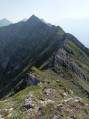
(2) Leave the Col de Belles Ombres path and continue straight on towards the north along a well-marked track that climbs beneath the Rochers de Belles Ombres before levelling out; this is the lower Belles Ombres track, which continues without difficulty.
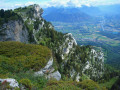
(3) Halfway along this ridge, you can see, below and to the right, distinctive rocks rising above the trees: this is the Dromadaire. To descend to it, go well past its vertical projection and follow faint tracks down a steep grassy slope, passing a small rocky outcrop, until you reach the level of the rocks.
It is possible to reach a small pass just below the “head” of the Dromadaire to cross over to its southern slope. Return to its northern slope to climb one of the steep paths leading back to the ridge, which you then follow northwards.
After the first cirque, you can follow the ridge to the right and back to reach a viewpoint. After two more small cirques, head for the ridge of the Rocher des Griffes de l’Ours, which you climb via a path running mainly along the northern edge of the ridge.
(4) From the summit, head back towards the path and follow it northwards, descending slightly to reach the bottom of another grassy cirque. Red-orange markings indicate that you should climb up to the left to reach, via a steep slope, the Grotte de l’Ours and its arch.
(5) From the cave, retrace your steps to the ridge path, which ends 200 m further on above a cliff, and follow it southwards, passing the Griffes de l’Ours once more
(4) 150 m further on, look out for a marker leading up to the right towards a rocky outcrop fitted with a rope. Avoid taking this tricky route, but continue for a further 20–30 m along the path to reach the foot of a wide grassy gully.
(6) Climb the steep but not particularly difficult slope (provided the ground is dry) following faint tracks to reach the upper Belles Ombres path, which ascends from the left.
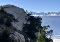
(7) Follow it to the right, winding your way along the foot of the Rochers de Belles Ombres, with ascents to cross the limestone spurs and descents to cross the bottoms of the cirques – which are often impressive and sometimes exposed.
Cross four or five cirques in this way, following a well-marked path. After descending a little to around 1,690 m, do not miss a blue and yellow mark on the rock.
(8) Leave the upper ridge here and head completely to the left, straight up the slope, along a steep path that leads to a low point on the ridge.
Take the ridge path on the left for a long stretch through the forest heading south, initially close to the cliffs, then climbing up its western flank whilst regularly passing close to the ridge again.
The final ascent takes you out of the forest into a summit meadow, with the highest point of the Rochers de Belles Ombres – the 1,843-metre point – to your left; you reach this by following the edge of the cliffs.
(9) Begin the descent by first following the level meadows at the summit of the Rochers de Belles Ombres, via either of the paths criss-crossing them. The descent then veers slightly south-west and becomes steeper, leading to the pass at the Col de Belles Ombres.
(10) Turn left to descend the path on its eastern slope, passing the upper track on your left, then returning to the start of the lower track.
(2) Follow the route back down and rejoin the Chemin du Col de l’Alpe.
(1) Once you reach the Chemin du Col de l’Alpe, turn left to descend, passing the Cabane de l’Allier and then Pré Orcel (S/E).


 Tourism professional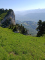
 Extremely difficult
 Visorando Member
 Moderate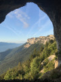
 Very difficult
