Country:

 City:
City:


From the A41 motorway, take the Pontcharra exit (no. 22), then follow the D1090 southwards to La Buissière. Head up to the right towards La Flachère via the D284, turn right, then take the first road on the left (Chemin de Pierre Plate) to park in the hamlet of Le Boissieu (near the fountain or, if there’s no space, drive up to the top of the hamlet where there’s a large lay-by at the start of the unpaved track).
(S/E) Walk up to the top of the hamlet and continue along a forest track which crosses the Ruisseau des Granges via a stone bridge (from where you can see the waterfall) and heads northwards to a junction signposted ‘Boissieu’.
(1) Turn left to continue climbing via two hairpin bends and, after a right-hand bend, reach the start of the waterfall path (cairn).
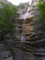
(2) Turn left to climb this steep, straight path, which eventually levels out as you approach the more eroded section of the Teppes-Cochon Waterfall.
(3) It is usually easy to cross the stream to enjoy different views, then head back down the same path towards the previous point.
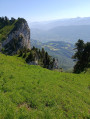
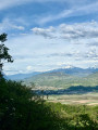
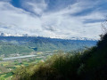
(2) Turn left to rejoin the Chemin de Pierre Plate, which climbs northwards and crosses the Ruisseau du Rif Mort via another stone bridge. Continue the climb towards the Rocher de Saint-Georges, before turning left to ascend a paved section leading to an unobstructed viewpoint over Belledonne and the Grésivaudan.
(4) The path veers to the right and approaches the Rif Mort, then climbs along the left bank to the hamlet of Saint-Georges.
(5) Turn left onto the CD 282, then take Rue de la Benoit immediately on the left, followed by Rue de l’Adret on the left again, heading towards Sainte Marie-du-Mont. The road becomes a track and, at the last houses, turn left along a meadow to cross the hilltop at 966 m.The track descends more and more steeply to cross the Ruisseau des Granges via a first footbridge.
(6) It climbs again, hugging the hillside, before descending once more to cross a tributary via a second footbridge.
(7) The climb takes you back up to the plateau, alongside a field, then along a path leading to the hamlet of Les Prés.
(8) Turn left to join the circular fitness trail via the Chemin de la Vieille Église. You’ll reach a Y-junction.
(9) Take the left-hand branch of the fitness trail for about a hundred metres (towards Pas du Facteur and the orientation table).
(10) Turn left onto the Pas du Facteur trail, which runs alongside a field, then enters the forest, heading eastwards and remaining more or less level, until it reaches the edge of the cliff.
(11) Cross a small rocky outcrop, then the path plunges down towards the valley, first over two ledges where you’ll need to ‘use your hands’, though steps have been carved into the rock, making the passage easier, although it remains fairly vertical.
Once in the forest, the path plunges down to the left at the foot of the rocks: it is very steep and can be slippery. A section over a limestone slab and a sloping section above an earthy gully are fitted with a small cable to hold on to so as not to slip.
At the end of this tricky section, the path winds down a few times, then veers south-east. The slope becomes easier to navigate, and this long descent leads to some rocky outcrops above La Flacherie, then, via a stream bed, to the CD 282 (Route de la Montagne), onto which you climb.
(12) Turn left and walk down along the CD until you reach the CD 9. Turn left, heading north, and, 150 metres further on, turn left onto the Chemin de Pierre Plate, which leads back to the hamlet of Le Boissieu. (S/E)

 Visorando Member
 Moderate
 Very difficult
 Extremely difficult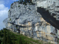
 Tourism professional