Cirque de Saint-Même: Waterfalls and Cave via the Pas Ruat

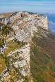
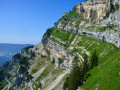
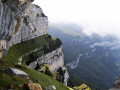
The Cirque de Saint-Même is very busy in summer, with most visitors content to have a picnic on the meadows or follow the signposted route through the waterfalls. The short circular loop suggested here extends this route by taking in an additional waterfall and the Source du Guiers Vif, via the steep Pas Ruat pass with its astonishing passage beneath the rock face emerging in front of the Grotte du Guiers Vif.

⚠️ This route is partly unmarked, unmaintained and presents significant risks. Hikers undertake this route at their own risk. Please refer to the official marked trails.

⚠️ The footbridge leading to the Grotte du Guiers Vif (4) was damaged by a rockslide in July 2023: a mayoral order currently prohibits access.

Details

2154574
Creation:
Last update:
Last review:
  • Walking
    Activity: Walking
  • ↔
    Distance: 2.62 mi
  • ◔
    Duration according to the author: 3 hrs 
  • ▲
    Difficulty: Very difficult

  • ⚐
    Back to start: Yes
  • ↗
    Ascent: + 1,056 ft
  • ↘
    Descent: - 1,030 ft

  • ▲
    Highest point: 3,763 ft
  • ▼
    Lowest point: 2,789 ft

Photos

Description of the walk

Head up from Saint-Pierre d’Entremont (Savoie), which can be reached from Les Échelles and the Pas du Frou or from Chambéry and the Col du Granier; pass through the hamlets of Saint-Même via the D45c and park in one of the many car parks located before the barrier blocking access to the site.

(S/E) Pass through the barrier and follow the road towards the chalet. You can either cross the Pont Drugey and walk up the left bank of the Guiers Vif or stay on its right bank. Continue across the entire alluvial plain to the footbridge at the bottom of Saint-Même.

From this footbridge, walk up the left bank for the final few metres leading to the first waterfall, the Pisse du Guiers.

(1) Return, cross the footbridge and head back down the right bank for 100 metres to reach the junction with the path leading up to the other waterfalls.

(2) The climb is quite steep through the forest, winding upwards and then traversing the hillside southwards, until you reach a sign at 1,035 metres.

(3) Continue climbing (signpost warning of a difficult mountain path) via the Pas de la Mort route and, at the first hairpin bend, veer right to descend slightly towards the Guiers before reaching the upper waterfall, the Source du Guiers.

Climb up the scree cone on the right-hand bank and enter a section equipped with a cable (a chimney followed by an exposed ledge on the right), which allows you to gain a foothold at the top of the waterfall, where the Guiers usually resurfaces (except during floods).

Enter the upstream cave (a short section secured with a cable), cross it over chaotic boulders and, upon exiting, climb up a cable-secured ledge to the right. You’ll reach the threshold facing the imposing Grotte du Guiers Vif.

(4) It is possible to visit this cave by climbing up to a small footbridge on the right and returning via the same path.

The return journey begins with a climb eastwards up a small rocky ridge equipped with a chain; the rest is an easier path along the hillside, which joins the Pas de la Mort path, which you follow down to the left until you reach the junction you passed on the way up.

(3) Follow the signposted route down to the Grande Waterfall, cross the footbridge and head down through the forest to the junction signposting the Isolée Waterfall.

(5) Take a short round trip south to visit this waterfall, then continue the steady descent through the forest. This leads to the cirque’s meadows, from where the return journey presents no difficulty: cross the footbridges to reach the chalet opposite, or turn left to take the Pont Drugey (S/E).

Waypoints

  1. S/E : mi 0 - alt. 2,789 ft - Cirque de Saint-Même car park
  2. 1 : mi 0.5 - alt. 2,953 ft - Pisse du Guiers Waterfall
  3. 2 : mi 0.65 - alt. 2,854 ft - Start of the climb towards the Grande Waterfall
  4. 3 : mi 1.02 - alt. 3,468 ft - Junction 1030m
  5. 4 : mi 1.17 - alt. 3,763 ft - Cave and spring of the - Guiers Vif (rivière)
  6. 5 : mi 1.69 - alt. 3,143 ft - Waterfall junction
  7. S/E : mi 2.62 - alt. 2,789 ft - Cirque de Saint-Même car park

Notes

Access to Saint-Même is subject to a toll in summer, to regulate visitor numbers and organise parking.

The Pas Ruat is impassable during high water, as the route taken may be used by secondary watercourses.

This route passes through a protected area, which may be subject to special regulations:

Worth a visit

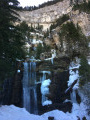
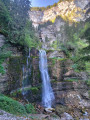
The waterfalls are the highlight of a visit to the Cirque de Saint-Même: the circular route takes you past all four waterfalls, the appearance of which varies considerably depending on the flow of the Guiers Vif.

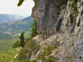
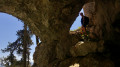
(¹) The Pas Ruat is a unique route as it crosses a temporary resurgence from one side to the other and emerges above the path taken. The technical nature of this section, which is equipped with cables, means it is not suitable for all walkers.

The Grotte du Guiers opens onto a wide porch and features a large section that can be explored without any special skills and without even having to stoop: in particular, you can follow a triangular route with just a torch, entering via the left-hand gallery and returning via the right-hand one.
For those seeking a greater challenge and equipped accordingly, it is possible to descend to the active cave system or explore the Marmites gallery.

Reviews and comments

4.8 / 5
Based on 7 reviews

Reliability of the description
4.9 / 5
Ease of following the route
4.4 / 5
Route interest
5 / 5
Gychor
Gychor

Overall rating : 4.3 / 5

Date of your route : Jun 27, 2026
Reliability of the description : ★★★★★ Very good
Ease of following the route : ★★★☆☆ Average
Route interest : ★★★★★ Very good
Very busy route : Yes

A really enjoyable and fun hike; you stay cool in the shade all morning. The route is secured with chains, so if you’re used to that, there aren’t any particular difficulties. My GPS watch wasn’t getting a very good signal, so it was a bit tricky to follow the GPX track – luckily the instructions are clear.

Machine-translated

never4nr
never4nr
• Edited:

Overall rating : 5 / 5

Date of your route : Sep 11, 2023
Reliability of the description : ★★★★★ Very good
Ease of following the route : ★★★★★ Very good
Route interest : ★★★★★ Very good
Very busy route : Yes

A hike worth doing! For my part, I turned back after the first chaotic blocks in the cave upstream of Pas Ruat because my partner couldn't accompany me into Pas Ruat.
Let's be clear, from Pas Ruat onwards, it's a via ferrata without a harness or carabiner (and therefore without the associated safety features). If you've never done a via ferrata before or have been scared on one in the past, don't go beyond the foot of the Source du Guiers waterfall. If you suffer from severe vertigo, don't even go beyond the danger sign (point 3) and follow the main path to the large waterfall. To illustrate: here is Pas Ruat, the man in the photo has to climb 2 metres up the wall by pulling himself up on a metal chain.
The trail is not very useful, as your GPS will not be accurate in the forest and caves (nor is the route, especially between points 3 and 4).
Since a rockslide and the municipal decree of 20 July 2023 (which can be found at danger sign 3 and on Altituderando, thanks to
JCParavy ), it is forbidden to take the footbridge leading to the Guiers Vif cave. As I understand it, this does not prevent you from doing the 3-4-3 circular route.

Machine-translated

richard71000
richard71000

Overall rating : 5 / 5

Date of your route : Jun 20, 2022
Reliability of the description : ★★★★★ Very good
Ease of following the route : ★★★★★ Very good
Route interest : ★★★★★ Very good
Very busy route : Yes

Visiting the cave after Pas Ruat requires a headlamp. There are no markers.
Go straight ahead to the back of the cave after a pillar, then turn left and walk 200 or 300 metres through a wide tunnel that ends at the entrance to the cave.
Then follow the route described
route taken on 10/06/22

Machine-translated

Bourachot
Bourachot

Overall rating : 5 / 5

Date of your route : May 23, 2020
Reliability of the description : ★★★★★ Very good
Ease of following the route : ★★★★★ Very good
Route interest : ★★★★★ Very good
Very busy route : No

A very beautiful hike with an excellent balance between interest and effort. Highly recommended.

Machine-translated

Mimizen38
Mimizen38

Overall rating : 5 / 5

Date of your route : Oct 14, 2019
Reliability of the description : ★★★★★ Very good
Ease of following the route : ★★★★★ Very good
Route interest : ★★★★★ Very good

A beautiful hike for those who are not afraid of heights (avoid in rainy weather for the Pas du Ruat).
The setting is magnificent.

Machine-translated

Michel S.
Michel S.

Overall rating : 4.3 / 5

Date of your route : Sep 02, 2019
Reliability of the description : ★★★★☆ Good
Ease of following the route : ★★★★☆ Good
Route interest : ★★★★★ Very good

A beautiful hike with a challenging climb at the Pas du Ruat.
We didn't see signpost 1035. You need good footwear because the path is littered with large roots.
Do the dangerous trail before tackling the big waterfall.
The descent leads to the footbridge opposite the first chalet restaurant (friendly welcome) (take the other direction if you want a gentler climb).

Machine-translated

Other walks in the area

For more walks, use our search engine .

The GPS track and description are the property of this route's author. Please do not copy them without permission.