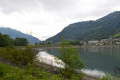
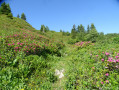
The south of Bramefarine, above the Pays d’Allevard

Starting from Allevard, a circular route mainly through woodland above the Flumet Basin.

Details

n°34171028
Creation:
Last update:
Last review:
  • Walking
    Activity: Walking
  • ↔
    Distance: 6.77 mi
  • ◔
    Average duration: 4h 45 
  • ▲
    Difficulty: Moderate

  • ⚐
    Back to start: Yes
  • ↗
    Ascent: + 1,873 ft
  • ↘
    Descent: - 1,854 ft

  • ▲
    Highest point: 3,215 ft
  • ▼
    Lowest point: 1,555 ft

Description of the walk

Park on Boulevard Jules Ferry near the gendarmerie, using the designated spaces.

(S/E) Head south (towards Grenoble) until you reach the traffic lights. Turn right onto Avenue Louaraz, go round the Salle de La Pléiade by turning left onto Rue de Cottard, and join Rue du Clos. Follow this street to the right until you reach the junction with Rue de Cotard.

(1) Carry on straight ahead, take the right-hand bend, then take the sharp left-hand bend to join Chemin de la Ronzière. Pass the left-hand bend and continue for about fifty metres, passing by the pond.

(2) Leave the road after the reservoir by taking the path on your right: double black arrow on a yellow background – Trail marker no. 3. Head towards Le Repos, cross the road and take the path opposite, leaving the ‘Unmonitored water’ reservoir on your right. Follow the winding path as it emerges from the forest to reach the hamlet of Bagin.

(3) Take the path that runs behind the houses without entering the hamlet via the road on the left, and join the road above, known as Route de la Chapelle Saint-Christophe. Follow it to the left to reach this hamlet.

(4) On leaving the hamlet, leave the road and take the tarmac track on the right leading to Le Grand Bossu. Continue along the track to La Cochette: yellow sign – Saint-Pierre 3.2 km – La Cochette 0.7 km.

(5) At the ‘La Cochette’ sign, take the path on the left which descends steeply to La Tour.

(6) Take the local path on the right. Cross the road and continue straight on down towards Saint-Pierre d’Allevard: yellow sign 1.8 km. Cross the junction of paths at the 779-metre mark, continuing straight on for about 500 metres.

(7) Take the hairpin bend to the left and reach the village at the Impasse des Terrasses.

(8) Follow the road downhill, go straight on at the junction to take Rue de Charvan. Then take the second street on the right (Rue de la Charrière) and you’ll come out onto Grande Rue.

(9) Turn left and go straight on at the roundabout. Just before you reach the slip roads for the D525, take the path on the left which leads to the departmental road.

(10) Cross at the pedestrian crossing and head towards the banks of the Bassin du Flumet. Turn left and follow the riverbank until you reach the entrance to Allevard.

(11) Leave the riverside path by turning left. Cross the Route de Grenoble at the protected crossing near Le Chaboud/Les Maladières (bus stop). First turn right then left to head up the Route du Chaboud and, after the Impasse des Buddleias, turn right onto the Chemin de la Noyeraie. Continue in the same direction along the Rue des Chartreux until you reach the junction with the Rue du Clos.

(1) Turn right and retrace your steps to return to the car park on Boulevard Jules Ferry (S/E).

Waypoints

  1. S/E : mi 0 - alt. 1,555 ft - Allevard Police Station, Boulevard Jules Ferry
  2. 1 : mi 0.44 - alt. 1,726 ft - Junction marking the end of the circular loop
  3. 2 : mi 0.8 - alt. 1,969 ft - Pond, fork to the right
  4. 3 : mi 1.67 - alt. 3,041 ft - Bagin
  5. 4 : mi 2.41 - alt. 3,054 ft - The Chapel of Saint Christopher
  6. 5 : mi 3.11 - alt. 3,140 ft - La Cochette
  7. 6 : mi 3.34 - alt. 2,743 ft - The Tower
  8. 7 : mi 3.76 - alt. 2,244 ft - Left turn
  9. 8 : mi 4.27 - alt. 1,795 ft - Rue de la Tour
  10. 9 : mi 4.58 - alt. 1,673 ft - Grande Rue
  11. 10 : mi 5.03 - alt. 1,647 ft - D525 road – Pedestrian crossing
  12. 11 : mi 5.65 - alt. 1,647 ft - Turn left at the fork
  13. S/E : mi 6.77 - alt. 1,555 ft - Allevard Police Station, Boulevard Jules Ferry

Reviews and comments

4.2 / 5
Based on 2 reviews

Reliability of the description
4.5 / 5
Ease of following the route
4.5 / 5
Route interest
3.5 / 5
ncm38
ncm38

Overall rating : 3.7 / 5

Date of your route : Aug 14, 2024
Reliability of the description : ★★★★☆ Good
Ease of following the route : ★★★★☆ Good
Route interest : ★★★☆☆ Average
Very busy route : No

To start with, you can park opposite the Salle de la Pléiade, where you’ll find shaded spaces under the trees or near point 1 (this will save you a few hundred metres, especially when you’re finishing the walk...=
At point 2, I couldn’t find the double black arrow on a yellow background – Trail marker no. 3 – so I carried on along the road until I rejoined the path further on (note that there’s no sign pointing towards Bagin; I followed the trail and, as it was possible to rejoin the path that crosses the road, I did so). It would be worth taking the path on the right to see where it leads at point 2.
At point 3, I didn’t go behind the houses as I had the impression we’d be crossing private land. I took the road to the right for about a hundred metres, then turned left at the junction: this takes you behind the houses indicated.
At point 6, the local footpath is right at the far left at the foot of the ‘Tower’. It’s well hidden, but if you look carefully, there’s a sign pointing to it.
After that, I just followed the signposts

Machine-translated

ocarina0656
ocarina0656

Overall rating : 4.7 / 5

Date of your route : Jun 25, 2023
Reliability of the description : ★★★★★ Very good
Ease of following the route : ★★★★★ Very good
Route interest : ★★★★☆ Good
Very busy route : No

Three-quarters of the walk is through woodland, so it’s possible to do it in summer when it’s very hot. However, the final quarter runs between Saint Pierre d’Allevard and Allevard, skirting the Fumet reservoir, where there aren’t many trees left. We got a bit lost in the village of La Tour, but we found our way back very quickly. I found this walk very pleasant and peaceful, with no particular difficulties. Good.

Machine-translated

Other walks in the area

For more walks, use our search engine .

The GPS track and description are the property of this route's author. Please do not copy them without permission.