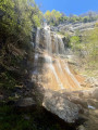
The Teppes Cochon waterfall

The first part of the walk is a bit of a slog, but the rest is fairly easy. It’s best to do this walk after a spell of rain to get the most out of the waterfalls.

Details

54441931
Creation:
Last update:
Last review:
  • Walking
    Activity: Walking
  • ↔
    Distance: 6.47 mi
  • ◔
    Average duration: 5h 10 
  • ▲
    Difficulty: Moderate

  • ⚐
    Back to start: Yes
  • ↗
    Ascent: + 2,559 ft
  • ↘
    Descent: - 2,543 ft

  • ▲
    Highest point: 3,091 ft
  • ▼
    Lowest point: 1,175 ft

Photos

Description of the walk

Head to the car park at the town hall or the church in Barraux.

(S/E) With the town hall on your left, take Rue du Carré opposite you for about 250 metres. Walk between the houses, then continue along the stony path. Go straight on at the first junction and climb up to the next Fork in the road.

(1) Turn left towards Saint-Georges. From there, the path is very steep for about 500 m. The gradient then eases off considerably over 400 m and, as soon as you emerge from the forest, the path is almost flat. Carry on until you reach a tarmac road.

(2) Turn left, then turn right straight away onto Rue des Lodges. At the Fork in the road, head up to the right until you reach Rue de Saint-Georges. Turn left, walk past the fountain and continue for just 100 m.

(3) Turn left onto the Chemin de Pierres Plate: from here, you’ll be following theGR® 965. Walk down this very pleasant path alongside the Rif Mort. Carry on until you cross this stream.

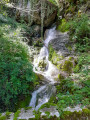
(4) If you’re lucky enough to pass by after a spell of rain, you’ll be able to see the first waterfall.
Walk down a further 250 m to reach a junction with a sign on your right pointing towards the Teppes Cochon waterfall.

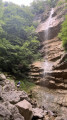
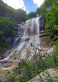
(5) Head in that direction: this section is not signposted. Be careful, as the slope is steep and the path is narrow. If the ground is damp, take great care as there is a high risk of slipping. Make your way to the waterfall. If it has rained in the last few days, you’ll be impressed by this waterfall: a sight not to be missed.

(6) Retrace your steps back to the junction.

(5) Then head off to the right. Walk downhill to Le Boissieu.

(7) At the crossroads, turn left. At the next one, do the same towards Le Fayet and, just after the bridge, leave the road to follow the path on the left, staying on theGR®. You’ll come out onto the D9; follow it in the same direction to reach Le Fayet.

(8) At the wash house, turn left onto the small road marked with theGR® sign. Continue along the path leading to the first houses in Barraux.

(9) Turn right onto the Chemin du Replat and go straight on until you reach the roundabout. Go round it on the left to follow the Grande Rue to the car park (S/E).


Waypoints

  1. S/E : mi 0 - alt. 1,181 ft - Town hall car park
  2. 1 : mi 0.42 - alt. 1,608 ft - Fork
  3. 2 : mi 1.99 - alt. 3,028 ft - Rue des Lodges
  4. 3 : mi 2.25 - alt. 3,081 ft - Chemin de Pierre Plate
  5. 4 : mi 3.1 - alt. 2,303 ft - Rif Mort stream
  6. 5 : mi 3.31 - alt. 2,060 ft - Turn-off for the waterfall, signpost
  7. 6 : mi 3.55 - alt. 2,411 ft - Cascade de Teppes Cochon (La Buissière)
  8. 7 : mi 4.27 - alt. 1,424 ft - Le Boissieu
  9. 8 : mi 5.22 - alt. 1,198 ft - Fayet Washhouse
  10. 9 : mi 6.21 - alt. 1,358 ft - Barraux, Chemin du Replat
  11. S/E : mi 6.47 - alt. 1,178 ft - Town hall car park

Notes

(1) You can take a return walk (1.5 km and 200 m elevation gain) to visit the Furet Waterfall.

Always be cautious and plan ahead when you're outdoors. Visorando and the author of this route cannot be held responsible for any accidents occurring on this route.

The GR® and PR® markings are the intellectual property of the Fédération Française de Randonnée Pédestre.

Reviews and comments

4.1 / 5
Based on 3 reviews

Reliability of the description
4.7 / 5
Ease of following the route
4.3 / 5
Route interest
3.3 / 5
Chabottes
Chabottes

Overall rating : 3 / 5

Date of your route : Jun 01, 2026
Reliability of the description : ★★★★☆ Good
Ease of following the route : ★★★☆☆ Average
Route interest : ★★☆☆☆ Disappointing
Very busy route : No

There’s no sign at the start of the path to the waterfall, just a marker. The final section is overgrown: lots of branches, brambles…

Machine-translated

granmejanlou
granmejanlou

Overall rating : 4.7 / 5

Date of your route : Apr 20, 2026
Reliability of the description : ★★★★★ Very good
Ease of following the route : ★★★★★ Very good
Route interest : ★★★★☆ Good
Very busy route : No

Trees have fallen across the path leading to the waterfall, so you need to be extra careful, especially on the way down. (One person in our group slipped and tumbled down the slope but was unharmed.)

Machine-translated

Ange Heureux
Ange Heureux

Overall rating : 4.7 / 5

Date of your route : Jun 29, 2024
Reliability of the description : ★★★★★ Very good
Ease of following the route : ★★★★★ Very good
Route interest : ★★★★☆ Good
Very busy route : No

We chose this walk because we discovered it through Visorando’s weekly email, and it ticked all the right boxes: under 6 hours, starting with an ascent followed by flat or downhill sections, between 500 and 800 metres of elevation gain, an hour’s drive from home, and it had rained recently, so the waterfalls would be flowing.
A challenging hike to start with: a steep climb, almost a vertical climb. We opted to go up to the Furet waterfall, which added 1 hour 20 minutes there and back to the route, but we weren’t disappointed – a beautiful waterfall and, in fact, a break in the climb, with a 200-metre ascent followed by a descent to the junction.
And from there, the climb is still a good hour long. Once at the top, there’s a lovely, flat plateau. After 1,200 metres, just as the track joins a path, we found a lovely spot for a picnic on the left, near an aerial, right on the edge of the precipice with a superb view over the valley.
We passed through the village of St-George and topped up our water bottles before heading back down. The storm rolling in convinced us not to climb back up to the Teppes Cochon Waterfall after all – even though it was the intended destination of the walk – as we were simply too tired. Once at the bottom, we took paths and roads to return, first in the rain and then in the sunshine, to Barraux, with one final climb and descent after Fayet. In fact, once we reached the other side of Château Fayet, we wondered if we could have gone closer to the château and thus avoided a bit of tarmac!
We didn’t see a soul throughout this pleasant but challenging walk, three-quarters of which was under the trees, and we’re glad we did it. We might come back another time to see the Teppes Cochon waterfall!

Machine-translated

Other walks in the area

For more walks, use our search engine .

The GPS track and description are the property of this route's author. Please do not copy them without permission.