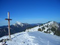
Col de Merdaret, from Pipay

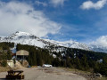
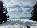
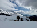
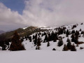
A circular route combining a walk through the forest and a traverse across a plateau, offering unobstructed views of the Belledonne peaks, whilst staying clear of the downhill ski resort. From the Col de Merdaret (alt. 1,798 m), it is easy to make a round trip to the Grand Rocher (alt. 1,926 m), a summit that is very popular in fine weather.

Details

71902286
Creation:
Last update:
Last review:
  • Snowshoeing
    Activity: Snowshoeing
  • ↔
    Distance: 4.88 mi
  • ◔
    Duration according to the author: 4 hrs 
  • ▲
    Difficulty: Moderate

  • ⚐
    Back to start: Yes
  • ↗
    Ascent: + 1,201 ft
  • ↘
    Descent: - 1,201 ft

  • ▲
    Highest point: 6,040 ft
  • ▼
    Lowest point: 4,885 ft

Photos

Description of the walk

From Theys or Les Adrets, head up towards the Sept-Laux ski resort – specifically the Pipay area – and continue along the road past the resort and its car parks until you reach the end of the tarmac section.

(S/E) Takethe signposted forest track straight ahead, which descends steadily to the well-marked passage under the high-voltage power line. Cross the Ruisseau de Pierre Herse to the next junction.

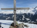
(1) Turn sharply right to climb, initially alongside the high-voltage power line, then veer left for a long and fairly steep uphill traverse through the forest until you emerge into the alpine zone, below the Croix du Merdaret.

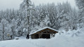
(2) Turn right and continue on level ground through the mountain pasture, passing to the right of the Chalets du Merdaret, then climb due east up a grassy ridge leading close to the Col de Merdaret.
(If the ridge is considered too steep, it is possible to take a wide circular detour to the left to reach the pass via gentler slopes.)

(3) Fromthe pass, it is possible to make a round trip to the Grand Rocher, following the easy ridge to the north.
To descend, head south without losing too much altitude, either close to the ridge or slightly further towards the south-west, down the slope. Continue in this direction, descending towards a clearly visible small pass beneath the high-voltage power line (which may involve a short climb to bypass a ravine).
Carry on staying as level as possible, over a few sloping sections, towards the place known as Les Plagnes (do not be tempted by the descent down the grassy slopes to the right).

(4) Go round the hill, keeping as level as possible, to take the descent due south towards the ski runs. Go round a hollow on the left to reach a ridge opposite, which allows you to climb easily back up to the Butte de Pipay, which has been clearly visible for some time.

(5) Cross the ridge of the Butte, heading west, and begin the descent, first through a few snow-covered grassy sections, then through the forest on a winding path. (snowshoe marker no. 7)
As you approach the road, at a major junction, turn right onto a forest track that leads back to the road, upstream of the resort. The walk back up to the car is then fairly short. (S/E

Waypoints

  1. S/E : mi 0 - alt. 5,240 ft - Pipay – end of the road
  2. 1 : mi 1.25 - alt. 4,944 ft - Gorge des Chèvres – Start of the ascent towards Merdaret
  3. 2 : mi 1.76 - alt. 5,653 ft - Merdaret Cross
  4. 3 : mi 2.35 - alt. 5,902 ft - Col de Merdaret (1798m)
  5. 4 : mi 3.55 - alt. 5,912 ft - Les Plagnes
  6. 5 : mi 4.26 - alt. 5,748 ft - Butte de Pipay
  7. S/E : mi 4.88 - alt. 5,240 ft - Pipay

Notes

When there is snow on the ground, the summer paths are barely visible, except in the forest.

In foggy conditions, finding your way can be difficult between (2) and (5), and even more so towards the Grand Rocher. 

Worth a visit

In good weather, there are views of the Belledonne range, its western slope, and the Chartreuse mountains opposite.

Reviews and comments

4.3 / 5
Based on 2 reviews

Reliability of the description
4 / 5
Ease of following the route
4 / 5
Route interest
5 / 5
geai47
geai47

Overall rating : 4.7 / 5

Date of your route : Aug 30, 2026
Reliability of the description : ★★★★☆ Good
Ease of following the route : ★★★★★ Very good
Route interest : ★★★★★ Very good
Very busy route : Yes

We varied the suggested route slightly by going as far as Cul de Pet and returning via the Pincerie chalet.
A beautiful ridge walk in the first light of autumn. Views on both sides (the Chartreuse and Bauges on one side, and on the other the 7Laux massif, Grande Valloire, Comberousse, etc...)

Machine-translated

User 23282522

Overall rating : 4 / 5

Date of your route : Aug 10, 2026
Reliability of the description : ★★★★☆ Good
Ease of following the route : ★★★☆☆ Average
Route interest : ★★★★★ Very good
Very busy route : No

A really lovely walk, but we did it the other way round and it was great

Machine-translated

Other walks in the area

For more walks, use our search engine .

The GPS track and description are the property of this route's author. Please do not copy them without permission.