The summit of Mont Granier

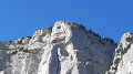
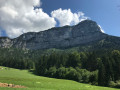
In the heart of the Hauts de Chartreuse Nature Reserve, the majestic Mont Granier welcomes you. Although the cross is inaccessible for safety reasons, this hike reveals astonishing geology and remarkable biodiversity.

Details

23719950
Creation:
Last update:
Last review:
  • Walking
    Activity: Walking
  • ↔
    Distance: 5.42 mi
  • ◔
    Average duration: 5h 20 
  • ▲
    Difficulty: Difficult

  • ⚐
    Back to start: Yes
  • ↗
    Ascent: + 3,235 ft
  • ↘
    Descent: - 3,222 ft

  • ▲
    Highest point: 6,335 ft
  • ▼
    Lowest point: 3,589 ft

Description of the walk

Park in the car park at the entrance to the hamlet of La Plagne.

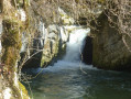
(S/E) Walk through the hamlet, then take the path through the forest on the left. As you pass, take a moment to admire the magnificent communal washhouse. The entire first part of the climb takes place in the cool shade of the forest. You’ll reach Les Granges du Priz.

(1) Turn right onto the path that runs alongside the field. Continue the climb until you reach the Lances crossroads.

(2) Carry on to the right along the path to reach La Balme à Colomb and its famous cave.

(3) Pass through the heart of the mountain to continue the ascent towards the heights of Chartreuse.

(4) Leave the path on your right which leads to the Pas des Barres and continue straight on along a tricky section. Caution! This section should not be attempted if you suffer from vertigo. You will reach a fork in the path.

(5) Turn slightly to the left to reach the foot of the summit. Take care here! It is not possible to go any further for safety reasons.

(6) Return via the same route to reach the car park in the hamlet of La Plagne (S/E).

Waypoints

  1. S/E : mi 0 - alt. 3,589 ft - La Plagne car park
  2. 1 : mi 0.52 - alt. 3,980 ft - Granges du Priz
  3. 2 : mi 1.12 - alt. 4,678 ft - Les Lances
  4. 3 : mi 1.42 - alt. 5,489 ft - La Balme à Colon
  5. 4 : mi 1.95 - alt. 6,063 ft - Junction
  6. 5 : mi 2.65 - alt. 6,253 ft - Junction towards Mont Granier
  7. 6 : mi 2.71 - alt. 6,335 ft - Mont Granier
  8. S/E : mi 5.42 - alt. 3,589 ft - La Plagne car park

Reviews and comments

4.5 / 5
Based on 2 reviews

Reliability of the description
4 / 5
Ease of following the route
4.5 / 5
Route interest
5 / 5
User 17842394
• Edited:

Super Granier

Machine-translated

Vassili B.
Vassili B.
• Edited:

Overall rating : 4.3 / 5

Date of your route : Aug 21, 2023
Reliability of the description : ★★★☆☆ Average
Ease of following the route : ★★★★★ Very good
Route interest : ★★★★★ Very good
Very busy route : No

A lovely walk with magnificent views once you reach La Balme à Colom. After the cave, you must follow the signposts carefully. Although I’m prone to vertigo, I don’t consider stage 4 to be particularly vertiginous. This section can be slippery, but you’re never facing a drop-off; it’s almost flat. Even though the section through the heart of the mountain (stage 3) isn’t technically difficult, you still need to be careful here (especially going downhill).

Machine-translated

Nadou
Nadou

Overall rating : 4.7 / 5

Date of your route : Nov 20, 2022
Reliability of the description : ★★★★★ Very good
Ease of following the route : ★★★★☆ Good
Route interest : ★★★★★ Very good
Very busy route : No

A brilliant hike last Sunday. The route takes you past a fairly deep cave with a nearby double cave. About ten ibex were grazing at the entrance to the cave; we were able to walk right past them and watch them. You really must stay on the path and not follow the track that goes to the left of the cave. There are some slightly technical sections with snow and ice, so it might be best to do this hike in summer. Magnificent scenery all along the walk!

Machine-translated

Other walks in the area

For more walks, use our search engine .

The GPS track and description are the property of this route's author. Please do not copy them without permission.