The Crêt de la Scia circuit

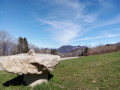
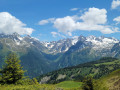
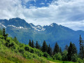
A local family walk for residents of Grenoble and Chambéry, ideal in spring and autumn, offering beautiful views of Belledonne, the Chartreuse and the Grésivaudan valley. It follows a small tarmac road for a few hundred metres.

Details

n°8293991
Creation:
Last update:
Last review:
  • Walking
    Activity: Walking
  • ↔
    Distance: 4.43 mi
  • ◔
    Average duration: 2h 45 
  • ▲
    Difficulty: Moderate

  • ⚐
    Back to start: Yes
  • ↗
    Ascent: + 833 ft
  • ↘
    Descent: - 814 ft

  • ▲
    Highest point: 3,130 ft
  • ▼
    Lowest point: 2,405 ft

Description of the walk

Park in the car park at Hurtières Town Hall.

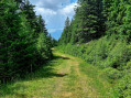
(S/E) Walk past the town hall on your right, then take the forest track on the left which heads south-west (hiking sign) and begins a gentle climb. You’ll soon reach the junction with the path coming from Tignieu; keep left. Shortly afterwards, pass the track on your right leading to the Outre barns. The gradient steepens before you reach the Col de la Croix des Adrets.

(1) It’s time for a break: a drinking water tap is available. Head towards Villard-Bernard (south-east) along a partially tarmac-surfaced track. There’s a lovely view of the Belledonne massif. Walk straight through the hamlet and join a tarmac road at a hairpin bend.

(2) Follow this road uphill to the left for about 600 metres.

(3) Take the path on the left (yellow markings) which climbs north-eastwards to reach the Col des Ayes, the highest point of the walk.

(4) View of the Sept Laux ski resort. Follow the small road as it descends for about twenty metres, then leave it to follow a path on the left which joins another road leading to a farm.

(5) Just before the farm, on the right, take a path that descends north-east and leads to the hamlet of Les Berts. Walk downhill through the hamlet to reach a tarmac section and turn left towards Les Vallins and L’Outre. You’ll come to a junction where the route joinsthe GR® de Pays du Balcon des Sept Laux.

(6) Follow it, turning left.

(7) After a short climb and at the hairpin bend, turn right onto a level track (marked with hiking signs). Follow this track to the Col de la Croix de Theys (elevation 786). Descend to the village of Hurtières and back to the starting point (S/E).


Waypoints

  1. S/E : mi 0 - alt. 2,408 ft - Car park at Hurtières Town Hall
  2. 1 : mi 0.85 - alt. 2,854 ft - Col de la Croix des Adrets
  3. 2 : mi 1.47 - alt. 2,864 ft - Villard-Bernard
  4. 3 : mi 1.81 - alt. 3,015 ft - Ascent to the left to the Col des Ayes
  5. 4 : mi 2.03 - alt. 3,117 ft - Col des Ayes
  6. 5 : mi 2.15 - alt. 3,054 ft - Turn right at the fork
  7. 6 : mi 3.03 - alt. 2,615 ft - Junction with the °°GR®°° de Pays, on the left
  8. 7 : mi 3.3 - alt. 2,612 ft - Flat track on the right
  9. S/E : mi 4.43 - alt. 2,408 ft - Car park at Hurtières Town Hall

Always be cautious and plan ahead when you're outdoors. Visorando and the author of this route cannot be held responsible for any accidents occurring on this route.

The GR® and PR® markings are the intellectual property of the Fédération Française de Randonnée Pédestre.

Reviews and comments

3.7 / 5
Based on 3 reviews

Reliability of the description
3.7 / 5
Ease of following the route
3.3 / 5
Route interest
4 / 5
COLIN paul
COLIN paul
• Edited:

Overall rating : 4 / 5

Date of your route : Mar 18, 2023
Reliability of the description : ★★★★☆ Good
Ease of following the route : ★★★★☆ Good
Route interest : ★★★★☆ Good
Very busy route : No

Hello,
This route is very good, though it’s of moderate difficulty, as there’s a fair climb to tackle before reaching the Col de la Croix des Adrets or the Col d’Hurtières.
However, as we’re not from the area, at this point you come to a junction where two roads meet (near a small house on the corner of these two streets) and there are no signs or markings. This is the only such spot. As a result, we extended the route by about 1.5 km, passing through Les Adrets – Villard-le-Château – Col des Ayes – Les Ayes to reach Les Berts, instead of heading to Villard-Bernard. Otherwise, it’s a very lovely route.

Machine-translated

gire38
gire38

Overall rating : 4.3 / 5

Date of your route : Mar 05, 2023
Reliability of the description : ★★★★★ Very good
Ease of following the route : ★★★★☆ Good
Route interest : ★★★★☆ Good
Very busy route : No

You can extend the walk by just under 1.5 km by walking around the Crêt de la Couan. At the Col de Theys, simply take the path on the right instead of heading back down to the starting point via the road. You’ll pass successively through views of the Theys valley, the Graisivaudan valley and the Hurtière valley. In mid-season, the descent towards Hurtière, with the sun setting over the Vercors, is very idyllic.

Machine-translated

WOLFFBLANC
WOLFFBLANC

Overall rating : 2.7 / 5

Date of your route : May 24, 2021
Reliability of the description : ★★☆☆☆ Disappointing
Ease of following the route : ★★☆☆☆ Disappointing
Route interest : ★★★★☆ Good
Very busy route : Yes

Hello,
An interesting route thanks to the beauty of the scenery. However, the route isn’t very well signposted, but as mentioned above, Visorando isn’t responsible for the signposting – though we did have a sat-nav. Far too many tarmac sections. Thanks for the suggestion!

Machine-translated

Other walks in the area

For more walks, use our search engine .

The GPS track and description are the property of this route's author. Please do not copy them without permission.