


 Country:

 City:
City:


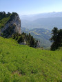
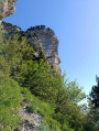
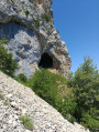
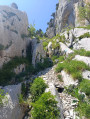
Start from the Pré Orcel car park above Sainte-Marie-du-Mont. From Les Prés, follow the signposts along a small tarmac road which gives way to a track.
(S/E) The path starts just below the spring; head left and follow the access track. The path that climbs to the right leads to the Col de l’Alpe. The path roughly follows the contour line with a series of ascents and descents.
(1) When you reach the foot of the Pas de la Rousse, the return route is to the right. Carry on straight ahead, ignoring the paths coming in from the left. After a steeper climb, you’ll reach a ridge.
(2) This is the foot of the Pas du Fourneau, marked by a cairn. Take the path on the right – which is barely visible in places – which becomes much steeper but presents no major difficulty. You will then emerge from the woods, and the distinctive ‘caiman’ rock comes into view. Climb up a steep gully almost to the foot of the rock.
(3) Turn right to reach the neighbouring cirque via a faint, horizontal track. Do not climb into the cirque that runs along the left-hand side of the Rocher du Caïman, even though a few tracks might suggest this is the route. Once in the other cirque, which is dotted with small rocky outcrops, head straight up the slope, climbing over the outcrops and then through the grass, veering left towards the south-west and then south.
(4) There is a cairn to help you pass over the Caïman, which can be seen a little further down below. Continue southwards to reach the base of the Pas du Fourneau. There are several options. As the ground is very dry, climb up a steep, earthy gully where the track leads.
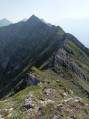
(5) Once on the ridge, head left, towards the south, along a narrow path. There are several tracks, but you must stay on the ridge. Then climb a rock at the end of the cliff which blocks the way. Pass the Alpette and continue on to the Grand Manti. The views are magnificent. Reach the summit via a grassy slope which you’ll come to near the Tunnel du Trèfle.
(6) After admiring the scenery and having a picnic, head back the way you came and turn right towards the clearly visible tunnel.
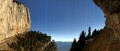
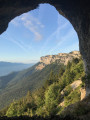
(7) The Trèfle Tunnel has several openings. The one to the north offers a view of the Arche de la Morille below. You must now make your way to the start of the Pas de la Rousse on or near the ridge. Once back on the ridge, keep to the right until you reach the Pas du Fourneau.
(5) Continue along the ridge, heading north, passing close to rock shelters and chasms.
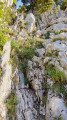
(8) You’ll reach the start of the descent. This isn’t clearly signposted; only a rather uninviting track leads towards the edge of the cliff. First, you’ll need to descend a small ridge covered in earth, which makes it very slippery. You’ll also need to be very careful further down due to the exposure. Further down, the path is steep and slippery as it’s made of gravel.
(9) At the junction, take the path on the left to reach the Trou de la Rousse.
(10) The archway is huge. After your visit, head back the way you came.
(9) Turn left and head back to the junction you passed on the way there.
(1) Return to the car park by taking the path on the left, heading in the opposite direction to your outward journey (S/E).

 Visorando Member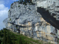
 Difficult
 Moderate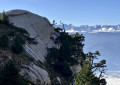
 Very difficult
