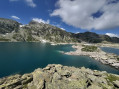
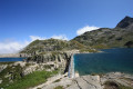
From the Lodge de la Martinette to the Refuge de l’Oule via Lac du Léat

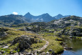
A very physically demanding day, with very steep slopes right from the start that give you almost no respite until you reach the refuge. But from the Refuge de la Grande Valloire onwards, the views are magnificent.

Details

103998641
Creation:
Last update:
Last review:
  • Walking
    Activity: Walking
  • ↔
    Distance: 8.13 mi
  • ◔
    Average duration: 7h 45 
  • ▲
    Difficulty: Very difficult

  • ⚐
    Back to start: No
  • ↗
    Ascent: + 4,619 ft
  • ↘
    Descent: - 2,129 ft

  • ▲
    Highest point: 6,542 ft
  • ▼
    Lowest point: 3,261 ft

Description of the walk

Start from the car park or the Lodge de la Martinette.

Do not leave your car in the lodge’s car park; move it 100 metres further down to the designated car park.

(S/E) Walk up the road that passes in front of the Martinette Lodge and take the street on the left.

(1) Continue along the GR®738 to the left, heading due north.

(2) Walk alongside Lac du Curtillard on your left. After the reservoir, at a T-junction, turn right, staying on the GR®. This will take you to a car park near the D525a at an altitude of 997.

(3) Turn right into the car park, following the signs. Begin a long and challenging climb through the forest, which takes you to your first viewpoint at the Chalet de la Grande Valloire (where you can top up your water supplies at a fresh water spring).

(4) Continue north towards Lac du Léat.

(5) Stay on the signposted path which branches off to the left (north-west).

(6) Pass above the Chalet de la Fouetterie and continue along the signposted path heading north-east.

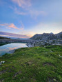
(7) At the Deuxième Chalet de Tigneux, continue along the signposted path to the chalet on the shores of Lac du Léat.

(8) Alternatively, turn right to quickly reach a spring hidden beneath a huge rock. It can get very busy there, so it may take a long time to fill your water bottle. That’s why it’s worth topping up at (3).

(9) Return to the chalet.

(8) Leave the GR®738 and head right (north-west). Climb up to the Léat cross (beautiful panoramic view).

(10) Turn right (south-east) and begin the descent. You’ll reach the Oule mountain pasture.

(11) Turn right for a final climb to the Refuge de l’Oule (E) (breathtaking views across the entire Upper Bréda Valley and as far as Chambéry and Lake Bourget on a clear day).

Waypoints

  1. S : mi 0 - alt. 3,520 ft - Parking or the Lodge de la Martinette
  2. 1 : mi 0.08 - alt. 3,543 ft - La Martinette
  3. 2 : mi 0.44 - alt. 3,451 ft - Lac du Curtillard
  4. 3 : mi 1.35 - alt. 3,268 ft - Valloires car park
  5. 4 : mi 3.59 - alt. 6,010 ft - Premier chalet de la Grande Valloire
  6. 5 : mi 4.32 - alt. 6,109 ft - Junction
  7. 6 : mi 4.48 - alt. 5,991 ft - Above the Chalet de la Fouetterie
  8. 7 : mi 5.13 - alt. 6,404 ft - Deuxième Chalet de Tigneux (1950 m)
  9. 8 : mi 5.94 - alt. 5,656 ft - Chalet - Chalet du Léat (1725m)
  10. 9 : mi 6.11 - alt. 5,669 ft - Source du Chalet du Léat
  11. 10 : mi 6.54 - alt. 5,974 ft - Croix du Léat
  12. 11 : mi 7.72 - alt. 5,459 ft - Oule mountain pastures
  13. E : mi 8.13 - alt. 6,014 ft - Refuge Antoine Cros, dit de l'Oule

Notes

Water sources

Excellent water sources at the Chalet de la Grande Valloire and the Refuge de l’Oule. The spring at Lac du Léat is very difficult to reach and has a very low flow.

Provisions

At the start, at La Martinette (small grocery shop, snack bar, cold meats and cheeses, excellent food!), then at the Refuge de l’Oule. La Martinette is a very pleasant stopover lodge and the Refuge de l’Oule is a staffed mountain refuge.

Accommodation

La Martinette: you can book a night in a dormitory or a double room, or pitch a tent at the lodge (€60 for a double room plus half-board)

Refuge de l’Oule: you can stay in the refuge or pitch a tent. Do remember to book in advance – the refuge is very small and camping spaces are limited!

Always be cautious and plan ahead when you're outdoors. Visorando and the author of this route cannot be held responsible for any accidents occurring on this route.

The GR® and PR® markings are the intellectual property of the Fédération Française de Randonnée Pédestre.

Other walks in the area

For more walks, use our search engine .

The GPS track and description are the property of this route's author. Please do not copy them without permission.