


 Country:

 City:
City:


Access is via the Upper Bréda Valley. After Allevard, drive up to Grand Thiervoz and, at the exit, join the track leading up towards Embarolin. Park at the foot of the path.
(S/E) From the car park, take the path opposite which climbs towards L’Embarolin.
(1) At L’Embarolin, continue climbing to reach the first Chalet de la Petite Valloire, then the second (La Fouetterie).
(2) Head straight ahead and join the junction with the GR®378.
(3) Turn left towards Lac du Léat to reach Montagne de Tigneux.
(4) Near the 1994-metre mark, follow animal tracks that head off to the right towards Lac des Naves. The vegetation gradually disappears as the tracks fade away.
(5) Pass above Lac de Naves and, ascending diagonally, reach the left-hand side of the rocky cirque of which the Passage de Tigneux forms part. Several routes are possible, but you mustn’t get too close to the rocks on the right. The slope becomes even steeper and you’ll need to use the rocks on the left-hand side to help you make your way up, as the chamois have eroded the Passage considerably.
(6) At the Passage, take in the view of the Montagne de l’Oule, which overlooks the refuge, though it is not yet visible. Follow the chamois track heading to the right – you’ll need to use your hands a few times – and reach the base of a rock which you must go round to the left. Continue climbing until you reach a grassy ledge that ascends to the right above the rock. The rest of the route along the ridge will be easier going until you reach the Pic de la Petite Valloire.
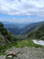
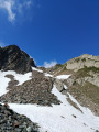
(7) Once again, the scenery is magnificent. The highest point of the Pointes de la Porte d’Église lies close by, looming menacingly on the ridge leading to Comberousse and then on to the Puy Gris. Make your way to the summit to find a lovely spot for a snack. From this vantage point, you can clearly see the off-trail descent route, from moraine to moraine, from snowfield to snowfield. You can even make out your next destination: the path linking the Refuge de l’Oule to the Col Morétan.
(8) Take a path on the left to descend the glacial ridge and begin the long descent to the Refuge de l’Oule.
(9) From the refuge, continue down to the Oule.
(10) Take the path on the left towards Lac du Léat. Get ready for a climb of over 200 metres, quite steep in places, to reach the Pierre du Pin.
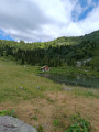
(11) Descend to the lovely Lac du Léat and its chalet, then head towards the Chalet de la Fouetterie on the left, passing via the Crêt du Tambour. You’ll need to climb another 100 metres before rejoining the ascent path. At the Crêt du Tambour, keep left until the next junction.
(12) Head down to the right for about twenty metres to find a rarely used track which saves you over 100 metres in elevation gain. The track roughly follows the contour line. Be careful: the slopes you’ll be crossing are steep, the track is narrow, and you can’t see your feet clearly due to the vegetation.
(2) Here, rejoin the ascent path and head back down to the car park via the reverse route of the outward journey (S/E).
 Visorando Member


 Moderate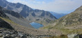
 Difficult
 Easy
Easy 
