Montouvrard, starting from Allevard

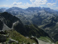
A three-hour walk starting from the village centre.

Details

33569192
Creation:
Last update:
Last review:
  • Walking
    Activity: Walking
  • ↔
    Distance: 4.20 mi
  • ◔
    Average duration: 3h 10 
  • ▲
    Difficulty: Moderate

  • ⚐
    Back to start: Yes
  • ↗
    Ascent: + 1,414 ft
  • ↘
    Descent: - 1,414 ft

  • ▲
    Highest point: 2,890 ft
  • ▼
    Lowest point: 1,526 ft

Photos

Description of the walk

Place de la Résistance – Allevard
Starting point: the Tourist Office. Parc des Forges car park nearby, Rue de la Libération (D108).

(S/E) From the Tourist Office, take Rue Chenal, then Rue de la Gorge. Cross the D108 and continue along Rue Étienne Tallard. After about fifty metres, turn right into Rue Bombec (a narrow, winding lane) and walk past a wash house. At the end of the street, first turn left then right, then left again between the houses and gardens of this old neighbourhood, then climb a few steps to reach the EDF canal promenade. Walk a few metres to the right to reach No. 12 Montée de Montouvrard.

(1) Take the path on the left opposite this alleyway, marked with yellow-red signs – Trail Station: a steep climb at the start, then almost flat after the right-hand bend. You’ll soon reach the next junction with the yellow sign for Montouvrard 2 km – 25 mins (sic!).

(2) Turn left, stay on the path all the way to Montouvrard and ignore the various access roads for cars on the right. After crossing the road three times, you’ll reach the hamlet of Montouvrard.

(3) Take the dead-end street, Rue du Bugnon, and, at the top of the street, turn right onto the Traverse de Montouvrard for 150 m.

(4) At the start of the right-hand bend in the road, continue along the grassy path opposite, cross the small plateau and head towards the hamlet of Les Fontanettes.

(5) Ignore the road coming from the right and pass under the house. When you reach the road, head towards Moret and take the path leading down to the right just after the garden (yellow markings). Cross the access path to Coudret twice, then continue down the slope just before the house. The path curves to the right and follows the contour line almost exactly, then takes a hairpin bend to the left and begins to descend again. Reach the junction at the signpost marked ‘Sous Coudret’.

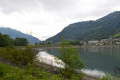
(6) Turn right onto the forest track on the right and join the access road to the hamlet of Gorge Granat. Follow it to the left and, at the hairpin bend that follows, take the path opposite, pass under the house and reach the edge of the Bassin du Flumet.

(7) Walk along the lake heading north and, after the skatepark, at the hairpin bend on the Route de Montouvrard, turn left; then, a few metres further on, take the path on the right (Promenade du Canal EDF), a former railway track. Continue straight on and rejoin the route taken at No. 12 on the Montée de Montouvrard.

(1) Follow the route back to the Place de la Résistance or the Parc des Forges car park (S/E).

Waypoints

  1. S/E : mi 0 - alt. 1,526 ft - Place de la Résistance - Bréda (rivière)
  2. 1 : mi 0.19 - alt. 1,598 ft - No. 12 on the Montée de Montouvrard
  3. 2 : mi 0.26 - alt. 1,686 ft - Montouvrard junction 2 km
  4. 3 : mi 1.24 - alt. 2,841 ft - Montouvrard, Rue du Bugnon
  5. 4 : mi 1.39 - alt. 2,877 ft - Grassy path opposite
  6. 5 : mi 1.9 - alt. 2,559 ft - Fontanettes
  7. 6 : mi 2.54 - alt. 1,926 ft - Forest track
  8. 7 : mi 3.11 - alt. 1,644 ft - Bassin du Flumet
  9. S/E : mi 4.2 - alt. 1,526 ft - Place de la Résistance

Reviews and comments

4.6 / 5
Based on 3 reviews

Reliability of the description
4.7 / 5
Ease of following the route
4.7 / 5
Route interest
4.3 / 5
Ch. D.
Ch. D.

Overall rating : 5 / 5

Date of your route : Apr 20, 2025
Reliability of the description : ★★★★★ Very good
Ease of following the route : ★★★★★ Very good
Route interest : ★★★★★ Very good
Very busy route : No

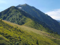
A lovely walk through varied scenery. The sun was shining and we enjoyed some beautiful views of the snow-capped mountains in the surrounding area.

As expected, the first few kilometres were quite steep. If it has rained in the days leading up to the walk, it’s best to follow the route as described.

Machine-translated

Jeanne38
Jeanne38

Overall rating : 4 / 5

Date of your route : Jun 20, 2023
Reliability of the description : ★★★★☆ Good
Ease of following the route : ★★★★☆ Good
Route interest : ★★★★☆ Good
Very busy route : No

The route includes some fairly steep and long climbs at times. From the description, I’d thought there were fewer of them. Otherwise, it’s a pleasant route through the woodland when it’s hot.

Machine-translated

liliane.clarens
liliane.clarens

Overall rating : 4.7 / 5

Date of your route : May 20, 2023
Reliability of the description : ★★★★★ Very good
Ease of following the route : ★★★★★ Very good
Route interest : ★★★★☆ Good
Very busy route : No

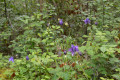
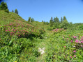
The route begins with a steep climb after the wash house, following a path through the forest lined with wild strawberries and flowers, accompanied by the chirping of birds, with clearings here and there offering views of the peaks and hamlets.
After Montouvrard, there’s a beautiful meadow full of flowers, including forget-me-nots, before a good descent to reach the edge of the lake and head towards Allevard.
Many thanks to the author for this challenging route in complete tranquillity.

Machine-translated

Other walks in the area

For more walks, use our search engine .

The GPS track and description are the property of this route's author. Please do not copy them without permission.