Country:

 City:
City:


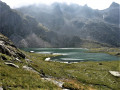
(S) Leave the refuge, cross the two footbridges over the dams, and join theGR®
(1) Head south-east.
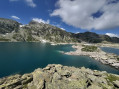
(2) Walk between Lac de la Motte and Cottepens, following the eastern shore of Lac Cottepens.
(3) Pass beneath the Lac du Cos dam, walk along the shore of Lac du Cos and head for the Bergerie du Cos.
Climb gently to reach the Col des 7 Laux.
(4) You’ve reached the highest point of the day; now it’s all downhill. Take the signposted path that winds its way past the lakes.
(5) You’ll pass by Lac Jeplan, Lac de la Corne and Lac de la Peatland.
(6) Begin the descent, the hairpin bends of which are visible, down to the road 800 metres below. Beautiful, well-marked, wide hairpin bends.
You’ll cross several streams without any particular difficulty; the crossings are clearly marked and well-graveled.
In the final section, the route is a little more exposed, running along the cliff face, but cables are in place and steps have been added. The path leads onto a dead-end ‘forest’ track (E).

 Visorando Member
 Difficult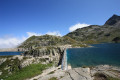
 Very difficult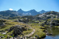
 Easy
Easy