


Refine your search for walks in Nousty
Nousty walks


 Circular route from Nousty via La Houn de Moussu and Chemin Henri IV.
 Visorando Member
 8.70 mi
 +492 ft
 -495 ft
 4h 25
4h 25
 Moderate
 Departure from Nousty (Pyrénées-Atlantiques)
Easy country hike around Nousty, starting from the village centre with its beautiful buildings and wash house.
On this very rural route, the Houn de Moussu is a local curiosity, a fountain providing water that is very good for your health, according to the elders. Legend has it that Henri IV drank from it when travelling from Pau to Coarraze.
There is a viewpoint shortly after the 419-metre altitude on the Chemin Henri IV.
The return through the fields, crossing fords, adds extra charm to the outing.
In the footsteps of Henry IV from Soumoulou
 7.60 mi
+325 ft
-328 ft
3h 45
Moderate
Departure from Soumoulou (Pyrénées-Atlantiques)
7.60 mi
+325 ft
-328 ft
3h 45
Moderate
Departure from Soumoulou (Pyrénées-Atlantiques)
A circular route around the lower part of the village of Soumoulou via Gomer, where you can discover part of Henri IV's trail, the GR® 782, in the hills. The village's central square offers easy parking.
Andoins from Soumoulou, the balcony of the Pyrenees
 9.40 mi
+400 ft
-417 ft
4h 40
Moderate
Departure from Soumoulou (Pyrénées-Atlantiques)
9.40 mi
+400 ft
-417 ft
4h 40
Moderate
Departure from Soumoulou (Pyrénées-Atlantiques)
An accessible and varied circular route on the balcony of the Pyrenees. Starting and ending in the centre of Soumoulou, this hike is appealing for its practicality: spacious car park, easy start and a circular route that avoids any complex logistics. The route alternates between quiet roads, country lanes and PR® footpaths, offering a gentle immersion in the contrasting landscapes of the Pyrenees and the Béarn plains.
The Chemin Henri IV in Lucgarier
4.34 mi
+410 ft
-397 ft
2h 20
 Easy
Departure from Lucgarier (Pyrénées-Atlantiques)
Easy
Departure from Lucgarier (Pyrénées-Atlantiques)
A hilly route through the woods along the Chemin Henri IV. The second part is mainly on a gravel track. There is little tarmac.
Rontignon ridge and hillside trail
 6.48 mi
+1,063 ft
-1,060 ft
3h 55
Moderate
Departure from Rontignon (Pyrénées-Atlantiques)
6.48 mi
+1,063 ft
-1,060 ft
3h 55
Moderate
Departure from Rontignon (Pyrénées-Atlantiques)
A beautiful route on the hillsides of Rontignon, a few kilometres from Pau. Several beautiful views of the ridges and the Pyrenees.
From Mazeres to Pardies Piétat
12.52 mi
+974 ft
-974 ft
6h 35
 Difficult
Departure from Mazères-Lezons (Pyrénées-Atlantiques)
Difficult
Departure from Mazères-Lezons (Pyrénées-Atlantiques)
A lovely walk along roads and tracks, including a visit to the Piétat Sanctuary and a return route via the ridges of the Baliros and Narcastet hills, back to the starting point in Mazères.
Mazeres-Assat circular loop via the Henri IV path
 15.36 mi
+292 ft
-282 ft
7h 20
Difficult
Departure from Mazères-Lezons (Pyrénées-Atlantiques)
15.36 mi
+292 ft
-282 ft
7h 20
Difficult
Departure from Mazères-Lezons (Pyrénées-Atlantiques)
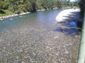
A circular loop of almost 25 kilometres taking you along the banks of the Gave, past the whitewater stadium, Franqueville Castle and part of the Henri IV path linking Pau to Lourdes. You will then return via Assat and the left bank of the Gave back to your starting point.
Piétat and its fountains
 5.89 mi
+518 ft
-541 ft
3h 10
Easy
Departure from Pardies-Piétat (Pyrénées-Atlantiques)
5.89 mi
+518 ft
-541 ft
3h 10
Easy
Departure from Pardies-Piétat (Pyrénées-Atlantiques)
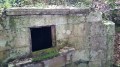
First, discover the site itself, the Sanctuary of Notre-Dame de Piétat, built in 1661 by the inhabitants of the farming community of Pardies. The region is rich in history! Next, enjoy the splendid view of the Nay valley to the south-east of Pau, and another beautiful panorama of the Pyrenees from the sanctuary's orientation table. Finally, you can have fun discovering the fountains and other springs hidden in the woods and hills of the site....
Crossing Pau and Bizanos via the Château de Franqueville
 7.50 mi
+187 ft
-207 ft
3h 35
Moderate
Departure from Pyrénées-Atlantiques
7.50 mi
+187 ft
-207 ft
3h 35
Moderate
Departure from Pyrénées-Atlantiques
A walk exploring the gardens, parks and squares of Pau and Bizanos, passing through the Ravin du Hédas, Pau Castle, the Eaux Vives Stadium and the hillside of Franqueville Castle; along the Gave de Pau, the Ousse, Bouries and Ariou Merdé streams; with magnificent views of the Jurançon hillsides and the Pyrenees, stretching from the Château de Pau to the heights of the Château de Franqueville.
A circular in the Morlaàs region
 4.16 mi
+364 ft
-361 ft
2h 15
Easy
Departure from Maucor (Pyrénées-Atlantiques)
4.16 mi
+364 ft
-361 ft
2h 15
Easy
Departure from Maucor (Pyrénées-Atlantiques)
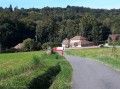
About fifteen kilometres north-east of Pau, the walk takes you through cornfields and oak and chestnut woods.
Between Saint-Vincent and Coarraze
14.44 mi
+1,709 ft
-1,732 ft
8h 10
Moderate
Departure from Saint-Vincent (Pyrénées-Atlantiques) (Pyrénées-Atlantiques)
A walk above the Nay plain, with panoramic views of the Pyrenees and the Piedmont!! Bring a picnic and enjoy the fresh air!!!
Bois de Pau and Pont-Long plain
8.04 mi
+39 ft
-39 ft
3h 45
Moderate
Departure from Pyrénées-Atlantiques
An easy, flat walk, alternating between forest (the Bois de Pau or Forêt de Bastard) and cultivated plains.Suitable for walking or mountain biking.
The Jurançon Hills
 4.07 mi
+922 ft
-912 ft
2h 40
Moderate
Departure from Jurançon (Pyrénées-Atlantiques)
4.07 mi
+922 ft
-912 ft
2h 40
Moderate
Departure from Jurançon (Pyrénées-Atlantiques)
A shaded walk on the hillsides of Jurançon to discover beautiful forests and estates.
The Menhir of the Ger Plateau
 7.30 mi
+538 ft
-538 ft
3h 50
Moderate
Departure from Ibos (Hautes-Pyrénées)
7.30 mi
+538 ft
-538 ft
3h 50
Moderate
Departure from Ibos (Hautes-Pyrénées)
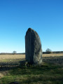
The route starts at the top of the Ger hill in Ibos and takes you to the Menhir on the Ger plateau. After entering the woods, the route becomes shaded and you will walk up the Géline. You will see a mini waterfall. You may even spot some deer...
Moderator's note : the slate bridge has been destroyed: see the notice dated 21/03/2022.
 The Grand Lées Valley
7.34 mi
+627 ft
-620 ft
1 hr
Easy
Departure from Gerderest (Pyrénées-Atlantiques)
Explore the Béarn countryside and its hamlets, as well as its regional produce, around the Grand Lées valley.
Around the Souy at Bois du Commandeur
5.87 mi
+89 ft
-89 ft
2h 45
Easy
Departure from Ibos (Hautes-Pyrénées)
Hike in the Bois du Commandeur in Ibos and Bordères-sur-l'Échez along the Souy river.The route is located between the D817 road from Pau and the D2 road from Bordères to Pintac, mainly using forest paths and trails. However, there are some short sections on roads.
⚠️ Read the comments on this hike.
The 4 churches route
 Tourist office
 8.00 mi
+879 ft
-863 ft
4h 25
Moderate
Departure from Montaner (Pyrénées-Atlantiques)
8.00 mi
+879 ft
-863 ft
4h 25
Moderate
Departure from Montaner (Pyrénées-Atlantiques)
This walk will take you to the four churches of Montaner, through forests and, from the plateaus, to vast panoramas with the castle tower as your anchor point.
The Mousqué plateau
 2.79 mi
+568 ft
-564 ft
1h 45
Easy
Departure from Saint-Pé-de-Bigorre (Hautes-Pyrénées)
2.79 mi
+568 ft
-564 ft
1h 45
Easy
Departure from Saint-Pé-de-Bigorre (Hautes-Pyrénées)
This beautiful, accessible walk is steeped in history; it follows the old Pontacq road used by charcoal burners in days gone by. Once you arrive at the Mousqué plateau, you can enjoy a shaded picnic area at the foot of century-old oak trees. From there, admire the superb view of the Saint-Péen massif and its countryside, then the Nay plain stretching all the way to Pau.
Long circular from Le Mousqué to Saint-Pé-de-Bigorre
 4.68 mi
+896 ft
-902 ft
2h 55
Moderate
Departure from Saint-Pé-de-Bigorre (Hautes-Pyrénées)
4.68 mi
+896 ft
-902 ft
2h 55
Moderate
Departure from Saint-Pé-de-Bigorre (Hautes-Pyrénées)
A must-visit spot for the locals of Saint-Pé and their friends, the peaks of Le Mousqué and La Tourette offer a change of scenery and magnificent panoramic views of the surroundings of Saint-Pé-de-Bigorre.Ideal at sunset in summer.
Around Saint-Pé-de-Bigorre
 4.35 mi
+512 ft
-538 ft
2h 25
Moderate
Departure from Saint-Pé-de-Bigorre (Hautes-Pyrénées)
4.35 mi
+512 ft
-538 ft
2h 25
Moderate
Departure from Saint-Pé-de-Bigorre (Hautes-Pyrénées)
In the Hautes-Pyrénées, near Lourdes, Saint-Pé-de-Bigorre reveals some of its charms during this hike: architecture, limestone massif and caves (with views of the Gave de Pau and the surrounding mountains), and even its Devil's Bridge!
Prairie de la Cantilerie or Prairie du Lapin Qui Tricote
 2.38 mi
+200 ft
-217 ft
1h 15
Easy
Departure from Saint-Pé-de-Bigorre (Hautes-Pyrénées)
2.38 mi
+200 ft
-217 ft
1h 15
Easy
Departure from Saint-Pé-de-Bigorre (Hautes-Pyrénées)
A few kilometres from the centre of Saint-Pé, a small pebble beach is the perfect spot for a refreshing dip in summer and a peaceful picnic break.
The knitting rabbit is hiding in the tall grass on the neighbouring property!
Montagnou de la Lit to Saint-Pé-de-Bigorre
 2.56 mi
+659 ft
-659 ft
1h 45
Moderate
Departure from Saint-Pé-de-Bigorre (Hautes-Pyrénées)
2.56 mi
+659 ft
-659 ft
1h 45
Moderate
Departure from Saint-Pé-de-Bigorre (Hautes-Pyrénées)
Starting from the Place des Arcades in Saint-Pé-de-Bigorre, enjoy a pleasant, peaceful walk to reach one of the hills sheltering the village, the “Montagnou de la Lit”, to the east. From up there, you can easily reach the entrance to the Grotte de la Résistance and, for the more adventurous, that of the Tute Faiouias.Magnificent views over the Gave de Pau valley and the ridges of the neighbouring peaks of the Saint-Pé massif.Return via the “Montagnou”, another hill above the village.
Grand tour of Saint-Pé-de-Bigorre via the hillsides
 6.40 mi
+597 ft
-584 ft
3h 30
Moderate
Departure from Saint-Pé-de-Bigorre (Hautes-Pyrénées)
6.40 mi
+597 ft
-584 ft
3h 30
Moderate
Departure from Saint-Pé-de-Bigorre (Hautes-Pyrénées)
On the hillsides of Saint-Pé-de-Bigorre, this 10 km route with an elevation gain of 180 m takes you through everything that makes the immediate surroundings of this village so beautiful: its small paths, meadows, woods, rivers and houses, in short, its rural heritage.Whether you're a regular walker or runner, a local or a visitor, you're sure to enjoy yourself here!
Le Montagnou de Saint-Pé
 1.03 mi
+236 ft
-213 ft
0h 40
Easy
Departure from Saint-Pé-de-Bigorre (Hautes-Pyrénées)
1.03 mi
+236 ft
-213 ft
0h 40
Easy
Departure from Saint-Pé-de-Bigorre (Hautes-Pyrénées)
A short walk in the hills above Saint-Pé-de-Bigorre offering breathtaking views of the village and its exceptional heritage: its 11th-century church, the former seminary and Catholic school, and the remarkable streets and houses dating from the 15th to the 18th centuries.There are also beautiful views of the mountain range to the south, including the Très-Croutz forest and the ridge of the Cirque de Bat dé Haü, stretching from the Toupiettes in the west to the Aülhet in the east.
Lengous and Montagnou
 3.34 mi
+433 ft
-440 ft
1h 55
Easy
Departure from Saint-Pé-de-Bigorre (Hautes-Pyrénées)
3.34 mi
+433 ft
-440 ft
1h 55
Easy
Departure from Saint-Pé-de-Bigorre (Hautes-Pyrénées)
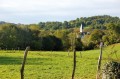
A pleasant walk through the woodland along the banks of the Gave de Pau, passing through Rieulhès, a typical Pyrenean hamlet. You’ll enjoy several remarkable views of the village of Saint-Pé-de-Bigorre.
Meadows of Garrapit and Bénac on the slopes of the Araü
 5.24 mi
+1,903 ft
-1,903 ft
4h 05
Moderate
Departure from Saint-Pé-de-Bigorre (Hautes-Pyrénées)
5.24 mi
+1,903 ft
-1,903 ft
4h 05
Moderate
Departure from Saint-Pé-de-Bigorre (Hautes-Pyrénées)
On the forgotten trails of Saint-Pé-de-Bigorre No. 6
The Araü is the mountainous ridge jutting out from the Massif de Saint-Pé down to the Gave de Pau at the foot of the village. Its imposing, entirely wooded silhouette conceals pretty clearings, once meadows, some well-known paths and others forgotten, used only by hunters and hiking enthusiasts beneath the tall trees of the forest.
Its summit, towering arrogantly over the village, is the Soum de las Toupiettas (1,357m).
Montné Ridges and Col du Prat d’Aürelh circular loop via Le Pladi
 9.32 mi
+3,688 ft
-3,684 ft
7h 30
Difficult
Departure from Saint-Pé-de-Bigorre (Hautes-Pyrénées)
9.32 mi
+3,688 ft
-3,684 ft
7h 30
Difficult
Departure from Saint-Pé-de-Bigorre (Hautes-Pyrénées)
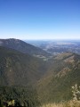
A beautiful, physically demanding day’s hike with several exposed sections along the ridges, taking you to the heights of the Saint-Pé-de-Bigorre massif, first to the east and then north-east, above the Génie Longue torrent.
Final stop at the Refuge du Col du Prat d’Aürelh (du Rey) and its summer pastures.
Magnificent scenery! Solitude guaranteed!
The Montagnou de la Pâle caves in the Très-Croutz Forest
 2.26 mi
+919 ft
-919 ft
1h 50
Easy
Departure from Saint-Pé-de-Bigorre (Hautes-Pyrénées)
2.26 mi
+919 ft
-919 ft
1h 50
Easy
Departure from Saint-Pé-de-Bigorre (Hautes-Pyrénées)
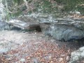
Just a stone’s throw from the village of Saint-Pé-de-Bigorre, this walk takes us along the trail of the massif’s caves, particularly those on a large hilltop, the Mountagnou de la Pale. The caves are dotted along this route as if laid out especially for the walker. We approach the gaping hole of the Gouffre du Hayau, whose unusual size and the draught of air coming in would surely draw you into its dark abyss, were you not careful...
This route was significantly altered in May 2024 by the creation of a new ‘karst trail’.
Cap des Litas via Coumo Rédo and Col d’Espadres
 9.39 mi
+4,229 ft
-4,209 ft
8h 00
Difficult
Departure from Saint-Pé-de-Bigorre (Hautes-Pyrénées)
9.39 mi
+4,229 ft
-4,209 ft
8h 00
Difficult
Departure from Saint-Pé-de-Bigorre (Hautes-Pyrénées)
On the forgotten trails of Saint-Pé-de-Bigorre No. 3
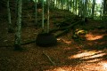
A challenging and demanding circular route above Serre Pourcou, across the mountainous plateaus and summer pastures of the Pyrenean foothills, and through the vast and impenetrable forest of Très Croutz, or the state-owned forest of Saint-Pé-de-Bigorre.
The diversity of the landscapes encountered never fails to impress the hiker...
Pic de Miquéu circular route via Coumo Redo and Calihourc
 6.98 mi
+3,586 ft
-3,570 ft
6h 20
Difficult
Departure from Saint-Pé-de-Bigorre (Hautes-Pyrénées)
6.98 mi
+3,586 ft
-3,570 ft
6h 20
Difficult
Departure from Saint-Pé-de-Bigorre (Hautes-Pyrénées)
On the forgotten paths of Saint-Pé-de-Bigorre No. 4
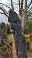
A beautiful view from the Pic de Miquéu (1,452 m) over the Saint-Pé Massif and the summer pastures, stretching as far as the peaks of the border range.
The route takes in several ancient paths not marked on maps, which adds to its appeal. On the way back, you’ll discover the remarkable site of Calihourc, with its sharp limestone pavement shaped like confessionals, celebrated and photographed by Abbé Abadie in his book *Le Sanglier du Picharrot*.
The Aygo Blanco Cave-Spring-Resurgence in the Très Crouts Forest
 2.10 mi
+833 ft
-823 ft
1h 40
Moderate
Departure from Saint-Pé-de-Bigorre (Hautes-Pyrénées)
2.10 mi
+833 ft
-823 ft
1h 40
Moderate
Departure from Saint-Pé-de-Bigorre (Hautes-Pyrénées)
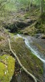
The Très Crouts Forest holds many curiosities. Here is an unusual one, as it is very rare in this area: a very active resurgent cave. At Aygo Blanco, the torrent gushes from the mountain at 650m and plunges 120m down through a series of small waterfalls, where the river spreads out its white angel’s hair…
An enchanting walk to discover this hidden gem!
Most of the route follows a path in reasonable condition, although it is old and unmarked.
The final 100 metres are quite rugged.
Bédeille and Les Picharrots via the rangers’ path
 6.67 mi
+1,991 ft
-1,988 ft
4h 50
Difficult
Departure from Saint-Pé-de-Bigorre (Hautes-Pyrénées)
6.67 mi
+1,991 ft
-1,988 ft
4h 50
Difficult
Departure from Saint-Pé-de-Bigorre (Hautes-Pyrénées)
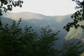
The Picharrots waterfall is a classic spot for lovers of the Saint-Pé Massif who aren’t afraid to tackle the challenges of navigating the Integral Biological Reserve, which is deliberately left completely untouched by human intervention.
This route offers an alternative, allowing you to take the Sentier des Gardes on the way there – a trail somewhat forgotten within the massif, but a truly epic one.
The final section of the route, between the Bédeille ravine and the waterfall, is more challenging and at times more exposed.
Return via the Génie Longue.
The Aoulhet mountain pastures
 6.71 mi
+2,881 ft
-2,881 ft
5h 35
Difficult
Departure from Saint-Pé-de-Bigorre (Hautes-Pyrénées)
6.71 mi
+2,881 ft
-2,881 ft
5h 35
Difficult
Departure from Saint-Pé-de-Bigorre (Hautes-Pyrénées)
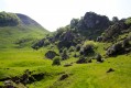
Discover a section of the Pyrenean foothills that has remained largely unspoilt: no forest tracks penetrate these vast wooded expanses. Explore unspoilt wilderness along an old path leading up to the mountain pastures and a former charcoal burners’ trail. Discover the vast beech forests of Tres Crouts and the Aoulhet mountain pastures, undoubtedly the most picturesque and wildest spots in the Pibeste-Aoulhet Regional Nature Reserve.
Aoulhet hut
 3.47 mi
+2,480 ft
-2,480 ft
3h 45
Moderate
Departure from Saint-Pé-de-Bigorre (Hautes-Pyrénées)
3.47 mi
+2,480 ft
-2,480 ft
3h 45
Moderate
Departure from Saint-Pé-de-Bigorre (Hautes-Pyrénées)
The Cabane de l'Aoulhet is a popular destination for the inhabitants of Saint-Pé, located above the village in the heart of the Très-Croutz forest.
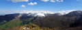
Although it is a stop on many routes in the massif, it can also be a popular destination in itself, on the border between the sunny summer pastures and the mossy forest, with a remarkable view of the Montné cliffs, the steep-sided Génie Longue valley, the Picharrots cliffs and the other summer pastures of Prat du Rey.
Soum de la Génie Braque via the Tres-Croutz forest
 6.27 mi
+3,698 ft
-3,698 ft
6h 05
Difficult
Departure from Saint-Pé-de-Bigorre (Hautes-Pyrénées)
6.27 mi
+3,698 ft
-3,698 ft
6h 05
Difficult
Departure from Saint-Pé-de-Bigorre (Hautes-Pyrénées)
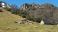
A lovely mid-mountain hike through the lush forest of Saint-Pé-de-Bigorre (or Tres-Croutz or Crouts = Three Crosses in Bigourdan). The first quarter of the hike is a bit challenging, as it is steep. You then pass through the Aülhet and Artigue mountain pastures, before following the ridge westwards to the summit of Soum de la Génie Braque. Well known to locals, this route offers a guaranteed change of scenery!
 Soum de la Génie Braque circular loop via Cabanes d'Isarce and d'Aülhet
 9.88 mi
+4,364 ft
-4,364 ft
8 hrs
Difficult
Departure from Saint-Pé-de-Bigorre (Hautes-Pyrénées)
9.88 mi
+4,364 ft
-4,364 ft
8 hrs
Difficult
Departure from Saint-Pé-de-Bigorre (Hautes-Pyrénées)
An exceptional and magnificent circular route on the heights of Saint-Pé-de-Bigorre, in the Tres-Croutz forest, then along the ridge of the Soums de Maletaule. This route circles the Génie Braque torrent, which supplies water to the village below. On the mountain pastures, the landscapes are magical in both summer and winter, on the northern side (St-Pé) and the southern side (the main Pyrenees range).
The Génie Braque torrent and return via the Aülhet
 6.85 mi
+3,360 ft
-3,360 ft
6h 05
Difficult
Departure from Saint-Pé-de-Bigorre (Hautes-Pyrénées)
6.85 mi
+3,360 ft
-3,360 ft
6h 05
Difficult
Departure from Saint-Pé-de-Bigorre (Hautes-Pyrénées)
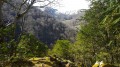
A lovely, challenging and demanding route through the Très-Croutz forest, passing along the bed of the La Génie Braque torrent.The circular route returns via the Aülhet ridge (and its hut, open all year round) after passing through the mountain pastures of the Bat de Haü cirque, clearly visible from the Gave de Pau valley and Saint-Pé-de-Bigorre.
Paybou Chasm circular loop via Calihourc and the Sentier de Gatès
 4.52 mi
+2,697 ft
-2,684 ft
4h 25
Difficult
Departure from Saint-Pé-de-Bigorre (Hautes-Pyrénées)
4.52 mi
+2,697 ft
-2,684 ft
4h 25
Difficult
Departure from Saint-Pé-de-Bigorre (Hautes-Pyrénées)
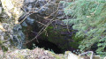
Visiting the gaping maw of the impressive Gouffre de Paybou, lost deep within the steep forest, is just one of the reasons to undertake this splendid hike in the heart of the Très-Croutz Forest, in the Saint-Pé Massif.Here, we follow in the footsteps of Abbé Bernard Abadie, who brought fame not only to this chasm – which he ‘invented’ – but also to the remarkable and eerie site of Calihourc, where he posed for posterity, pipe in hand, beret firmly perched on his head and a mischievous look in his eyes…
Warning!This walk takes place in the heart of the wilderness in a rather challenging environment: steep slopes, rocky outcrops, cliffs, thorny undergrowth, and at times a complete lack of signposting, or even a lack of a proper path… This is why it is reserved for experienced, fit walkers with a good sense of direction. A GPS device may also prove very useful.
A circular route to the Pic du Merdanson from Arthez-d’Asson
8.93 mi
+3,855 ft
-3,865 ft
7h 30
Difficult
Departure from Arthez-d'Asson (Pyrénées-Atlantiques)
An excellent way to climb the Merdanson whilst remaining almost entirely under tree cover, which is very pleasant in summer. No technical difficulties during the summer months. There is also the option of climbing the Pic de Pas de Broc.
=> Map and GPX track are very useful.
The Henri IV Trail
 20.70 mi
+732 ft
-1,421 ft
10h 10
Difficult
Departure from Lourdes (Hautes-Pyrénées)
20.70 mi
+732 ft
-1,421 ft
10h 10
Difficult
Departure from Lourdes (Hautes-Pyrénées)
A beautiful route linking Lourdes to Pau along an ancient Roman road steeped in history. The Henri IV trail stretches across the Hautes-Pyrénées and Pyrénées-Atlantiques departments, along the foothills of the Pyrenees.
The Pladi Trail and the Prat dou Rey Hut
 7.18 mi
+2,411 ft
-2,395 ft
5h 25
Difficult
Departure from Saint-Pé-de-Bigorre (Hautes-Pyrénées)
7.18 mi
+2,411 ft
-2,395 ft
5h 25
Difficult
Departure from Saint-Pé-de-Bigorre (Hautes-Pyrénées)
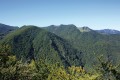
Le Pladi is a mountain pass featuring a small, peaceful clearing. This route, along the Picoulets ridge, offers panoramic views over the Sauguet pastures and the Tres Crouts forest. You can extend the walk by heading to Prat dou Rey in the Batsurguère valley, or head back down the same way.
La Crèque Noèle in Rieulhès
 0.71 mi
+161 ft
-167 ft
0h 30
Easy
Departure from Saint-Pé-de-Bigorre (Hautes-Pyrénées)
0.71 mi
+161 ft
-167 ft
0h 30
Easy
Departure from Saint-Pé-de-Bigorre (Hautes-Pyrénées)
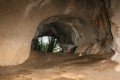
This short family walk takes you to a charming little cave that’s very easy to reach. Over the millennia, it has been home to all sorts of creatures, as well as humans. All have left traces, few of which are visible to the naked eye, apart from the bear droppings and the markings from palaeontological excavations.What remains is the cave’s impressive size – surprising and rare in the region – and its location in the ever-mysterious Très-Croutz Forest.
Long circular loop of the Pibeste-Aoulhet Reserve
 15.30 mi
+5,512 ft
-5,512 ft
10 hrs
15.30 mi
+5,512 ft
-5,512 ft
10 hrs
 Very difficult
Departure from Saint-Pé-de-Bigorre (Hautes-Pyrénées)
Very difficult
Departure from Saint-Pé-de-Bigorre (Hautes-Pyrénées)
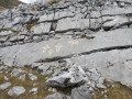
An exceptional, challenging and demanding route through the Très-Croutz forest, first on the Gave de Pau side, with a brief detour to the Val d'Azun side at the Col d'Andorre, then on the plateau at 1,400 m, between the Col d'Espadres and the Saint-Pé ridge (Maletaule or Soums).Summer pastures with centuries of pastoral activity, at the crossroads of important local historical sites, including the famous Très Croutz (the Three Crosses of the Bigourdan bishoprics).
From Les Aoules to Ferrières via the Soum de Souste and the Soum d’Arangou
4.42 mi
+2,241 ft
-1,962 ft
4h 00
Moderate
Departure from Arthez-d'Asson (Pyrénées-Atlantiques)
This walk is only suitable for walkers who are comfortable with steep and long climbs. This rarely used route offers a peaceful walk in absolute silence in the shade of the Monbula woods. You must first leave a car at the finish point on the D126, on the left-hand side of the road, and then walk to the Aoules car park. The walk can be done in either direction, but the descent towards Ferrières will be easier.
From the Croix de Buzy to Bescat
 5.83 mi
+509 ft
-509 ft
3h 10
Moderate
Departure from Buzy (Pyrénées-Atlantiques)
5.83 mi
+509 ft
-509 ft
3h 10
Moderate
Departure from Buzy (Pyrénées-Atlantiques)
On the way there, exceptional views of the Ossau Valley and the Pyrenees mountain range.
On the way back, you will pass through the small village of Bescat. The walk is then more shaded.
Buzy Cross
5.08 mi
+177 ft
-177 ft
2h 30
Easy
Departure from Buzy (Pyrénées-Atlantiques)
A variation on the Croix de Buzy circular path, as a return walk.
It is an easy walk with a beautiful view of the Pyrenees. It starts on a gravel road and then follows a dirt track.
Little shade. A stream at the end of the route with a poorly defined path.
The valleys of Yerse and Aguée via Arriousec to Peyras
 10.62 mi
+4,695 ft
-4,678 ft
8 hrs
Very difficult
Departure from Asson (Pyrénées-Atlantiques)
10.62 mi
+4,695 ft
-4,678 ft
8 hrs
Very difficult
Departure from Asson (Pyrénées-Atlantiques)
On the forgotten trails of Saint-Pé-de-Bigorre No. 5A long journey from the Ouzom Valley, through Les Aoules, to the Génies Valley, in the unfathomable Saint-Pé massif.In all seasons, the landscapes and forests are impressive and majestic.Its main attraction lies in the beauty of the two valleys crossed from end to end: the Yerse and the Aguée, sites of ancestral pastoralism where shepherds and their flocks lived from June to October. There are still many traces of this to be found.
Caubios-Loos circular route via the Sanctuary of Sainte Quitterie
 6.86 mi
+620 ft
-600 ft
3h 40
Moderate
Departure from Caubios-Loos (Pyrénées-Atlantiques)
6.86 mi
+620 ft
-600 ft
3h 40
Moderate
Departure from Caubios-Loos (Pyrénées-Atlantiques)
Circular route through the countryside and woods with beautiful views of the Pyrenees and a visit to the Sanctuary of Sainte-Quitterie. This saint, renowned in the south-west, has given her name to many springs and fountains reputed to be miraculous.
This circular route mainly follows route no. 9 in the old booklet "32 walks and hikes in Miey de Béarn".
Signs and markings (yellow lines) are in place for a good half of the route, but after that it becomes more uncertain.
Pas de Broc and Merdanson peaks loop from Durrieu
8.81 mi
+3,458 ft
-3,448 ft
7h 05
Difficult
Departure from Louvie-Juzon (Pyrénées-Atlantiques)
Circular route in the foothills of the Béarn Pyrenees. Beautiful views over the plains of Bruges Nay and, further afield, towards Pau. If Ossau is not visible, Durban, Montdragon and Moulle de Jaut beckon, as if inviting us to climb them soon. This hike can be completed as a round trip in 5½ to 6½ hours, including stops.
Col d'Ech from Omex
 1.73 mi
+413 ft
-417 ft
1h 10
Easy
Departure from Omex (Hautes-Pyrénées)
1.73 mi
+413 ft
-417 ft
1h 10
Easy
Departure from Omex (Hautes-Pyrénées)
Short hike on the outskirts of Lourdes, in the Batsurguère valley. Above the charming village of Omex, there are isolated pastures in a natural basin, the source of the Moules stream. The pass is topped by the Soum of the same name and the Mail des Portes, the start of the beautiful Pernes ridge, towards the Soum du Montné, gateway to the Saint-Pé-de-Bigorre massif and the Très-Crouts forest.
Les Noyers and the Pierre du Diable in two circular loops from Bénac
8.31 mi
+896 ft
-896 ft
4h 35
Moderate
Departure from Bénac (Hautes-Pyrénées) (Hautes-Pyrénées)
A half-day hike through meadows and fields, from Bénac to Hibarette, then through the wooded hillsides from Bénac to Layrisse.The two circular loops link up easily, taking 3½ hours for hikers and 4 hours for families. This route is well suited to Nordic walking and can be completed in 2½ to 3 hours.The second section is well suited for some short interval training, with three hills of 1 km each.
Boucle du Béout
 2.65 mi
+1,280 ft
-1,276 ft
2h 20
Difficult
Departure from Lourdes (Hautes-Pyrénées)
2.65 mi
+1,280 ft
-1,276 ft
2h 20
Difficult
Departure from Lourdes (Hautes-Pyrénées)
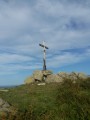
Tour of the Cité Saint-Pierre via the Béout ridge, passing by the summit cross and the old cable car station with views of Lourdes, the Gave de Pau and the start of the Vallée des Gaves.This hike in a wild area, with little or no signposting and trails that are difficult to see in summer and overgrown with ferns (especially on the descent), makes it accessible only to "adventurers" over the age of 10 who are not afraid of discovering this little summit!
Le Béout in the hills above Lourdes
 3.37 mi
+1,263 ft
-1,247 ft
2h 40
Moderate
Departure from Lourdes (Hautes-Pyrénées)
3.37 mi
+1,263 ft
-1,247 ft
2h 40
Moderate
Departure from Lourdes (Hautes-Pyrénées)
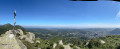
Short hike in the hills above Lourdes. The route is very quiet but well worth a look. It follows the northern ridge, which is the longest and has the greatest elevation gain.
From the main summit at 791m, where a cross has been erected, there is a 360° view of the Lourdes region.
From the second summit at 719m, there is a viewpoint with the old Béout cable car installation. A little further on is the entrance to the cave known as the "Gouffre de Lourdes", which is 82m deep.
Route du Tos de la Courade
 2.45 mi
+564 ft
-538 ft
1h 35
Easy
Departure from Bescat (Pyrénées-Atlantiques)
2.45 mi
+564 ft
-538 ft
1h 35
Easy
Departure from Bescat (Pyrénées-Atlantiques)
This is a family hike in the Ossau Valley, south of the city of Pau, between the villages of Bescat and Sévignacq-Meyracq.
Mainly through the woods, it leads to the Tos de la Courade (tos = watering hole) and then joins theGR®78via a well-maintained path, before returning to the starting point. It overlooks the Ossau Valley to the south and, in the second part of the walk, the plain of Pau.
Cabane du Col du Prat d'Aürelh (Prat du Rey)
 6.08 mi
+1,617 ft
-1,627 ft
4h 10
Moderate
Departure from Ségus (Hautes-Pyrénées)
6.08 mi
+1,617 ft
-1,627 ft
4h 10
Moderate
Departure from Ségus (Hautes-Pyrénées)
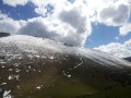
This hike is not technically difficult but goes beyond the scope of a "Sunday stroll". Its appeal lies in reaching the pastoral summer pastures above the magnificent Batsurguère valley, at the gateway to Lourdes, and taking a break in a perfectly maintained refuge hut. To the west, you can see the Aguée valley, towards the Col d'Espadres. The place is quiet and superb. With a bit of luck, you will be in the company of horses roaming free on the grassy slopes of the pass.
Circular from Sainte-Colome in the Ossau Valley.
 3.70 mi
+650 ft
-686 ft
2h 15
Easy
Departure from Sainte-Colome (Pyrénées-Atlantiques)
3.70 mi
+650 ft
-686 ft
2h 15
Easy
Departure from Sainte-Colome (Pyrénées-Atlantiques)
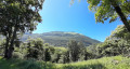
An easy, rural circular from Sainte-Colome in the Ossau Valley, alternating between beautiful woodland paths and farm tracks, offering a wonderful introduction to the Béarn foothills and the pretty village of Sainte Colome.
Marked with PR®, then VTT and then GR®78.
The Pic du Jer
 5.29 mi
+1,798 ft
-1,798 ft
4h 00
Moderate
Departure from Lourdes (Hautes-Pyrénées)
5.29 mi
+1,798 ft
-1,798 ft
4h 00
Moderate
Departure from Lourdes (Hautes-Pyrénées)
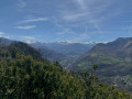
A classic family walk. A stunning view from the summit, from where, in good weather, you can see the Vignemale, the Pic du Midi de Bigorre, the Ardiden, etc. There are also lovely views towards Lourdes, Tarbes and Pau all along the ascent. The first section is through a well-shaded forest, whilst the second is more exposed. Bring a cap and water in summer. It is a shame, however, that the summit has been left to fall into disrepair, as the promontory is no longer accessible, nor is its orientation table.
Soum de Basta and Pic du Jer
 8.67 mi
+2,641 ft
-2,641 ft
6h 15
Moderate
Departure from Lourdes (Hautes-Pyrénées)
8.67 mi
+2,641 ft
-2,641 ft
6h 15
Moderate
Departure from Lourdes (Hautes-Pyrénées)
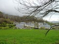
An off-the-beaten-track hike that takes you up two small peaks near Lourdes.A good sense of direction is required for the climb to the Pic du Jer. Do not attempt this hike in wet weather.
⚠️ User comment dated 8 March 2026 => There appears to be a serious access issue at the start due to the poor condition of the track. See alternative route in the practical information section.
Tour of the Arudy glacial valley
 11.70 mi
+1,608 ft
-1,604 ft
6h 45
Very difficult
Departure from Arudy (Pyrénées-Atlantiques)
11.70 mi
+1,608 ft
-1,604 ft
6h 45
Very difficult
Departure from Arudy (Pyrénées-Atlantiques)
A somewhat long walk, but not difficult, with good yellow PR® Route de la Vallée d'Arudy signposting, which occasionally overlaps with a GR®. Beautiful views of the Ger massif and perhaps towards Ossau. Several interesting churches along the way.
Malarode Cave circular trail
 3.45 mi
+1,063 ft
-1,066 ft
2h 30
Moderate
Departure from Arudy (Pyrénées-Atlantiques)
3.45 mi
+1,063 ft
-1,066 ft
2h 30
Moderate
Departure from Arudy (Pyrénées-Atlantiques)
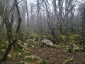
Is it hot or grey? Here is a half-day forest trail that is perfect for children. However, avoid periods when it is too wet due to some slippery descents. At the top of the walk, you can enjoy a view of Arudy, and birds of prey are often visible. Above all, don't forget a torch to venture a little way into the cave. Opposite, the other cave, which is closed, contained prehistoric remains (on display at the Arudy museum).
Aubuchous circular loop
 1.96 mi
+427 ft
-417 ft
1h 15
Easy
Departure from Gez-ez-Angles (Hautes-Pyrénées)
1.96 mi
+427 ft
-417 ft
1h 15
Easy
Departure from Gez-ez-Angles (Hautes-Pyrénées)
A beautiful, easy circular path near the small village of Gez-ez-Angles, located a few kilometres from Lourdes. You will walk along an open ridge to the small summit of Aubuchous, where you can enjoy a wide panorama of the foothills and the Pyrenees mountain range, before returning to the village via a more wooded path.