Country:

 City:
City:


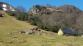
Meet at the car park below the Monastery of Bethlehem, in Saint-Pé-de-Bigorre, at the former Peyras farm.
(S/E) The path starts from this small car park, not towards the monastery gate but directly from the car park itself, on the right as you enter, through the bushes and undergrowth, towards the bed of the Génie Longue.
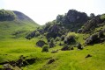
(1) Cross the stream via a lovely brand-new footbridge (as of September 2016). Head straight ahead along a tiny, unmarked path that climbs up the slope of the Montagnou de la Pale, beneath the high-voltage power line. The path winds several times beneath and to the right of the high-voltage power line.
(2) Directly beneath the power line, the path reaches a junction that is not visible from the ground, where one branch heads off to the left (out of sight) and the other to the right – the one you will take. This is the Chemin des Gardes (of the Saint-Pé State Forest). Follow this path along the western slope of the Croupe de la Pale, beneath the Picoulets (the small peaks). Depending on the season or when the path was last cleared, progress may be slowed by brambles and bushes obstructing this ancient path. Pass under the high-voltage power line for the first time.
From there, the path is sometimes difficult to follow on the ground. Be sure to follow the ‘logging markers’ carefully (see Practical Information below) as there are no coloured markings.
NB: The path is only partially marked on the paper IGN map, but is fully marked on the digital version (the Visorando map).
Pass under the high-voltage line a second time. Shortly afterwards, be careful not to take the path that heads north-east, which is also clearly marked with logging trail markers.
Reach the Bédeille ravine. The stream is dry (as it runs underground) most of the time (even along the section shown as a solid line on the map).
(3) The path is still clearly marked on the IGN map with a dotted line but is difficult to find when approaching from this direction. Look carefully again for the logging trail markings. If using a GPS, make sure you’re positioned towards the left of the marked path.
NB: There is also an off-trail section roughly following the dotted line on the IGN map, starting from a large flat rock slab in the Bédeille and passing under a long rocky outcrop, but it is very steep and quite dangerous.
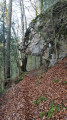
The path passes a striking natural feature: a rock formation overhanging the path. If you turn round, you can see the resemblance to a wild boar’s head.
Stay on the path until just to the left of the 803-metre mark.
This marks the start of a gentle descent of 55 metres in elevation. You’ll pass through carpets of mountain daffodils.
(4) Reach a headland overlooking the Puyau de Caubole at an altitude of around 740 metres. There are a few markings carved into the trees; these indicate the boundary of the private enclave within the nature reserve. Begin the descent towards the Puyau de Caubole on a narrow but clear path (as of 2016).
(5) Reach the Puyau de Caubole, an area outside the boundaries of the Nature Reserve. The first destination of the walk has been reached.
Although this former meadow is now overgrown, the setting is enchanting and perfect for a break. Hundreds of butterflies, a lovely ray of sunshine filtering through the tall trees that have now taken over the site, and the charming stream which, rising at the foot of the Montné cliffs, flows into the Génie Longue just a stone’s throw away. In its bed, pebbles as red as blood!
The rest of the walk is easier. Leave Puyau de Caubole via the west, between two rows of so-called ‘dry stone’ walls – which are actually covered in moss and may well be an old ‘bargueira’. Follow a narrow path to quickly rejoin the main path from Peyras to Les Picharrots.
(6) Return section: turn left onto the path, which is now marked in yellow. Don’t expect a magnificent, wide, well-marked path. It’s more of a human-made track, often overgrown with vegetation or cluttered with branches, or even fallen trees, although it was cleared in January 2019.
The path is narrower than the Chemin des Gardes. You’ll be walking through woodland overgrown with snowdrops in season (December–January). At times the path winds through the bed of the Génie, at other times it veers away from it. The final 100 metres are easier to walk along within the bed of the Génie. This entire section was marked with cairns in early 2019.
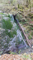
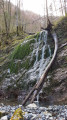
This waterfall is an outward-curving rock formation over which flows the headwaters of the Génie Longue, a tributary of the Aguée rivers. On the right bank, a stream of similar size flows into it, originating from the Fontaine d’Escorcens at the head of the Cot du Prat d’Aüreilh valley.
Water flows vary greatly depending on the season and, in particular, following stormy downpours on the slopes above.
(7) Retrace your steps.
(6) Next, the return route follows the banks of the Génie Longue stream.
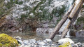
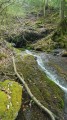
This descent is enchanting: small waterfalls, pools, a winding riverbed carved through bluish-grey, black and white limestone, and water of remarkable clarity.
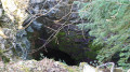
(8) Below the Soum d’Artigue (de Richou) (1,230 m), the path passes right by a cave not to be missed, the Tute Hau Pas, on the left.
(9) Continue along the Génie Longue, heading north then north-west, until you cross the first footbridge.
(1) Carry on along the river until you reach a second footbridge, the one you crossed on the way there.
You’ll soon reach the car park (S/E).


 Visorando Member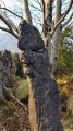

 Moderate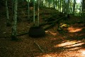
 Tourist office