Country:

 City:
City:


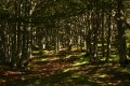
Park your car in the small car park (maximum 4 or 5 cars) below the entrance to the Monastery of the Sisters of Bethlehem, in Peyras.
From Peyras to the Aülhet hut (5) via Coumo Redo (3) and Pla de Bers
(S/E) The path, which is quite wide, starts to the right of the entrance gate. Flanked by low walls of large dry stone, it runs horizontally for a few dozen metres and is clearly marked in yellow.
(1) At the first Fork in the road, go straight on (to the left, the path is signposted ‘Refuge de l’Aoulhet 3h’).
We’ll opt for an alternative route to the usual path up to the Cabane d’Aülhet: the historic Coumo Redo path, which was restored by hunters a few years ago.
The path is still visible as a dotted line on the IGN map, but is unmarked.
After fording the Coumo Redo (or using the rickety footbridge if the water is too high), the easiest route leads up to a ruined barn and a former Second World War youth work camp, Les Castets, now used as a camping site by Scouts in the summer.
After the ruined barn, turn left and continue to the far end of the clearing. The path is no longer marked on the IGN map (but can still be found on OpenStreetMap).
(2) As soon as the climb begins, just behind a tree at stone marker no. 193, leave the path that continues through the valley and head westwards uphill towards La Coumo Lio.
Numerous stone markers (white and red) dot the massif, marking the boundary of the undivided Saint-Pé state-owned forest.
The path is well-defined and fairly wide, but is not signposted at the start. However, you will soon come across some blue spray-painted markings on the trees.
At the first fork in the road, about 300 metres past the marker (10–15 mins max), turn sharply left to head up towards the Sarrat dets Castets. The path is known as a favourite spot for wild boar hunters, but no longer appears on any map. There are numerous traces of blue markings.
This old path, though perfectly well-marked and maintained, will take you up to an altitude of around 600 metres, where it turns towards the other side of the serrat, towards the Coumo Redo ravine.
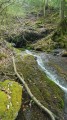
It continues along this side of the ridge, crossing the boundary of the Saint-Pé ‘Integral Biological Reserve’ (RBI), marked by blue lines on a white background (or simply blue lines) and a signpost (see photo; unfortunately broken in March 2017), until you reach the Redo torrent and cross it over a fine slab, just downstream of a modest 1.50-metre waterfall (dry in September 2016). It takes between 1h30 and 2h to reach this point.
(3) From the Redo, continue due east along the clearly visible path, although it is narrower and sometimes obstructed by fallen trees on the slope.
You’ll reach the very steep ravine of a tributary to the Redo, featuring several other charming little waterfalls.
Please note: there is no waypoint here, and do not cross the ravine at this point!
Climb up the shallow ravine, keeping to the left bank, following an uninviting but well-marked orange trail.
(4) A few dozen metres higher up, cross the ravine and continue until you reach Pla de Bers, precisely at the crossroads marked 824.
The rest of the route is more conventional, as you turn right onto the historic transhumance path towards the summer pastures of Aülhet or Aoulhet (pronounced “aouyette”).
The path is clearly marked in yellow (it partly follows Route No. 3 of the Pibeste-Aoulhet Nature Reserve). The ground is very stony and slippery in wet weather.
Gradually, the dense forest and boxwood undergrowth thin out and the path winds through a high-canopy beech forest. After a walk of between 20 minutes and half an hour, depending on your pace, you reach a semi-circular beech grove known as the Amphitheatre.
The path resumes its ascent through this beautiful forest, passing a remarkable, moss-covered rocky outcrop on the left. At the edge of the forest, there is a wooden signpost for the nature reserve (RNR Pibeste-Aoulhet), which is very useful for finding the entrance to the woods on the way back, especially if there is a bit of mist. Arrival at the mountain pastures.
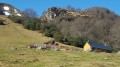
(5) After a short climb, still marked in yellow, you reach the Aülhet mountain hut, now a magnificent timber-clad building divided into two sections: one for shepherds, the other for walkers, hunters and cavers (since late 2016). There are a few recent cattle gates nearby.
Despite the winding nature of our path and the difficulties along the way, it took us just three hours, as indicated on the sign for the “easy” path through the valley.
From Aülhet (5) to the Col d’Espadres (8)
After a short break, resume the route by climbing across the grassy slope behind the hut, heading towards the Col d’Espadres (signpost), also marked as Espades on maps. Pass the rock on your right, which bears a commemorative plaque marking a 1944 weapons airdrop.
Head towards the nearest peak, the Soum d’Artigue, and reach the small pass of Aülhet at 1,215 metres. The vast and beautiful Artigue summer pasture opens up before you. ‘Artigue’ means ‘pasture acquired through clearing’ in the Occitan language. Take the narrow path that winds to your right up the hillside, beneath the rocky massif.
Pass by the Fontaine de la Digitale (note as you go that a pipe channels this spring to a drinking trough slightly below and on to the Aülhet hut). The route is still marked in yellow, but the markings are more widely spaced. Take care not to miss a marker!
(6) Reach the Col de Larbastan (1,350 m, below the peak of the same name at 1,368 m). Continue to the left of the pass, climbing towards the Soum de la Génie Braque.
The path climbs steeply up the slopes of the Pic de Miquéu and the Pic de Hourbilagous, both of which you’ll leave to your left. Please note that in winter, the snow-covered northern slopes of this peak are known avalanche zones…
This is the path of the Cuts d’Ausèth (the dolines or large sinkholes, literally ‘birds’ nests’ in Bigourdan).
You reach the ridge of the plateau at a place called Bosc deth Troncar (1,455 m) (in Bigourdan: ‘forest of the truncated one’; referring to the truncated mountain?). A signpost for the nature reserve points straight on towards the Plateau de l’Isarce (via the Soum de la Génie Braque) and to the left towards the Col d’Espadres. Turn left.
Do not venture into this area in fog or low cloud cover; the numerous sinkholes are a danger to walkers.
If the weather is fine, rather than following the faint trail – which is still marked in yellow – take the shortest route up to the pass at 1,508 metres. There is no proper path, just cattle tracks, but there is no risk of getting lost as you can see your surroundings at all times. From the top of the soum, there is a magnificent view over the Toue plateau to the west and the Gargante valley to the east.
Head back down through the young beech woods and a few rocky outcrops to quickly reach – though via a tricky stretch of sharp limestone pavement off the beaten track – a very open area: the Col d’Espadres, or d’Espades (1,416 m). It will have taken between 4½ and 5 hours to reach this pass.
It is an ideal spot for a picnic break, provided it is not too windy, as it sometimes is (otherwise, head down into the Aguée valley). Whether to the east, towards the Aguée, or to the west, towards the Yerse, the view is magnificent! And the place is steeped in mystery. In both valleys, these high-altitude summer pastures lie on a geological formation of marl known as ‘Sainte-Suzanne’ type – black, schistose marl, often yellow on the surface due to weathering. Herds are often found on the pass itself and in the summer pastures.
(7) To your right is a magnificent viewpoint, the Bosc deth Troncar.
From the Col d’Espadres (8) to the Cap des Litas (10)
(8) To descend into the Aguée valley, you can either follow the path along the sharp limestone pavement – the crumbling limestone strata – and pass to the north of the old shepherds’ hut, or take a cattle track in the middle of the pass and pass to the south of the hut, near numerous sinkholes.
In both cases, there are no signposts. The second route is not accessible until May–June, due to a snowfield blocking the descent.
Walk for about 400 metres, and, still following no signposts, head north towards a small pass called Porto de la Gleise, which is not marked on maps (Col de l’Église in Bigourdan, probably the route taken by shepherds returning to the village via a path through the Gargante valley, which has now disappeared). It is a large clearing, not yet completely overgrown, although the vegetation is gaining ground here...
(9) Right in the middle of the small pass, look for the boundary marker, engraved directly onto a large boulder, marking both the boundary of the state-owned forest and the RBI.
From there, take an imaginary path due east, following very precisely the markings of this shared boundary painted on the trees (and sometimes even carved into the bark).
The walk is easy through a young beech forest with little undergrowth and a very gentle incline or decline along the Sarro Pourcou ridge.
Whilst the old charcoal burners’ path has completely disappeared, you thus reach Cap des Litas – the tip of this ridge – with surprising ease, before it plunges into the abyssal depths of the Génie Longue and its impressive waterfalls.
From Cap des Litas (10) to the Cabane d’Aülhet (5)
(10) A dotted line does indeed appear on the paper IGN map, but it is no longer shown on the more recent digital version. In fact, on the ground, there is no trace left of this old path leading to the bottom of the Gargante valley, at the place known as ‘la cabane des Italiens’ or ‘Bat Séco’.
Never mind; through the beech forest – whose trees are older than those on the Serrat – you can easily head down the gentle slope to the left, covering a 150m descent without any difficulty.
However, to avoid any unpleasant surprises such as rocky outcrops or impenetrable thickets, I suggest sticking to the route described here: head west up to 1,290 metres, then north-west towards the stream bed.
At the 1,130-metre mark, in the middle of a vast beech forest, at a place known as ‘La Cabane des Italiens’, you reach the bed of the Ruisseau de la Fontaine d’Ariails (names not shown on the IGN map); the path branches off to the east, joining the bank of the Ruisseau de la Gargante at an elevation of 969m.
Shortly before the stream, you leave the RBI trail (blue markings on the trees) and soon come across old yellow markings – large, broad marks on the trees. This is one of the landmark trails of the Saint-Pé massif, also known as the ‘Sentier de Serre Pourcou’ or ‘des Tachouères’ (a place where badgers are found, in Bigourdan/Gascon).
(11) This area was completely cleared at the end of the 19th century to support charcoal production, which in turn supported the production of nails and other ironwork, specialities of Saint-Pé.
Follow the path to the left in the right direction (north-west), which winds its way through the beech trees, before finally heading north-east to climb up to the Aülhet, the hill on which the mountain hut where our journey began is perched.
At the foot of the Soum de l’Artigue, you’ll come across the first metal cattle troughs and pens, on the plateau known as Hount-Debat. Pass beneath the Soum de l’Artigue, heading south, then east along a wide path that has recently been widened to lay a water pipe. Reach the Aülhet hut.
From the Aülhet hut (5) to Peyras (E)
(5) Head back down the mountain pasture to the signpost for the nature reserve (which you passed on the way up).
Do not take the same path as on the way up, but head off to the right along the edge of the woodland towards the east, off the beaten track, until you reach the top of the ridge. In the forest, look for the actual path, marked in yellow (the same old colour as at Bat Séco), which is not shown on maps. This is also a charcoal burners’ path. Here and there, you’ll come across metal charcoal kilns (known as ‘Moreau kilns’) abandoned there by their former owner, probably in the early 20th century. There’s still charcoal in several of them… This stretch is particularly picturesque…
You pass the Puntou de las Crampes (a name not shown on the map) at 1,016 metres on your right (first to the east, then to the south).
(12) Join the Tachouères path at around 890m. Here we leave the “forgotten paths of the Saint-Pé Massif” and return to civilisation…
Turn left onto the well-marked yellow trail and continue downhill. The path runs along the edge of the Génie Longue ravine, which you can only spot if you look carefully, as the vegetation is so dense here.
At Pla de Bers, don’t miss the old hut and the charcoal burners’ metal vat, to the left of the path. Join the uphill path shortly after Pla de Bers.
Carry on straight ahead along a well-marked yellow transhumance path that is clearly signposted. You’ll reach the first junction you passed on the way there.
(1) Follow the path on to Peyras (S/E).




 . We really enjoyed it – it’s a welcome change from hikes with motorway-style paths, and whilst it’s not the GR 10, it’s very interesting in terms of following a route; it’s a great learning experience and the scenery you pass through is very varied, with a touch of the supernatural
 As for the description, the vegetation is indeed overgrown and, as it’s not very well-used, the path isn’t always clearly marked – but that’s just fine.

 Visorando Member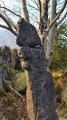

 Moderate
  Tourist office