Country:

 City:
City:


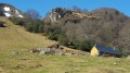
After Arthez-d’Asson, take the D126 towards Ferrières and Soulor. 100 metres past Claria Farm, leave the road and head up to the end of the track, a former training rock in a quarry: ten spaces available.
(S/E) Head back down towards the road for about a hundred metres. About fifty metres before the road, turn sharply right. Follow a path which soon climbs steeply through the ferns. Pass two hunting posts. After the ferns, a wooded area leads you to the Col d’Isou.
(1) Take a good track to the left (south-west). After about 2 km, you’ll reach the Col de Nabails.
(2) Carry on straight ahead (east) for about a hundred metres, until you reach a hut and a junction.
(3) Carry on straight ahead and, after about fifty metres, turn right. Climb up and, after a few hairpin bends, reach the Col de Pan.
(3) If you wish, turn left (north-east) and make a quick ascent of the Pic du Pas de Broc.
(5) Descend via the same route back to the Col de Pan.
(4) Continue south (to the left when returning from the Pic du Pas de Broc, to the left if you have not attempted this ascent).
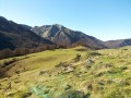
(6) At the Fork in the road that appears immediately, take the path on the right. Follow the ridge up to the summit of the Pic du Merdanson.
(7) Continue south-west for about a hundred metres until you reach a Fork in the road. Then turn left (south-south-east) and descend steeply. Turn left again (east) and continue the descent.
(8) Turn left again (north) and go round the Merdasson on the right. Then head north-east, continuing to descend.
(6) Veer slightly to the right to reach the Col de Pan straight away.
(4) Turn left, then immediately right, and, following the outward route in the opposite direction, return to the hut situated near the Col de Nabails.
(3) Turn right (north-east) and follow the long descent through the wooded Turounet valley.
(9) At a fork in the road, veer left (north-north-east). Continue downhill to a T-junction.
(10) Turn right (east) and follow a path downhill.
(12) You’ll come out onto the D126; follow it carefully to the left. Pass through the hamlets of Tort and then Milla, ignoring the turn-off to the left for the hamlet of Boué. At the start of a right-hand bend, turn sharply left to quickly reach the car park (S/E).
 Visorando Member
 Moderate
 Very difficult
 Tourist office
 Easy
Easy