Montné Ridges and Col du Prat d’Aürelh circular loop via Le Pladi

A beautiful, physically demanding day’s hike with several exposed sections along the ridges, taking you to the heights of the Saint-Pé-de-Bigorre massif, first to the east and then north-east, above the Génie Longue torrent.
Final stop at the Refuge du Col du Prat d’Aürelh (du Rey) and its summer pastures.
Magnificent scenery! Solitude guaranteed!

Details

196270
Creation:
Last update:
Last review:
  • Walking
    Activity: Walking
  • ↔
    Distance: 9.32 mi
  • ◔
    Average duration: 7h 30 
  • ▲
    Difficulty: Difficult

  • ⚐
    Back to start: Yes
  • ↗
    Ascent: + 3,688 ft
  • ↘
    Descent: - 3,684 ft

  • ▲
    Highest point: 4,521 ft
  • ▼
    Lowest point: 1,401 ft

Photos

Description of the walk

The route starts shortly after Ferme Cacha, at a bend in the road. Park your car in the small car park with two spaces.

(S/E) Turn right off the road (in the direction you came from) onto the yellow-marked path towards Le Pladi. N.B. The start is signposted as “Route No. 4” or “Karst Discovery Trail” by the Saint-Pé-de-Bigorre Tourist Office, and is marked in green. Follow the bends.

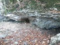
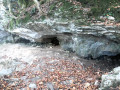
At the 570-metre mark, about 800 metres after the start, you’ll pass the entrance to the Grotte de la Bouhadère on your right (which blows cool air in summer). When a path joins from the right, continue south-east and cross a gully. The path briefly joins a small road: follow this road to the right towards the Ferme de Soulas.

(1) At the 650-metre mark, leave the road, turn right and head into the forest.

(2) At the fork in the road, take the path on the right. The climb becomes steeper, with hairpin bends, up to the Pré de Sauguet.

(3) Head south then south-east and follow the magnificent Picoulets ridge, overlooking the steep-sided Génie Longue valley. Climb gently up to the Col de Haü.

(4) The final part of the ascent to Pladi takes you through a magnificent beech forest in a ‘coume’ (a ravine). Through a gap in a rocky ridge, you finally emerge onto the Pladi mountain pasture at an altitude of 1,221 metres.

(5) Look out for the spring and the ruined hut.
Leave the Pladi clearing by climbing the northern slope opposite the hut; this section is unmarked and off the beaten track. Enter the woodland and, without reaching the rocky ridge, go round it to the left.
You’ll soon find yourself on the south-eastern slope, still in the forest, and should head for the ridge on your right as soon as possible.

(6) Follow this ridge to the left (south-west) to the Soum d’Aserole beneath a pylon (1,364 m), then on to the Soum du Montné (1,389 m).
Take care of the sheer cliffs to the north-west, as they are vertiginous… Any fall would be fatal!

(7) Continue southwards, still following the ridge, to the unnamed Soum (1,310 m) above the Prat d’Aürelh hut (or Rey on some maps), also situated beneath a pylon.

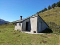
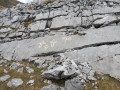
(8) Then descend south-eastwards, across an old sharp limestone pavement in open terrain towards the pass, keeping the Prat d’Aürelh hut in your sights. Reach the hut at an altitude of 1,215 m.

(9) Descend to the Col du Prat d’Aürelh (1,185 m; the Fontaine d’Escorcens is nearby). Retrace your steps back to the hut.

(9) Then take a yellow-marked path heading north-east, climbing gently through the mountain pastures towards a wood above Aserole, the beech forest of Bois de la Sirote. Cross the wood, staying on the path, to reach the Pladi.
Please note that some sections are quite rocky!

(5) On the way down, follow the same yellow-marked path as on the way up.

Waypoints

  1. S/E : mi 0 - alt. 1,401 ft - Small car park on the left-hand side of the road
  2. 1 : mi 0.97 - alt. 2,110 ft - Elevation 650 – leave the road, take the path on the right
  3. 2 : mi 1.25 - alt. 2,329 ft - Fork in the road at elevation 719
  4. 3 : mi 1.68 - alt. 2,831 ft - Sauguet Meadow
  5. 4 : mi 2.61 - alt. 3,415 ft - Col de Hau
  6. 5 : mi 3.15 - alt. 3,953 ft - Le Pladi
  7. 6 : mi 3.43 - alt. 4,219 ft - Aserole Ridge
  8. 7 : mi 3.98 - alt. 4,455 ft - Soum du Montné (1389m)
  9. 8 : mi 4.47 - alt. 4,268 ft - Unnamed peak (1,310 m)
  10. 9 : mi 4.67 - alt. 3,976 ft - Cabane du Cot du Prat du Rey (1215m)
  11. S/E : mi 9.32 - alt. 1,404 ft - Small car park on the left-hand side of the road

Notes

Estimated time
I completed this route in 5 hours, including breaks and a picnic. However, this was a very tight schedule involving sections of trail running. Experienced walkers should allow around 7 hours.

Shelters
There is only one proper shelter on the route in the event of heavy rain or thunderstorms: the Prat du Rey refuge-hut (9). There are also a few small shelters under rocks on the descent from La Génie Longue.

Equipment
Bring the usual equipment for mid-mountain hiking (hiking boots, suitable clothing, rainwear, water, food, survival blanket, knife, compass, map, whistle, etc.).

Flora and fauna
The vegetation in this mountain range reflects the extent of soil dryness caused by the terrain and the highly permeable nature of the substrates
, but this is offset by very high rainfall and cloud cover: boxwood, beech, lime and hazel are ubiquitous… (source: Saint-Pé Tourist Office).

Worth a visit

Things to see during the hike:
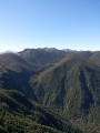
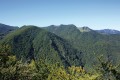
- The magnificent landscapes of the mountain range! Also note the striking contrast between the sheer drops and dark ravines on the northern side and the long summer pasture plateaus stretching from Batsurgère in the east to the headwaters of the Aguée, the Col d’Espades, and on to the border of Béarn at the Yerse stream.
- From the unnamed pass (8), an exceptional view over the Génie Longue valley and the Serrat Pourcou, which ends with the Cap des Litas due west.
- From the hut (9), a beautiful view of the summer pasture, the pass and the Soum du Prat du Rey (1,525 m) opposite, which overlooks the whole area and separates us from the Argelès-Gazost valley to the south.
- The unique flora and fauna,
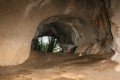
- the numerous cave entrances (more than a dozen along the path during the hike); 1,600 throughout the massif! You can also venture as far as the entrances to the magnificent Gouffre du Hayau, the Grotte de la Pale, and so on (as you climb towards the Picoulets).
- the ‘trail through karst terrain’ recommended by the Saint-Pé-de-Bigorre Tourist Office (specific document).
- Man’s handiwork: our ancestors, with the pastures cleared from scrubland (artigues), the low stone walls, the often-ruined huts, the unblocked springs and fountains, … Our contemporaries, with the high-voltage power lines, the mountain refuge, the pastoral facilities, …
- Le Pladi is a very ancient grazing ground for the shepherds of Rieulhès. But now, only the spring and the rustling of the tall grass mark the passing of time in this large, peaceful and sun-drenched meadow.

Nearby attractions
- The town of Lourdes and the Marian Sanctuary;
- The Batsurguère Valley;
- The village of Saint-Pé-de-Bigorre, the village itself, its cultural heritage, its events, the Très Crouts Forest and the Pibeste-Aoulhet Regional Nature Reserve, water sports;
- The story behind the reserve’s new signposting in autumn 2014;
- The Gaves Valley,
- An alternative route allows you to complete a circular loop: descending from the Fontaine d’Escorens to the Picharrot waterfalls (Picharrot = waterfall in the Bigourdan dialect). Please note: this is not a footpath but a ravine descent, requiring abseiling equipment, over steep slopes and small to medium-sized waterfalls. Do not attempt this descent without the proper equipment! At Picharrot, then take the path along the Génie Longue

Recommended reading to immerse yourself in the majesty and solitude of the Saint-Pé massif:
- *Le Sanglier du Picharrot* by Abbé Bernard Abadie, *A Solitary Figure in the Mountains of Saint-Pé* (1969), published by Editions Marrimpouey Jeune

Reviews and comments

3.9 / 5
Based on 3 reviews

Reliability of the description
4 / 5
Ease of following the route
3.7 / 5
Route interest
4 / 5
Clémentine 40
Clémentine 40

Overall rating : 3.7 / 5

Date of your route : Jun 10, 2024
Reliability of the description : ★★★★☆ Good
Ease of following the route : ★★★☆☆ Average
Route interest : ★★★★☆ Good
Very busy route : No

Rugged terrain requiring care and vigilance. The path is more or less visible; a difficult descent down a steep slope. The final section of the path is heavily overgrown with vegetation that can scratch arms and legs. A long 10-hour hike.

Machine-translated

MCTOUL
MCTOUL

Thanks, ours65!
It’s true that parking is limited. The Soulas car park is bigger, but it means you miss out on an interesting part of the walk; more importantly, it’s very busy with cavers, hunters and walkers on the karst trail. There isn’t always space for more than two cars!
Happy hiking to you all!
Kind regards

Machine-translated

ours65
ours65

A lovely walk, taken in late winter along the lower path, as there was still snow on the ridges. A beautiful view of the plain and the mountain range from the summit of Montné.
However, the suggested starting point on the road to the Cacha farm, at the bend leading towards Courrouau, has limited parking for just two cars, as indicated. To access a larger car park when travelling with several vehicles, it is best to go via Rieulhès, heading towards the Forest of Lourdes; on leaving Rieulhès, at the crossroads with a cross, continue straight on; then, at the old mill, turn right, cross the Rieulhès stream, and continue for about 3 km towards Soulas Farm along a narrow but tarmac road. Just before the Soulas farm, on a left-hand bend, there are several places where you can park without any problems (Altitude 600 m – Coordinates 30T 0732831 – 4774275).

Machine-translated

MCTOUL
MCTOUL

Thanks, Sylvain S3!

Machine-translated

Sylvain S3.
Sylvain S3.

Overall rating : 4 / 5

Date of your route : Aug 07, 2017
Reliability of the description : ★★★★☆ Good
Ease of following the route : ★★★★☆ Good
Route interest : ★★★★☆ Good

I did this walk a month ago. And the route is described accurately in this guidebook.
There’s a spring that flows all year round at Le Pladi, next to the cow feeding trough.
Thank you

Machine-translated

PaulManzano
PaulManzano

Overall rating : 4 / 5

Date of your route : May 06, 2016
Reliability of the description : ★★★★☆ Good
Ease of following the route : ★★★★☆ Good
Route interest : ★★★★☆ Good

In fact, we simply followed the standard hike route: two cars, one at the finish point, the Vert Couret farm, and the other at the starting point, Le Bergons. From the Col du Prat du Rey, we followed the directions given for the standard route.
So we set off from the Bergons car park (1,039 m), via the Escala du Prat du Rey, the Col du Prat du Rey, Le Pladi, the Col de Hau, the Picoulets ridge, and Vert Couret farm (617 m). It is essentially a walkers’ route, without the difficulties of the ridges above the Prat du Rey, but very interesting.

Machine-translated

Other walks in the area

For more walks, use our search engine .

The GPS track and description are the property of this route's author. Please do not copy them without permission.