Country:

 City:
City:


From Saint-Pé-de-Bigorre, cross the Gave de Pau at the bridge in the Le Bout-du-Pont neighbourhood. Follow the signs for “Monastère de Bethléem” until you reach a small road on the right signposted “Sep”. Take this track for a few hundred metres until you reach a pumping station. Park in the adjacent car park.
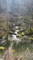
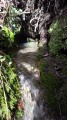
(S/E) At the corner by the pumping station’s fence, take a path that winds its way down into the forest. As soon as possible, leave this path and take a small track on the left that descends even further into the stream bed. Follow this old path (sometimes there are several tracks on the same bank or on different banks) as close as possible to the Génie Braque. The route is very rugged. There are no signposts, apart from a few marks made with adhesive tape or red and white warning tape.
NB: the path shown on the paper IGN map is not quite the same as the one shown on the digital IGN map. It is best to rely on the terrain, using your sense of direction.
As you make your way upstream, you’ll need to cross from one bank of the Génie to the other, either via footbridges (in varying states of repair), through fords, or by skilfully navigating the exposed rocks. You will first pass by the Génie drinking water intake (“prise d’eau” on the paper IGN map). Near this path, you will need to wade straight across the river, as a fenced-off area blocks the route of the old path.
You will then pass all the tributaries of the Génie as they flow into it. Around the 750m mark, the path at the bottom of the torrent is no longer passable, but a track opens up on the right-hand side, allowing you to reach the main Sep-Bat de Haü via Les Gatés path, marked in yellow.
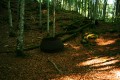
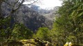
(1) Follow the path to the left; the going becomes much easier in this section. Gradually, the dense, damp woodland of boxwood, hazel and chestnut trees gives way to a magnificent beech forest. Then head up the Génie Braque, keeping to the left bank (beautiful views of the ravine and the right bank).
(2) Optional section: at the bottom of a small coume (torrent bed), take a round trip to the Chourrepich waterfall, or ‘Petit Picharrot’.
(3) Retrace your steps.
(2) Head south (to the right if returning from the waterfall, straight on if you have skipped this detour) along the yellow-marked path. Follow it almost to the 975m mark.
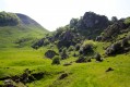
(4) The yellow-marked path clearly follows the right bank of the Génie via a ford (and not the left bank, as erroneously indicated by a purple line on the IGN map). Shortly afterwards, you’ll emerge at the foot of the mountain pastures, which are very steep. This marks the start of the Cirque de Bat dé Haü, to the north of the location marked on the map as ‘Clots des Cuts d’Ausets’ (this is another IGN error, as the Clots de Cuts d’Aüsets are situated on the other side of the ridge, i.e. to the south of the purple line and therefore of the Soum de la Génie Braque).
(5) Through the tall grass (in summer), following the yellow markings, or ‘in the middle of nowhere’ if snow covers everything in winter, following the tops of the wooden posts, you’ll reach the Bat dé Haü spring in a quarter of an hour.
NB: the digital IGN map shows “Cabane de Bat de Hau”, but in reality this is in ruins, almost completely scattered; “Ruins” as indicated on the paper map. The highlight of this spot remains the spring, which is clearly visible and well signposted.
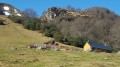
Continue towards l’Aülhet. The junction between the two former summer pastures is reached via the Platè de l’Abétou, beneath the Bois du Trounca, along the Mesplè path, with virtually no climb for about an hour. The path winds through wild and very remote landscapes, at the foot of the Garrocq d’Eth Abétou rock formation (1,208 m), then skirts the flank of the Soum des Brioles (or Soum de Mesplè – 1,272 m), a modest peak on which a few isolated conifers grow. Reach the new Aülhet (or Aoulhet) mountain hut, a wooden cabin nestled in the Aülhet summer pasture.
(6) Then follow the shepherds’ path, a very old mule track, also known as the “Coumo-Redo path”. Leave the hut and head west-north-west towards the edge of the forest, following faint yellow markings whilst keeping to the most well-trodden part of the path. At the edge of the forest, the path is marked by the signpost for the regional nature reserve. From there, the yellow markings are once again clearly visible all the way down into the valley.
Pass the hamlet known as l’Amphithéâtre – another magnificent beech forest on a circular hillside – then descend a slope called l’Escala and pass the Pla dé Bers crossroads, a former favourite spot of woodcutters and charcoal burners. Follow the ridge overlooking the Coumo Rédo (ravine) to the left until you are almost at the former Peyras farm, now the Monastery of Bethlehem.
(7) As the path reaches a junction with a sunken track completely overgrown with boxwood, you’ll find, at the Fork in the road, on a post to the left, various signposts marked ‘Aoulhet’ and another reading ‘Soum de la Génie Braque’. Take the path that branches off to the left towards the Castets cave. It crosses the Rédo via a ford (the pretty footbridge having been destroyed in 2024)... A small waterfall and the surrounding scenery make this a truly charming spot... Further on, the path passes through a strange area, dotted with ruins and odd remains of buildings. This is a former ‘youth camp’ dating from the Second World War. There are various wooden scout huts here. Further down, the path crosses the Génie Braque via another footbridge which cannot be avoided. But be careful – it is particularly slippery!
The route ends with a short climb – which you descended on the way out – until you reach the Sep pumping station, the start and finish point (S/F).

 Visorando Member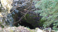

 Moderate
  Tourist office