The Aoulhet mountain pastures

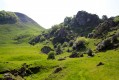
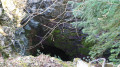
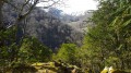
Discover a section of the Pyrenean foothills that has remained largely unspoilt: no forest tracks penetrate these vast wooded expanses. Explore unspoilt wilderness along an old path leading up to the mountain pastures and a former charcoal burners’ trail. Discover the vast beech forests of Tres Crouts and the Aoulhet mountain pastures, undoubtedly the most picturesque and wildest spots in the Pibeste-Aoulhet Regional Nature Reserve.

Details

1080839
Creation:
Last update:
Last review:
  • Walking
    Activity: Walking
  • ↔
    Distance: 6.71 mi
  • ◔
    Average duration: 5h 35 
  • ▲
    Difficulty: Difficult

  • ⚐
    Back to start: Yes
  • ↗
    Ascent: + 2,881 ft
  • ↘
    Descent: - 2,881 ft

  • ▲
    Highest point: 3,970 ft
  • ▼
    Lowest point: 1,273 ft

Photos

Description of the walk

From Saint-Pé-de-Bigorre, cross the Bout-du-Pont neighbourhood and head towards the hamlet known as ‘Peyras’ or the ‘Monastery of Bethlehem’. Park in the monastery car park.

(S/E) The path starts to the right of the Monastère de Bethléem and winds its way through the boxwood trees (yellow markings). Head up to the left 200 metres after the car park.

(1) A fairly direct path climbs through the forest to Pla de Bers.

(2) After an hour and a half’s walk, you’ll come across a beautiful semi-circular beech forest known as the ‘amphitheatre’. Above this, go round a large rock on the right. The path levels out and leads to the mountain pasture.

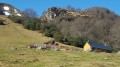
(3) As you emerge from the woods, head south-west to the right to reach the Cabane de l’Aoulhet.

(4) Behind the Cabane de l’Aoulhet, take a small path that leads into the forest amongst the holly bushes. Follow the almost flat path.

(5) Go round the Soum des Brioles on the right and reach the edge of the beech forest.

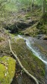
(6) At the edge of the beech forest, carefully cross a small stream – the banks may be slippery – and continue westwards.

(7) Follow the path, which descends gently and winds through the pastures of Bat de Hau to the spring of the same name.

(8) From the spring, head down through the meadow and back into the beech wood. After a few hairpin bends on the steep slope of a valley, the path crosses the spring-fed stream. Continue with the stream on your right.

(9) Follow the forest track, which offers lovely views of the valley here and there.

(10) You will reach the Sep water tower; take the tarmac road to return to the car park at the Monastery of Bethlehem (S/E)

Waypoints

  1. S/E : mi 0 - alt. 1,329 ft - Car park at the monastery in Peyras
  2. 1 : mi 0.16 - alt. 1,407 ft - The Aoulhet Trail
  3. 2 : mi 1.15 - alt. 2,864 ft - Pla de Bers beech forest
  4. 3 : mi 1.78 - alt. 3,655 ft - Exit from the woods
  5. 4 : mi 1.94 - alt. 3,825 ft - Cabane de l'Aoulhet
  6. 5 : mi 2.63 - alt. 3,970 ft - Circumnavigation of the Soum des Brioles
  7. 6 : mi 3.15 - alt. 3,743 ft - Stream
  8. 7 : mi 3.48 - alt. 3,593 ft - Bat de Hau pastures
  9. 8 : mi 3.7 - alt. 3,527 ft - Source de Bat de Hau
  10. 9 : mi 4.35 - alt. 2,657 ft - Forest track
  11. 10 : mi 5.97 - alt. 1,617 ft - Sep Water Tower - Station de pompage de Sep (437m)
  12. S/E : mi 6.71 - alt. 1,329 ft - Car park at the monastery in Peyras

Notes

Aoulhet Hut
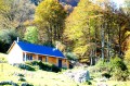
Restored in 2017, the Aoulhet hut is open to the public all year round and free to access. Situated at an altitude of 1,165 metres, the hut features a spacious ground-floor room with a wood-burning stove and a mezzanine sleeping six. Part of the hut is reserved for pastoral activities (west side). The local council relies on everyone’s sense of civic responsibility to ensure this place is kept clean and pleasant.

Water points
Drinking water point at the Aoulhet hut.

Precautions
Hiking is not recommended in winter (damp conditions, etc.).
The Saint-Pé-de-Bigorre massif is a limestone range featuring deep chasms: do not stray from the paths!

Hiking guide
- Hiking guide no. 3 “Les estives de l’Aoulhet” available free of charge from the Saint-Pé-de-Bigorre Tourist Office or for download at www.saintpedebigorre-tourisme.com
- Guidebook to the Pibeste-Aoulhet Regional Nature Reserve on sale at the Saint-Pé-de-Bigorre Tourist Office: “De bois en estives” (100 pages, €9). Following in the footsteps of the curious walker, you’ll discover a few secret spots, some steeped in history, and a remarkable natural heritage. As you wander along each trail, a thousand and one points of interest will reveal themselves to you.

Alternative routes
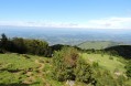
Behind the Aoulhet hut, climbing up across the grassy slope, you can head towards the Col de Larbastan (add 45 minutes from the hut). The view from there is superb!
For the more determined, you can even go as far as the Soum de la Génie Braque.

Worth a visit

Highlights along the route:
- magnificent views of the Pyrenean foothills
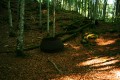
- extensive beech forests
- a shepherds’ hut

_Pibeste-Aoulhet Regional Nature Reserve__
The Pibeste-Aoulhet Massif Regional Nature Reserve is the largest regional nature reserve in mainland France, covering 5,110 hectares. It is a true gem of biodiversity, a refuge for hundreds of plant and animal species, including some of the rarest and most endangered in France and Europe, such as the bearded vulture, the Egyptian vulture and Manescau’s erodium… The richness of the reserve’s flora, fauna and landscapes will delight observant walkers! Please note that the reserve is a protected area governed by regulations. It is forbidden to pick plants or disturb animals, to light fires, to camp, to leave rubbish or other waste, to bring dogs that are not kept on a lead, or to introduce or destroy plants.

Reviews and comments

4.1 / 5
Based on 4 reviews

Reliability of the description
4.3 / 5
Ease of following the route
4 / 5
Route interest
4 / 5
Clo
Clo

Overall rating : 4.7 / 5

Date of your route : Aug 14, 2026
Reliability of the description : ★★★★★ Very good
Ease of following the route : ★★★★☆ Good
Route interest : ★★★★★ Very good
Very busy route : Yes

A very pleasant route, ideal for very sunny weather and hot days. There are two places where you’ll need to look carefully for the path: just before Pla de Bers (don’t go as far as the cattle pen) and downstream from the ruins of the Bat de Hau hut (head towards the drinking trough to find the path).

Machine-translated

caroll65
caroll65

Hike completed in October 2021. I can confirm that the path is difficult to spot near the spring; you need to head down into the small valley below the spring. After that, it’s simply a case of following the path. Watch out for slippery patches. Only moderately interesting if you don’t enjoy forest walks.

Machine-translated

Houzounet
Houzounet

Overall rating : 3.7 / 5

Date of your route : Sep 18, 2020
Reliability of the description : ★★★☆☆ Average
Ease of following the route : ★★★★☆ Good
Route interest : ★★★★☆ Good
Very busy route : No

A lovely climb through the beech forest. Beautiful scenery when you reach the hut, but afterwards we couldn’t find the path leading back down from the spring and struggled for a while before finding it at the bottom of the valley. Then, at a junction with no signposting, we took the wrong turn and had to turn back. At the end, when you reach the road, you can head down to the right along a path, cross the stream and then head back up to a scooter campsite; turn left onto a path which joins the original route a little further on, thus avoiding having to return via the road. The route is a bit too wooded (monotonous). Best done in good weather as it gets very damp.

Machine-translated

OT Saint-Pé
OT Saint-Pé

On the map or hike guide, it’s clear that the majority of the signposted route runs through woodland. As the forest is classified as a nature reserve, it is very well-preserved and unspoilt, so the paths are by no means ‘wide, easy-going trails’. I’ve marked out the ridges and peaks above the hut to help you explore the mountain pastures more fully and enjoy the beautiful panoramic views. As this alternative route is rather long and challenging, I’d recommend returning via the same route you took on the way there. I’m sorry to hear that this walk disappointed you. I look forward to welcoming you back to the tourist office.
Pauline, Saint-Pé-de-Bigorre Tourist Office.

Machine-translated

fredpau
fredpau

Overall rating : 3 / 5

Date of your route : Aug 22, 2018
Reliability of the description : ★★★★☆ Good
Ease of following the route : ★★★☆☆ Average
Route interest : ★★☆☆☆ Disappointing

We set out on this hike thinking we’d spend a bit of time in the mountain pastures, as mentioned in the guidebook. The mountain pastures are only reached once you climb above the hut and make up a very short section of the hike.
The route is long and often takes you through dense, rugged woodland.
To top it all off, the tourist office that published the guide advises against doing the circular route shown on the guide and recommends instead climbing up to the peaks above the hut and returning via the same route. Really disappointing...

Machine-translated

MCTOUL
MCTOUL

Overall rating : 5 / 5

Date of your route : Mar 12, 2018
Reliability of the description : ★★★★★ Very good
Ease of following the route : ★★★★★ Very good
Route interest : ★★★★★ Very good

A lovely route through the Saint-Pé massif, the Très-Croutz forest and the traditional summer pastures.
Thanks to the ‘visorandonneuse’ app, which allows us to enjoy this route in complete peace and quiet...

Machine-translated

Other walks in the area

For more walks, use our search engine .

The GPS track and description are the property of this route's author. Please do not copy them without permission.