Tour of Caster Bern in the Lourdes Forest

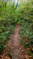
On the outskirts of Lourdes, the Bois de Subercarrère stretches out over four hundred hectares of shade and coolness. The Castet Bern trail winds its way peacefully through the deciduous trees and undergrowth: 3.9 km, 54 m elevation gain – perfect for a leisurely family walk.
The town fades from view. You walk to the sound of birdsong, on the lookout for a roe deer, a great spotted woodpecker or a red squirrel. Fun information boards and a game booklet spark the curiosity of the youngest visitors and turn the walk into a land of discovery. But the woodland also holds its secrets: a name meaning ‘above the road’, legends that storytellers still bring to life, centuries of forestry history and, nearby, the route taken by pilgrims on the Way of St James. A breath of fresh air in the countryside, a real forest bath, within everyone’s reach.

Details

n°109078361
Creation:
Last update:
Last review:
–
  • Walking
    Activity: Walking
  • ↔
    Distance: 3.03 mi
  • ◔
    Average duration: 1h 35 
  • ▲
    Difficulty: Easy

  • ⚐
    Back to start: Yes
  • ↗
    Ascent: + 180 ft
  • ↘
    Descent: - 174 ft

  • ▲
    Highest point: 1,506 ft
  • ▼
    Lowest point: 1,306 ft

Photos

Description of the walk

The starting point is the car park at a place called La Pépinière, which has plenty of parking spaces, a children’s playground, a fitness trail, picnic tables, etc.

Park your car near the signpost for the Bois de Lourdes walks, close to the Fontaine de la Pépinière.

(S/E) Head west, away from Lourdes. The route immediately follows a narrow path through the forest, running parallel to a small tarmac road known as the ‘pram path’. These two routes intersect several times. The route is marked in yellow. After 1 km, the two paths join a wider tarmac track at the junction marked by the ‘Sentier du Caster Bern’ signpost, which includes a map.

(1) Take the track to the right for 300 metres until you reach a Fork in the road at the leaning tree marked “130”.

(2) Follow the wide path which branches off to the left from the track; it remains clearly signposted. This path then circles round the Caster Bern to the north; you cannot go wrong, even though several tracks are visible to the left or right of the path. 500 metres after the previous fork, you reach the junction with the pond and the quiz post on the right-hand side of the path.

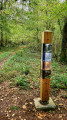
The sign provides clues about a piece of flora or fauna, then asks the question “Who am I?”, in reference to the nearby pond (NB: in September 2026, following a scorching summer, the pond was completely dry). Neither the IGN map nor OpenStreetRando show this junction!

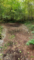
(3) Keep straight on along the main path marked in yellow. Pass well-marked paths on your left (a shortcut) and right. The path climbs very steeply, with deeply rutted tracks on both the right and left in the loose earth. You’ll reach another junction on a new path: the Table de Pierre crossroads.

At the bend, a large granite boulder – an erratic rock, more or less flat – has been cleared of moss and the surrounding area cleared of undergrowth. It’s a great spot for a short break for the tired little legs of the youngest or the oldest walkers!

(4) The route takes a sharp left-hand hairpin bend and heads off again towards the south-east. You go round a first fallen tree, which has been cleared to allow passage, then a second, for which steps have been cut out of logs.

You’ll soon find yourself overlooking the road from Saint-Pé-de-Bigorre to Lourdes – also known as the Way of St James – which gives this forest its name, ‘Subercarrère’ (see the ‘Practical Information’ section).

800 metres from the last junction, you’ll reach this road at the junction at elevation 426. A remarkable large oak tree stands nearby.

(5) Follow the road with caution for 300 m. Please note: even though there is very little traffic, you must walk in single file on the left-hand side of the road, facing the oncoming traffic.

NB: From here, we take a variation on the ‘official’ route to complete a proper circular route; this section is therefore unmarked.

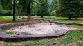
Reach the western end of the area containing the (former) ponds and the bandstand. Enter this area from the right-hand side of the road to ensure your safety.

(6) Leave the area near the bandstand, crossing the road to take a path heading first due north, then due east, towards the Pépinière area. Follow a very good path alongside the road through the very dense woodland at this point. Cross the Pépinière area to return to the starting car park (S/E).

Waypoints

  1. S/E : mi 0 - alt. 1,339 ft - Aire de la Pépinière – Lourdes Forest - Gave de Pau
  2. 1 : mi 0.75 - alt. 1,342 ft - Junction with the ‘Sentier de Caster Bern’ signpost and map
  3. 2 : mi 0.94 - alt. 1,325 ft - Fork in the road at the leaning tree – Turn left
  4. 3 : mi 1.29 - alt. 1,339 ft - The fork at the pond and the information post
  5. 4 : mi 1.53 - alt. 1,470 ft - Table de Pierre crossroads
  6. 5 : mi 2.11 - alt. 1,391 ft - Crossroads at elevation 426
  7. 6 : mi 2.38 - alt. 1,342 ft - Aire des Bassins
  8. S/E : mi 3.03 - alt. 1,339 ft - Aire de la Pépinière – Lourdes Forest - Gave de Pau

Notes

This description relates to a summer hike undertaken with the family in late September 2026.

Parking at the start
The official car park has space for around fifty vehicles.

Condition of the trails
In September 2026, all the trails were in excellent condition.

Estimated time
We completed this route in just under 2 hours, including numerous breaks, particularly to take photos.

Difficulty
Hike classified as ‘Easy’, Visorando rating.
The IBP index is 14 HKG (hike), which corresponds to a ‘Very Easy’ route for a hiker of average fitness.

Alternatives
- Several options to extend or shorten the route, via cross-country paths or routes back to the car park (see map),
- Climb to the summit of Caster Bern; not tried...
- Take a detour along the banks of the Gave from the car park.

Water sources
There are no drinking water points along the route. The water at the Fontaine de la Pépinière is marked ‘Not for drinking’. Allow at least 0.5 litres per person.

Shelter
There is no other proper shelter on the route apart from the kiosk at the Aire des Bassins (6).

Picnic area
There are two along the route, at the Pépinière and the ponds areas (S/E) and (6).

Equipment
In summer, bring the usual kit for a lowland hike: light hiking boots or trainers, suitable clothing, possibly rainwear, sunglasses, a hat, sun cream, UV-protective lip balm, etc.

Visitor numbers
The route is not very busy even in the height of summer. Whatever the season, don’t forget to let your friends and family know your exact route and inform them of any changes by text or phone.

Check the weather forecast.


maps
If, whilst on your route or whilst using the map, you notice any errors in signposting or place names, you can become a contributor and report them:
- signage errors, safety issues, conflicts of use, environmental concerns: click here.
- mapping errors, place names: click here.

Worth a visit

Things to see along the route:

The shaded route winds its way through deciduous trees and undergrowth, in a cool and soothing atmosphere, ideal for observing local wildlife.

Between (S/E) and (2), you can see, amongst other things, a fine oak, a young beech grove, a copse of red oaks and numerous erratic boulders.

Between (2) and (5), star-shaped signs on the trees, numbered from 1 to 4, refer to the Lourdes Tourist Office Guide. Even without the guide, if you’re with children, you can still get them to look for these numbered stars!

As you walk along the path, the sound of birdsong accompanies you and makes you want to slow down.

Playful signs and displays dot the route to spark the curiosity of the youngest visitors. A activity booklet, available from the Tourist Office, even turns the outing into an educational adventure.

Places to visit nearby:

- The town of Lourdes, the Marian Shrine;
- The Batsurguère Valley;
- The village of Saint-Pé-de-Bigorre, with its cultural heritage, events, the Très Crouts Forest and the Pibeste-Aoulhet Regional Nature Reserve, as well as water sports;
- The Gaves Valley.

Other walks in the area

For more walks, use our search engine .

The GPS track and description are the property of this route's author. Please do not copy them without permission.