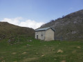
From the Croix de Buzy to Bescat

A circular walk offering magnificent views of the Pyrenees and, with a bit of luck, the Pic du Midi d’Ossau too!

Details

n°2288839
Creation:
Last update:
Last review:
  • Mountain biking
    Activity: Mountain biking
  • ↔
    Distance: 5.60 mi
  • ◔
    Duration according to the author: 1 hr 
  • ▲
    Difficulty: Easy

  • ⚐
    Back to start: Yes
  • ↗
    Ascent: + 558 ft
  • ↘
    Descent: - 541 ft

  • ▲
    Highest point: 1,722 ft
  • ▼
    Lowest point: 1,266 ft
  • ⚐ Country: France
  • ⚐
    Area: Pyrenees
  • ⚐ City: Buzy (64260)
  • ⚑
    Start/End: N 43.159687° / W 0.425954°
  • ❏
    IGN map(s): Ref. 1546ET

  • ◶
    Type of surface: Not specified
  • ⇧
    Bike carrying: Not specified
  • ▲
    Difficulty: Not specified
  • Hour-by-hour weather

Description of the route

Park in the car park with around ten spaces at La Croix de Buzy.

Cycle signpost no. 1 (circular Green loop), which is very easy to follow.

(S/E) Start the walk by following the wide gravel path, heading due south.
The first part of the circular route is fairly flat with a slight climb.

(1) Turn left at the first junction and continue south.

(2) The path veers off the road and heads into the woodland on the right.
If you’re not confident on a bike, or if you’re with children, I’d advise you to stay on the road. The path simply bypasses a short stretch of road.
Follow this dirt track, which has a steep climb dotted with branches and roots.

After this section, a steep descent along the road will take you to the village of Bescat.
Turn right at the crossroads and head straight up the hill.
If you need a drink, there are public toilets available just past the church.

(3) At the church, face forwards and head straight up to the top.
If you’ve decided to go via the cemetery, turn left, follow the road which runs to the right of the cemetery and join the main road.

At this junction, head back down to the bottom of the valley. Cross the Ruisseau d’Escou stream, then follow the path which climbs for about 1.5 km.

(1) Once you’ve finished the climb, rejoin the path you took on the way up and turn left to return to the car park (S/E).

Waypoints

  1. S/E : mi 0 - alt. 1,490 ft - Car park at La Croix de Buzy
  2. 1 : mi 0.64 - alt. 1,512 ft - Junction of the circular loop
  3. 2 : mi 2.05 - alt. 1,624 ft - Section through the forest
  4. 3 : mi 3.09 - alt. 1,565 ft - Bescat. Water supply
  5. S/E : mi 5.6 - alt. 1,490 ft - Car park at La Croix de Buzy

Notes

Hike discovered thanks to TopoPyrénées.

Reviews and comments

5 / 5
Based on 1 review

Reliability of the description
5 / 5
Ease of following the route
5 / 5
Route interest
5 / 5
petitpalois64
petitpalois64

Overall rating : 5 / 5

Date of your route : Feb 19, 2024
Reliability of the description : ★★★★★ Very good
Ease of following the route : ★★★★★ Very good
Route interest : ★★★★★ Very good
Very busy route : Yes

A lovely walk, especially when the sun’s out.
An accessible hiking trail, easy to walk on, although there may be a few spots ‘damaged’ by tractors – but they’re just doing their job and we’re out for a stroll, so let’s be cool about it.
A magnificent view of the Pyrenees, particularly of ‘Jean-Pierre’ (Pic Ossau).
Halfway along the route, there are a few picnic tables where you can stop for a break, or you can carry on to the village of Bescat to take a break there.
There are two possible circular routes, and the route can be done either clockwise or anti-clockwise.
The start and finish are at the same spot, which is very handy for collecting your car.
Note that at the start of the walk – though not so much at the finish – you’ll find “l’Etable de l’Ossau” where you can grab a bite to eat: http://www.letabledossau.com/
Enjoy the walk, everyone.

Machine-translated

For more walks, use our search engine .

The GPS track and description are the property of this route's author. Please do not copy them without permission.