The Abbé Karst Trail in Saint-Pé-de-Bigorre

In the footsteps of water and early humans, close to the underground world

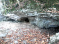
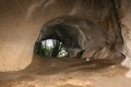
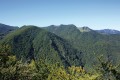
Beneath the forest of Très-Crouts lies a secret world: over 1,850 caves have already been recorded in this limestone massif, known as “karst”, a Slavic term describing these fissured and rugged landscapes, carved out by water over millennia. Caves, chasms, underground passages… and no doubt more treasures yet to be discovered.

This circular walk invites you on a journey of discovery into the bowels of the Earth, first explored by Abbé Abadie in the early 20th century. In the shade of the tall trees of a remarkable forest, you’ll walk in the footsteps of the very first humans, those from the distant times of the last ice ages, and in those of the cave bears and hyenas, some of whose remains await you as you wind your way along the path.

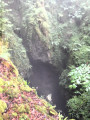
The route, made easier by steps and handrails, remains accessible to all. A thrill awaits you at the Gouffre du Hayaü, where the footbridge overlooks the abyss.

Details

n°108166673
Creation:
Last update:
Last review:
–
  • Walking
    Activity: Walking
  • ↔
    Distance: 1.06 mi
  • ◔
    Average duration: 0h 50 
  • ▲
    Difficulty: Moderate

  • ⚐
    Back to start: Yes
  • ↗
    Ascent: + 354 ft
  • ↘
    Descent: - 328 ft

  • ▲
    Highest point: 2,162 ft
  • ▼
    Lowest point: 1,870 ft

Photos

Description of the walk

From the Route de Lourdes (the D937), cross the bridge over the Gave de Pau, then pass through the Rieulhès neighbourhood, and follow the signs for “Karst Trail” or “Ferme Soulas”. Shortly after the Couret Farm (“Le Poney Fringant”), there are three small car parks, each with space for four vehicles.

(S/E) Take the wide dirt track leading into the Très-Crouts Forest. Pass a large cut-stone marker painted with the numbers ‘109’ in red on a white background. At the signpost (and a specific marker), head up to the left of the path to find the vertical entrance to the Gouffre de la Borne 109. This chasm is identifiable by a steel bar spanning its entrance and a wooden barrier providing basic protection against access. Do take care in the vicinity, however !

Continue along the path, passing marker 110 on your left. You’ll reach a fork on the level stretch, marked by a three-way signpost. Continue straight ahead on the “Karst Trail” (ignore the path leading uphill to the left). You’ll reach a second fork.

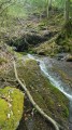
(1) Continue downhill to the right. This old pastoral path is very steep and has numerous limestone boulders on the ground, shaped by cattle’s hooves and eroded by runoff. At times, it feels as though you are walking along the bed of a stream. After a short Z-bend, you’ll reach the Gouffre de la Bouhadère, marked by an information sign. Depending on the season, a powerful draught from the blowhole [buhadera] may blow outwards or, conversely, inwards into the cave.

(2) Carry on straight ahead and you’ll soon reach the next notable feature of the sinkhole and its information board. Go round it and take the path on the left, which is always well signposted (leaving the path leading down to the right). Walk on like this for a few hundred metres, following the contour line, alongside a cliff of varying height on your left. You’ll reach the cave marked ‘Grotte de la Pâle, entrance 1’, with an information board. Do not attempt to enter this narrow opening!

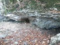
(3) Continue along the same path until you reach the Grotte de la Pâle, entrance 2. Here, you’ll find several information boards about the cave’s human and animal inhabitants; the two entrances are connected internally via a network of chambers and a narrow, fascinating passageway. Carry on straight along the path until you reach a large metal staircase (right in the middle of the forest!). Climb the stairs, which face south-east, and continue along the path. You’ll reach the next entrance, the Grotte des Araignées (or LP19).

An information board provides details on exploring other caves in the massif. You can safely enter this cave with just a head torch, crawling on all fours. There is no danger; it ends in a dead end. Continue straight on along the path; a fork leads uphill to the right, towards the Crèque Noèle and its information board. You can enter this cave standing up without any danger for about a third of its length.

(4) Head back down to the main path and continue to the right. You’ll come to several sections where steps or even handholds and climbing holds, made of reinforcing steel, are fixed into the rock to aid your progress. After several small ledges, you’ll reach the majestic and terrifying Gouffre du Hayaü.

An information board prepares the hiker for the discovery of the chasm and its impressive 30-metre-deep entrance shaft! We read previously (WP (2)) that this cave connects with the Grotte de la Bouhadère, with a total length of 1.3 km and a vertical drop of 162 m. When cavers enter this cave, they emerge at the Grotte de la Bouhadère after descending more than 100 m underground; this is known as a ‘traversée’.

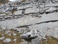
(5) Continue across the imposing sharp limestone pavement, following the path which is now barely visible. Descend about twenty metres over several easy ledges to reach a more comfortable, level path. But just to the left, a narrow, unmarked path leads upwards. After a few dozen metres, you will reach the last remarkable cave in the area, the Grotte des Coumates.

It should be noted that it is not part of the circular route featured on the ‘official’ Abbé Karst Trail, as access to it is somewhat complicated. Despite an uninviting and complex entrance, it is a karstic cave with a significant vertical drop of 90 metres and a length of 300 metres, accessible to cavers without a harness or rope.

After returning to the main path, continue straight on along the contour line. You will reach the Y-junction, Bodhéra 628, which you passed on the way out.

(1) Carry on straight ahead to reach the car park at the start (S/E).

Waypoints

  1. S/E : mi 0 - alt. 2,011 ft - Car park for the karst trail (Ferme Soulas)
  2. 1 : mi 0.18 - alt. 2,080 ft - Y-junction “Bohadera 628m”
  3. 2 : mi 0.34 - alt. 1,890 ft - Grotte de la Bouhadère
  4. 3 : mi 0.45 - alt. 1,909 ft - La Pâle Cave 1
  5. 4 : mi 0.61 - alt. 2,073 ft - Crèque Noèle
  6. 5 : mi 0.69 - alt. 2,129 ft - Hayaü Chasm
  7. S/E : mi 1.06 - alt. 2,011 ft - Car park for the karst trail (Ferme Soulas)

Notes

  • Access to the car park involves a narrow, winding road for 2 km; it is therefore strongly advised against for motorhomes, minibuses, etc.

The mountain ridge we are focusing on today (or ‘chaînon’ – a ‘sarrat’ or ‘serra’ in Gascon) is that of La Pale, topped by the Picoulets ridge (meaning ‘little peaks’).
Traversed for centuries by pastoralists and charcoal burners – known as ‘eths pastre’ (shepherds) and ‘eths ahumats’ (charcoal burners) – this ridge was also explored in the mid-20th century by Abbé Bernard Abadie, who discovered most of the remarkable caves throughout the Saint-Pé massif, and particularly here:

- Grotte des Coumates

- Gouffre de la Borne 109

- Gouffre du Hayaü

- Bouhadère Cave

- Grotte de la Pâle (or Grotte des Gabarrets)

- Crèque Noèle, ...

  • Cave warning
    - The locations of the caves on the IGN map are very approximate, if not completely inaccurate; do not rely on them. OpenStreetMap is a better option.
    - Entering the caves without being accompanied by a qualified caver can be dangerous. Only the entrance to Crèque Noèle and the Grotte des Araignées (watch your head, though!) are safely accessible with a torch.
  • Estimated time
    The circular walk is estimated to take 1 hour 30 minutes, including breaks. This is a fairly generous estimate.
  • Shelter
    Only the entrance porch of the Bouhadère Cave may possibly serve as shelter in the event of a heavy rainstorm or hailstorm.
  • Equipment
    The forest environment is damp and therefore slippery, so suitable kit is required. Bring the usual kit for a short route in the mid-mountain range (hiking boots, suitable clothing, rainwear, water, a little food, a knife, a compass, a map, a whistle, etc.).
  • This route passes through a protected natural area, the Pibeste-Aoulhet Regional Nature Reserve; please respect the regulations in force there.
  • Dogs must be kept on a lead at all times.
  • The karst trail is marked with signposts and information boards. Each of these stops corresponds to a chapter in the educational booklet, which provides all the information needed to understand the karst landscape. Available from the tourist office (€2).

This route and some of the practical information are taken from the leaflet “Karst Trail – Into the Bowels of the Earth”, published by the Saint-Pé-de-Bigorre Tourist Office. Full details and educational information can be found in the booklet mentioned above.

Worth a visit

Flora and fauna
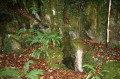
The vegetation of this mountain range reflects the extent of soil dryness caused by the terrain and the highly permeable nature of the subsoil. This is a south-facing slope, which is very sunny, well sheltered and fairly arid. On the northern slope, the situation is quite different, with a mix of deciduous and coniferous trees: boxwood, birch and hazel – two pioneer forest species – as well as larch, American red oak and beech – two species that colonised the forest in the late 19th century – alongside Douglas fir and spruce. On the ground and on the trunks, mosses and ferns take centre stage.
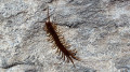
The wildlife is mainly aerial: many birds of prey live within the reserve’s boundaries.

Geology
It is well worth consulting the guide published by the Saint-Pé tourist office, which provides an excellent description of the surrounding environment: the ‘sentier kastique’ of Saint-Pé-de-Bigorre, which is mentioned on the tourist office’s website and in the linked leaflet.

Trails in the area
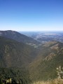
- At the first junction, after Marker 109, the path leading up towards the heights forms part of a section of an old route from the ‘first-generation’ karst trail, still referred to as the ‘Discovery Trail’ on IGN maps. It leads up to the heights of La Pâle, at a place called Sauguet, passing by the ‘picnic table’ viewpoint above Saint-Pé. At the end of the trail, there is a stunning view over the Génie Longue Valley.
- From the Ferme Soulas car park, this is the starting point for the Pladi trail, which also leads to the ridges of the Soum d’Azerole and the Mout-Néü, and to the Cot du Prat d’Aüreilh.

Places to visit nearby
- The town of Lourdes;
- The Batsurguère Valley;
- The village of Saint-Pé-de-Bigorre, with its cultural heritage, events, the Très-Crouts Forest and the Pibeste-Aoulhet Regional Nature Reserve, as well as water sports.
- The Bétharram Caves;
- The Gaves Valley,

Other walks in the area

For more walks, use our search engine .

The GPS track and description are the property of this route's author. Please do not copy them without permission.