Country:

 City:




As the route does not form a circular route (unlike my usual habit), you’ll need to park a car at the finish before heading to the starting point (or arrange to be picked up by a kind soul at the finish).
The starting point is situated in the heart of the countryside at the end of a tiny, barely passable road, at a place known as Le Col de Bellocq (or Cot de Belloc), a place name which quite aptly describes this beautiful spot (Bell-Lloc, meaning ‘beautiful place’). Park your car at the foot of the sign posted by the National Forestry Office and the Regional Council, which describes the walks in the Vath Vielha (meaning ‘valley of hamlets’ in Bearnese, pronounced ‘Batbielle’).
The route is marked in yellow, as are practically all the walks in the massif.
(S) The path starts immediately to the left of the signboard with a gentle climb through the forest. The Cabane d’Isarce is signposted as being 2½ hours away; this time is for keen walkers, but it’s a fair trek even for those who take it at a leisurely pace.
As this side of the massif faces due north, at this altitude – from 400 m upwards – the vegetation is lush and dense, and the undergrowth is very damp.
For a few hundred metres, follow the high-voltage power line parallel to it towards the south-east; the path then branches off to the south, then to the west, still through the forest with a moderate to steep gradient.
Pass the Source de Gourret des Porcs (or Fontaine de Court des Ports on Geoportail). At an altitude of around 800 m, after about an hour’s climb, you’ll reach a large, sloping meadow.
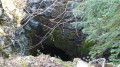
(1) The path splits into two: straight ahead, it leads to Arthez-d’Asson, via the Asson quarry, along the Nabails (or Niébras) path; to the left, at a 90° angle, is the ascent to L’Isarce via the Liots (or Liets on the IGN map) path. Continue along this left-hand path as it climbs, passing the 968-metre mark and reaching the plateau at the 1089-metre mark, where the Grotte de Bérouéde-dessus is situated (30 metres to the left of the path).
(2) Just past a small meadow, which precedes the steep climb up Les Escalats, the path takes the name Era Amarradéro (a ravine used as a chute for felled timber).
Continue through a magnificent beech forest; the vegetation becomes less dense and the ground drier.
A straight, steady climb takes you from 1,089 m to 1,242 m, where you reach the Source de l’Abérouède. Here you’ll find a concrete trough, a protective fence for livestock and, a few dozen metres further down, a plastic cistern, all on the edge of the woodland. It takes 5 minutes to reach the Cabane de l’Isarce.
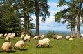
(3). The landscape changes completely over the next hour and 45 minutes as you pass through the summer pastures characteristic of the Pyrenees at this altitude. From June onwards, you’ll come across cows and sheep all along the route.
Once past the hut, continue the ascent to reach, in a few minutes, the Plateau de l’Isarce and the plateau’s ridge at an altitude of 1,350 metres.
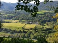
Start to take in the magnificent views to the west, south and east. To the north lies the Pic des Toupiettes (also known as the Pic d’Araü or Arrau), which rises to 1,357 metres and features a hut and a cave.
(4) Turn right, skirting the doline to the west, which is marked at 1,294 m on the IGN map. Stay as close as possible to the ridge line. This almost coincides with the border between the Hautes-Pyrénées and the Pyrénées-Atlantiques, and thus between Gascony (or the Pyrenees) and Béarn, and now between Midi-Pyrénées and Aquitaine.
The path runs alongside the cirque of the Forêt de Saint-Pè-de-Bigorre to the north and east, with some interesting sheer drops…
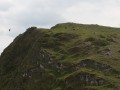
Continuing on a fairly steady ascent, you’ll easily reach the summit of the Gangues de Courraü (1,447 m), then the Soum de Marti-Peyras (1,464 m), and finally the Soum de Male-Taule (1,480 m).
All along the route, you’ll pass dozens of sinkholes on the right-hand side of the path, varying in depth (marked on the map by a circular contour line with an inward-pointing arrow and dots inside), the ruins of old stone shepherds’ huts and, above all, magnificent scenery!
After the Soum de Male-Taule, the path turns eastwards and reaches a rocky massif. Go round it to the right or left, then pass a huge, rather rocky summer pasture on your right – this is La Toue – with one last ruined hut (one of the three old huts of Latoue) and a recent cattle enclosure.
One final climb, still along the ridge, takes us to the end point of the walk: the Soum de la Génie Braque at an altitude of 1,529 metres.
Enjoy a 360° view: the Tarbes and Pau plains, the main range of the Pyrenees and, closer by, the Saint-Pé cirque, the Soum de Moulle (1,544 m), the Pic de Hourbilagous (1,460 m), the Soum du Montné (1,387 m, with its electricity pylons)...
(5) Leave the Soum de la Génie Braque via the eastern route. Take care not to lose the path, as although the markings are clearly visible, they are quite widely spaced and no continuous trail is really visible. Do not hesitate to turn back if you go more than 2 minutes without seeing a yellow marker!
At 1,455 m, join a clearly marked trail at the signpost for the Bosc deth Troncar.
Carry on towards the Cabane de l’Aoulhet and continue along the cliff face, then the steep slopes of the Cirque de Saint-Pé, passing numerous sinkholes on your right, followed by the peaks of Hourbilagous and Miquéu.
(6) Just before the Col du Larbastan (1,350 m, not shown on the IGN map, but indicated by a sign on a rock at the site), turn left, heading due north, down towards one of the many springs of the Génie Braque stream. Just before turning, you’ll notice a cattle gate at the foot of the spring from the path. Leave this on your right and take the track running along the hillside towards the west.
Leave the rocky barrier at 1,250 m on your right as well and go round it to the west. Then head downwards, following animal tracks towards a small, isolated tree at the edge of the cliff, at 1,150 m. The path is not clearly marked and is no longer signposted.
(7). Make your way to the Source de Bat dé Haü (there is no longer a hut, as erroneously stated on the IGN map, but only its ruins just behind the three-way signpost for the nature reserve), sometimes through tall grass. There, the nature reserve signpost reads ‘Vath de Hau’ (the ‘V’ is pronounced ‘B’ in Bigourdan/Gascon/Béarnais) and a plaque on the rock reads ‘Source de Bat de Haou 1060 m’.
The spring flows directly into a trough, protected by a grille, exactly like the previous two.
(8) Go round the spring to the south and west, keeping it on your right. Then head towards “Sep – Parking”. The path then enters a section that is very poorly maintained on the right bank of the Génie Braque, as indicated on the ground and marked from time to time in yellow. In the first sloping meadow, pass the fallen tree on the right.
NB. The IGN map, however, shows a purple path on the left bank. I didn’t go looking for it, as the rain was starting to make my presence there rather unwelcome...
100 metres lower down, join a path in better condition and, a further 550 metres lower down, reach the Sep pumping station without any trouble.
The path we’ve just followed is clearly marked in yellow and features several numbered markers painted red, as is the case throughout the massif. However, it continues to descend gently and you mustn’t lose heart… The vegetation here is once again lush, even more so than at the start; some parts of the forest never see the sun. You’ll pass by several caves marked on the map before arriving at the pumping station (E).


 Tourist office
 Easy
 Visorando Member
 Difficult