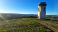
In the footsteps of Gaston Fébus in Montaner

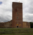
This walk takes you past the unmissable medieval castle of Gaston Fébus, built entirely of brick, and explores the countryside around the village of Montaner.

Details

n°10031827
Creation:
Last update:
Last review:
  • Walking
    Activity: Walking
  • ↔
    Distance: 6.68 mi
  • ◔
    Average duration: 3h 45 
  • ▲
    Difficulty: Moderate

  • ⚐
    Back to start: Yes
  • ↗
    Ascent: + 797 ft
  • ↘
    Descent: - 778 ft

  • ▲
    Highest point: 1,138 ft
  • ▼
    Lowest point: 797 ft
  • ⚐ Country: France
  • ⚐ City: Montaner (64460)
  • ⚑
    Start/End: N 43.345568° / W 0.008435°
  • ❏
    IGN map(s): Ref. 1644SB, 1645SB
  • Hour-by-hour weather

Photos

Description of the walk

Park near Montaner Town Hall

(S/E) In front of Montaner Town Hall, take Costa de Fébus Street. At the junction with Church Street, carry on straight ahead for a few metres, then turn right onto a dirt track leading to the edge of the woods. There, several paths lead up to Montaner Castle.
You’ll reach the junction with the rampart walk, below the castle.

(1) Turn left to climb the path facing the castle and continue straight on along the rampart walk. Follow this path downhill until you reach the D62 road.

(2) Turn right and carry on straight ahead, leaving the D225 road on your right. Cross the bridge over the Lys Daban.

(3) Immediately afterwards, take a dirt track on the right. Continue along this track, which has several bends, and ignore the side paths. You’ll come out onto another track; follow it to the right and you’ll immediately reach a junction with a tarmac road.

(4) Turn right and stay on this track, which becomes a tarmac road, until you reach Peyroutou Farm.

(5) Take the path on the left just after the farm. At the junction with the D63 road, turn right and, a short distance further on, turn left. Pass in front of a riding centre and cross a country lane.

(6) Turn left and head straight down the slope. Take care: the path is slippery and in poor condition. Continue to the junction with a track and turn right. Follow this track to a T-junction.

(7) Turn left and carry on until you reach the D225 road. Turn right, then pass a junction and take a path on the right, which is not very visible.

(8) Stay on this path as it climbs, then cross a tarmac road, walk past a house and carry on straight ahead until you reach the D63 road, then turn right. Follow the bend in the D63.

(9) Turn left onto a path which crosses a meadow and leads into the woods. Please note: the path is barely marked, if at all, on the ground. This path joins the tarmac road passing in front of Gardey Farm. Continue down the tarmac road until you reach the three-way junction.

(10) Turn left and stay on this road until you reach the junction with the D225. Turn right and continue to Montaner Town Hall (S/E).

Waypoints

  1. S/E : mi 0 - alt. 850 ft - Town hall car park
  2. 1 : mi 0.46 - alt. 1,066 ft - Wall walk - Château de Montaner
  3. 2 : mi 0.92 - alt. 807 ft - Mouret track
  4. 3 : mi 1.15 - alt. 797 ft - Mouret, after the - Lis (rivière)
  5. 4 : mi 1.99 - alt. 1,079 ft - Junction with the Nicoulau path
  6. 5 : mi 3.28 - alt. 1,089 ft - Peyroutou
  7. 6 : mi 3.62 - alt. 1,106 ft - Talabot Track
  8. 7 : mi 4.34 - alt. 915 ft - Junction of country lanes. Passage close to - Uzerte (cours d'eau) - Affluent du Lis
  9. 8 : mi 5.12 - alt. 988 ft - D225 road – Path starts on the right
  10. 9 : mi 5.83 - alt. 1,125 ft - D63 road – Path starts on the left
  11. 10 : mi 6.39 - alt. 869 ft - Lavielle
  12. S/E : mi 6.68 - alt. 850 ft - Town hall car park

Notes

Poorly maintained path after point (6)
Poorly maintained path after point (8)
Path difficult to follow on the ground after point (9)

Worth a visit

Montaner Castle
Montaner Church

Reviews and comments

3.8 / 5
Based on 2 reviews

Reliability of the description
4 / 5
Ease of following the route
3 / 5
Route interest
4.5 / 5
Kokolapin40
Kokolapin40

Overall rating : 4 / 5

Date of your route : May 13, 2024
Reliability of the description : ★★★★☆ Good
Ease of following the route : ★★★☆☆ Average
Route interest : ★★★★★ Very good
Very busy route : No

The variety of landscapes, the views and the fact that it wasn’t very busy meant we had a lovely afternoon out as a family. It was just as well we’d downloaded the map before setting off, as there are very few signposts there!

Machine-translated

Castelet
Castelet

Overall rating : 3.7 / 5

Date of your route : Aug 21, 2023
Reliability of the description : ★★★★☆ Good
Ease of following the route : ★★★☆☆ Average
Route interest : ★★★★☆ Good
Very busy route : No

A lovely walk in the countryside. The section leading to the village of Montaner isn’t easy to follow. You have to climb over fences, cut across a meadow, join a path at the edge of the forest… and so on. We thought we’d got lost, but it turned out to be the right way after all!

Machine-translated

Other walks in the area

For more walks, use our search engine .

The GPS track and description are the property of this route's author. Please do not copy them without permission.