Country:

 City:
City:


Access: from Saint-Pé-de-Bigorre, cross the Gave de Pau at the bridge in the Le Bout-du-Pont neighbourhood.
Follow the signs for ‘Monastère de Bethléem’ until you reach a small road on the right signposted ‘Sep’. Take this road, then follow the track for a few hundred metres until you reach a pumping station. Park in the adjacent car park.
(S/E) At the corner of the station’s fence, on the river side, take the path which descends steeply towards the Génie Braque. Cross the footbridge and climb up the opposite slope to the site of a former Second World War youth work camp, the old Castets clearing.
There are several ruins here (low walls, slabs, a brick chimney and a ruined barn). Today, the site is often used as a camping area by Scouts in the summer. Numerous paths make it difficult to reach the ruined barn shown on the map, not far from the “Grotte de Castets” marker. A good landmark is the bearing to the barn from the river crossing: 165°, following several paths through the undergrowth, which are more complex than the dotted line on the map.
Leave the ruined barn on your left and continue straight on, climbing slightly until you reach the far end of the clearing (a wooden Scout structure for their flagpoles often stands majestically here). The path is no longer marked on the IGN map but can still be found on OpenStreetMap.
(1) After a short, very steep climb, just behind a tree at stone marker No. 193, leave the path which descends straight back down into the valley and turn right at a right angle, heading uphill towards the west (towards Coumo Lio).
NB: numerous stone markers (white and red) dot the massif in this way; they demarcate the indivisible State-owned Forest of Saint-Pé. This is the only one visible along the entire route.
The path climbs gently; it is well-defined, fairly wide but unmarked. However, quite soon you will spot a few blue spray-painted marks on the trees, mainly on the right-hand side of the path. Continue along this old mule track, which is often bordered by a low dry-stone retaining wall on the right.
(2) 310 m after marker No. 193, you’ll reach a junction that’s not very visible but marked with the letter ‘L’ (indicating a left turn), painted in blue on a tree to the right of the path.
Turn left – practically retracing your steps – onto a path which very quickly becomes clearly marked and signposted in blue.
Walk just a few dozen metres on level ground and, at a junction marked by a fairly low cairn made of two large stones, take the path on your right which leads into the forest and up the slope of the Sarrat dets Castets.
From here, the path is particularly narrow and very poorly marked.
Although there are no traditional markings, you will still find ‘logging trail markings’ (see Practical Information below) almost all the way to point 8.
260 m after point 3, you’ll also start to come across occasional markings, mostly in red paint, or sometimes orange, or occasionally with red strips of fabric.
Continue the ascent, keeping well on the ridge (the Sarrat).
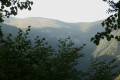
In the distance to the left, there are several wonderful views of the Soum des Toupiettes, the summit of the Araü mountain.
(3) Just before the 946-metre point, cross a 5-metre ledge (R5), keeping slightly to the right of the ridge where you’ll need to use your hands. It is not exposed.
Shortly afterwards, the path veers slightly to the left of the ridge.
(4) At the Couhéssadéres (confessionals) site in Calihourc (a dark, unpleasant spot; a den; an ugly, poorly situated wood) (NNMSC = name not shown on maps), take a short photo break then continue along the ridge, through a young beech forest and undergrowth that is becoming increasingly sparse.
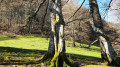
(5) Reach the pretty, level clearing at Couret Beroy (NNMSC). A fine tree stands in the middle of it. The logging trail markings, or red and orange markings, come to an end.
This is the junction with the path known as the Sentier des Tachouères (NNMSC), which links the Aülhet mountain pastures with those of Bat dé Haü. The markings are yellow.
The path leaves the clearing to the west and continues through an ancient beech forest. First, leave the first valley, the Lio, on your right; it has several tributaries, all very ravine-like.
Pass beneath the Soum des Briolles (or Soum de Mesplé, NNMSC) on the left, with its gentle slopes that lead down to the path you are following. At the same time, leave the first sarrat, the Abédat (NNMSC), on your right.
You will also pass the Coumat de la Lit and reach the Sarrat de la Garro (NNMSC), clearly visible on the right.
Still deep in the forest, shortly after the ridge, leave the path to your right and descend onto the crest. As soon as possible after the rocky outcrops, turn right along the cliff face, down a very, very steep slope.
NB: without a GPS, from here to point 8 and La Génie Braque, finding the trail may prove difficult...
(6) A few dozen metres further on, you will find the entrance to the Gouffre de la Tranchée in a crevice. The entrance is nestled between two elongated rock formations, as if in a trench, hence its name.
This is the second entrance (or exit) to the Paybou-Tranchée network on the left-hand slope of the sarrat (to the west), which descends towards La Génie Braque.
On your way back, head in a northerly direction (azimuth 225°).
(7) Reach the Gouffre de la Garro, also known as the Gouffre de la Waterfall.
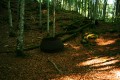
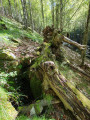
It is easier to locate using a GPS. A large, fairly short beech tree, about 40 cm in diameter, has fallen and is covering the mouth of the 13-metre-deep entrance shaft (see photo No. 130704).
Continue the descent for just a few tens of metres in elevation, whilst heading northwards. Avoid several rocky outcrops by keeping them on your right.
A cairn-marked path may sometimes be visible, leading to the chasm.
Warning! You must use a GPS to locate this chasm, as it must be approached from the bottom rather than the top of the slope (risk of slipping and falling into the chasm).
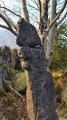
''NB: When looking up the slope from the bottom, the location of the chasm can be identified more easily by the presence of a striking beech tree with a large branch extending from its base and rising steeply vertically to form a U-shape (see photo No. 130700).
''
(8) Reach the entrance to the chasm. “It’s enormous! The diameter is around ten metres. The entrance shaft is 45 m deep. Standing on its edge, you feel as though you’re being sucked into the void. Caution: danger!
The dimensions of the cave itself are impressive: 1,400 metres in length and a vertical drop of 181 metres!”
Continue the route by heading down the slope towards the north-west, with the Génie Braque as the junction point, at the minimum distance between it and the Sentier de Gatès (NNMSC; path towards Bat dé Hau, shown in black and purple dotted lines on the IGN map), at elevation 830. The azimuth is 290°. Take care on the descent; there are several rocky outcrops to avoid, and there has already been an accident in this area in the past.
Crossing the Génie presents no difficulty (except possibly during high water following a storm).
Quickly rejoin the Sentier de Gatès. Turn right onto this path, which is very well marked and signposted in yellow.
This descent may seem quite gentle compared to the route taken so far.
At the 466-metre mark, leave the path and join a section of well-tarmacked road. Continue along this road for a few dozen metres until you reach the car park (start/finish).




 Visorando Member

 Moderate
  Tourist office