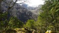
The Aygo Blanco Cave-Spring-Resurgence in the Très Crouts Forest

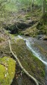
The Très Crouts Forest holds many curiosities. Here is an unusual one, as it is very rare in this area: a very active resurgent cave. At Aygo Blanco, the torrent gushes from the mountain at 650m and plunges 120m down through a series of small waterfalls, where the river spreads out its white angel’s hair…
An enchanting walk to discover this hidden gem!
Most of the route follows a path in reasonable condition, although it is old and unmarked.
The final 100 metres are quite rugged.

Details

1094478
Creation:
Last update:
Last review:
  • Walking
    Activity: Walking
  • ↔
    Distance: 2.10 mi
  • ◔
    Average duration: 1h 40 
  • ▲
    Difficulty: Moderate

  • ⚐
    Back to start: Yes
  • ↗
    Ascent: + 833 ft
  • ↘
    Descent: - 823 ft

  • ▲
    Highest point: 2,116 ft
  • ▼
    Lowest point: 1,312 ft

Photos

Description of the walk

Park in the Sep-Peyras car parks at the Monastère de Bethléem, the former Peyras farm, in Saint-Pé-de-Bigorre, after following a small winding road from the village into the heart of the national forest.

(S/E) The path, which is fairly wide and marked in yellow, starts to the right of the entrance gate. Lined with low walls of large dry stone, it runs horizontally for about 300 metres.

At the first Fork in the road, go straight on (to the left, the yellow-marked path is signposted ‘Cabane d’Aoulhet’).
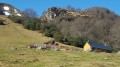
From there, there are no further proper markings. Within a few tens of minutes, you’ll reach the Coumo Redo (Coume Rede) stream, which is sometimes dry. Ford it near the Scouts’ footbridge. Then the easiest route climbs up to a ruined barn and a former Second World War youth work camp, Les Castets, now used as a camping site by the Scouts in the summer.

After the ruined barn, turn left and continue to the far end of the clearing (a Scout building for their huts stands majestically here). The path is no longer marked on the IGN map (but it can still be found on OpenStreetMap).

(1) After a short climb, just behind a tree, at stone marker no. 193, leave the path which descends back into the valley and turn right, heading uphill towards the west (towards La Coumo Lio). Numerous stone markers (white and red) dot the massif; they demarcate the undivided Saint-Pé–State state-owned forest. However, this is the only one visible on this particular route.

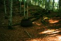
The path is well-defined and fairly wide, but not signposted. However, you’ll soon spot some blue spray-painted marks on the trees. Stay on this old mule track, which is often bordered by low stone walls on the right.

(2) 700 metres further on and 100 metres higher up, the path seems to come to an abrupt halt. In fact, it makes a sharp bend to the left around a large beech tree, climbing steeply, then around two smaller ones, before continuing its route towards the south-west. You need to keep a close watch so as not to lose the trail, which is now becoming very narrow, little-used and strewn with leaves.

You’ll need to cross a small, very damp gully cluttered with trees, staying on the contour line.
The terrain is at times very rugged. The end is near, with a few hairpin bends to complete the ascent along the edge of the gully.

The beautiful Aygo Blanco then gradually comes into view in the distance, its sound of cascading waterfalls growing louder.
Do not descend too far in their direction, as you risk passing at the foot of a rocky outcrop. Stay on the path that runs above this outcrop.

(3) You finally reach the Aygo Blanco resurgence. The path even passes directly above the cavity before continuing towards the Coumo Lio ravine.

After a few metres in the open air over almost smooth, horizontal slabs, the river plunges down to join the Génie Braque. You can explore these by descending the torrent along one of the two banks, provided you are not put off by the slippery, muddy edges or the slopes littered with rocks and brambles.

The beautiful Aygo Blanco then reveals the full splendour of its beauty, spreading its angelic hair across the limestone eroded by the water. Beneath one of the small waterfalls, on the left bank, you can glimpse a large, damp rock shelter…

The return journey follows the same route, apart from two optional detours:
- the Regard d’Aygo Blanco,
- the Trou de Coume Rede.

Leave the resurgence via the path you took on the way out, and immediately head off-track up the north-easterly slope, at an angle of approximately 50° from the path; a GPS will make finding it much easier.

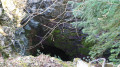
(4) Reach the entrance to the cave, the Regard d’Aygo Blanco. It is a penstock-style entrance. It was discovered in 1979 by the ADERS of Pau. It allows you to almost reach the underground section of the Aygo Blanco river, after a difficult 50-metre crawl… but only just beyond a simple fault between the rocks, about 10 metres wide... through which you can hear the rushing water but cannot see it.

Head back down the path and stay on it.

(1) At marker 193, turn right (instead of left) onto the path leading down towards Coumo Redo.
Very soon, on the right-hand side of the path, you’ll reach the cavity known as the Trou de Coume Rede. It is 3 metres deep and 3 metres wide. You’ll therefore almost reach the bottom of Coumo Redo.

Wade across Coumo Redo and continue along the opposite bank heading north until you reach the Scouts’ footbridge.
Then follow the same path as on the way there, but in the opposite direction, to return to the car park (S/E).


Waypoints

  1. S/E : mi 0 - alt. 1,316 ft
  2. 1 : mi 0.44 - alt. 1,516 ft - Marker 193 at Les Castets
  3. 2 : mi 0.84 - alt. 1,883 ft - Turn left as you climb
  4. 3 : mi 1.04 - alt. 2,106 ft - Aygo Blanco resurgence
  5. 4 : mi 1.1 - alt. 2,116 ft - Regard d’Aygo Blanco Cave
  6. S/E : mi 2.1 - alt. 1,312 ft

Notes

As is often the case, I’m taking you along little-known, unmarked paths that are sometimes even hostile to walkers: here, the slopes of the Serrat deth Castets.
All these ancient places – and sometimes the paths themselves – are briefly described by Abbé B. Abadie in his 1969 book *Le Sanglier du Picharrot*.

Warning!
This hike takes place in the heart of the wilderness in a rather challenging environment: steep slopes, rocky outcrops, cliffs, thorny undergrowth, a complete lack of signposting, and at times no clearly visible trail… This is why it is reserved for seasoned hikers with a good sense of direction. A GPS device may also prove very useful.
The paper IGN map shows no path between (1) and (3), but the OpenStreetMap digital map roughly indicates a route.
This walk is classified as ‘Difficult’ due to the challenges described above, particularly the numerous sections without signposting. The route is still suitable for families, provided there is an experienced walker in the group or a GPS device is used. Not recommended for children under 10 or people with reduced mobility.

Estimated time
I completed this route in 1 hour 55 minutes, including breaks, photos and visits to the entrances of several caves along the way. This is a fairly tight estimate, given the route’s difficulties. Allow at least 2 hours 30 minutes to be on the safe side, or set off in the morning with a packed lunch to eat there, returning in the afternoon.

Water sources
None of the rivers encountered are known to be safe to drink from. You should be wary of all springs or water sources you come across, as drinking water in the mountains is not guaranteed to be risk-free...

Places to stop and take shelter
In the event of heavy rain or thunderstorms, there is no proper shelter along the route.
Only the entrance to Aygo Blanco (3) might possibly accommodate three or four walkers crouching and huddling under its entrance porch.
There are also a few makeshift shelters provided by low walls or rock faces dotted here and there.

Equipment
Bring the usual equipment for a mid-mountain hike (hiking boots, suitable clothing, rainwear, water, food, survival blanket, knife, compass, map, whistle, GPS, etc.).

Visitor numbers
In spring and summer, from (S/E) to (1), you may come across a few hikers. Very rarely anyone in winter.
Further on, up to (2), it is not uncommon to come across cavers, as both above and below (2) there is a very popular cave system (“the second most beautiful in the Hautes-Pyrénées”: the Moustalhous network).
Beyond that, encounters are rare… until the publication of this walking guide.

Spelling of place names / Toponymy
Several place names have different spellings: in Occitan, Bigourdan, Gascon, Frenchified Gascon, French, and the IGN’s distorted version.

Worth a visit

General information
The Aygo Blanco resurgence.
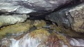
With a good torch or headlamp, you can explore the interior of the cave, from which the turbulent waters of the resurgence gush forth.
Aygo Blanco, resplendent in its finest finery, hardly hides its inner workings…
But only the brave, prepared to crawl for half an hour through water at 6°C, will be able to reach its ‘terminal’ siphon – the one that marks the end of human exploration. The water, however, comes from much further afield!
As it emerges into the open air, the water deposits its bacteria onto the limestone pebbles at the bottom of its bed, staining them blood-red. Pick one up to see for yourself!
A resurgence is a large spring gushing from a cavity of varying size.
The Aygo Blanco, situated on the Serrat deth Castets in the Très Crouts forest, near Saint-Pé-de-Bigorre, is one such resurgence.
It has a very strong flow and is distinctive in that it emerges from a very low but very long cavity – accessible to the most intrepid cavers – in freezing water (7°C on average) before ending in an impenetrable siphon.
Upon emerging into the open air, the water plunges down in a series of small waterfalls into the Génie Braque stream, which then flows into the stream known as ‘des 2 Génies’ (Braque + Longue), and finally into the Gave de Pau.

Flora and fauna
The vegetation of this massif reflects the extreme dryness of the soil, due to the terrain and the highly permeable nature of the substrates
which are highly permeable, but this is offset by very high rainfall and cloud cover: boxwood, beech, lime, hazel and ferns of all kinds are ubiquitous… This is why the wooded slopes are very damp and can sometimes be very slippery. (source: Saint-Pé Tourist Office).
Part of the walk runs alongside the Saint-Pé ‘Integral Biological Reserve’ (RBI), covering 1,010 ha of the 2,588 ha of the undivided forest of Saint-Pé (see the onf.fr1 and Natura 2000 websites).
Regarding the rationale for leaving “dead” trees in place, there are some interesting articles on the Wikipedia pages on Deadwood and List of ancient primeval forests.
You can spot the specific markings for this RBI, which consist of blue markings on a white background on certain trees and, occasionally, the letters “RBI” or a detailed information sign.

With a bit of luck, you may also come across a wealth of wildlife. In particular, wild boar, roe deer, countless birds and various insects, slugs, snails and occasionally amphibians (frogs, toads, newts).

Alternate routes
At (2), you can cut across the dense woodland and steep slopes to reach the base of Aygo Blanco. This reveals its lower reaches: small waterfalls and thousands of other minor resurgences. You can then fords the torrent and head up the left bank (note the beautiful rock shelter beneath a waterfall) until you reach the main resurgence.

You can enhance the suggested full route by:
- continuing along the path beyond Aygo Blanco, towards the Coumo Lio torrent. It is described as “very rough” by Abbé Bernard Abadie, the tireless walker, caver and chronicler of this mountain range.
- exploring the entrances to, or even visiting, several caves, chasms and karstic caves, most of which are not marked on the IGN map (1,600 cavities are recorded in the massif), provided you have the necessary skills and equipment! www.karsteau.org

A bit of history
The forest of Saint Pé is also known as the forest of Très-Croutz (or Très-Crouts, Tres Croutz, Tres Crouts or Tres Crots).
The origin of the name ‘Très-Croutz’ is thought to derive from the ‘Trois Croix’ (très croutz in Bigourdan/Gascon) carved into the stone at a place known as ‘la Toue’, right in the heart of the massif, at an altitude of around 1,400 metres.
The Three Crosses bear witness to age-old pastoral conflicts between Asson, Salles and Saint-Pé-de-Bigorre.
In 1569, the Bearnese Protestants of the Asson Valley decided to attack the Bigourdans of the Estrèms de Salles, with whom they were disputing the Azun and Maumula mountains. The 1,500 men intended to lay waste to the village of Salles and seize all the livestock from Vergoun. But the battle was won by the Bigourdans. These conflicts became so serious that the King’s army had to be called in. It was impossible for the Bishop of Tarbes to restore harmony. Source: Abbé B. Abadie, *Le Sanglier du Picharrot*, published by Marrimpoey Jeune.
At a place known as ‘Très-Croutz’, the bishoprics of Tarbes, Lescar and Oloron converged on this mountain.
Today, all that remains are three crosses carved into a rock, along with the inscription ‘1716’. They can be found on the IGN map between the ‘u’ and the ‘e’ in ‘La Toue’.

Nearby attractions
- The town of Lourdes and the Marian Shrine;
- The Batsurguère Valley;
- The village of Saint-Pé-de-Bigorre, the village itself, its cultural heritage, its events, the Très-Croutz Forest and the Pibeste-Aoulhet Regional Nature Reserve, water sports;
- The story behind the reserve’s new signposting in autumn 2014;
- The Gaves Valley;
- Hiking trails organised by the Saint-Pé Tourist Office

Find out more...
- It is well worth consulting the website and publications of the Pibeste-Aoulhet Regional Nature Reserve. The most notable of these is the “reserve guidebook”, packed with information, routes and anecdotes!
- The Saint-Pé Tourist Office also publishes numerous brochures and detailed hiking suggestions. One of the brochures may be of interest for discovering the massif’s flora and fauna: the ‘Karst Trail’ brochure, even though it does not cover this particular hike.
- The former Peyras farm, now the Monastery of Bethlehem.
- You can immerse yourself in local literature:
Abbé B. Abadie, *Le Sanglier du Picharrot* (published by Marrimpoey Jeune),
Jacques-Emile Mengelle, *Bigorre de mon enfance*,
Jean-Claude Mengelle, *Le solitaire de la Gargante*.

Reviews and comments

5 / 5
Based on 2 reviews

Reliability of the description
5 / 5
Ease of following the route
5 / 5
Route interest
5 / 5
MCTOUL
MCTOUL

Overall rating : 5 / 5

Date of your route : Aug 05, 2024
Reliability of the description : ★★★★★ Very good
Ease of following the route : ★★★★★ Very good
Route interest : ★★★★★ Very good
Very busy route : No

I’ve done this walk again, and it’s still just as enjoyable. This large spring is remarkable
The path, which was previously overgrown with ferns and brambles, has been cleared thoroughly. A few sections with fallen trees to work around, but no real problem.
The area around the spring has also been cleared.
Below the spring, numerous trees fell during the winter of 2023–2024.

Machine-translated

bermutibri
bermutibri

Overall rating : 5 / 5

Date of your route : Sep 10, 2018
Reliability of the description : ★★★★★ Very good
Ease of following the route : ★★★★★ Very good
Route interest : ★★★★★ Very good

A brilliant walk – a bit short, but still quite a challenge! Thank you.

Machine-translated

Other walks in the area

For more walks, use our search engine .

The GPS track and description are the property of this route's author. Please do not copy them without permission.