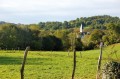
Between Saint-Vincent and Coarraze

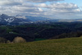
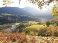
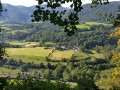
A walk above the Nay plain, with panoramic views of the Pyrenees and the Piedmont!! Bring a picnic and enjoy the fresh air!!!

Details

3143
Creation:
Last update:
Last review:
  • Walking
    Activity: Walking
  • ↔
    Distance: 14.44 mi
  • ◔
    Average duration: 8h 10 
  • ▲
    Difficulty: Moderate

  • ⚐
    Back to start: Yes
  • ↗
    Ascent: + 1,709 ft
  • ↘
    Descent: - 1,732 ft

  • ▲
    Highest point: 1,627 ft
  • ▼
    Lowest point: 922 ft

Description of the walk

(S) Starting point: Saint-Vincent.

(1) Head towards Coarraze via the D 412.

(2) As you pass through a wood, turn left straight away and rejoin the road. Turn right, then left onto the Bassots forest track.

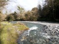
(3) Continue to Lake Sargaillouse,
Continue towards the village of Coarraze.

(4) When you reach the picnic area, turn left onto the Chemin d’Escaraude and carry on straight ahead until you reach the Route de Montaut.

(5) Turn left and continue along the road.

(6) Turn right onto the track that climbs, and carry on until you reach the road leading off to the left towards Saint Vincent.

(7) Leave this road to the left and follow the Laroin stream, then turn left, head back up towards the path you took earlier and follow it in the opposite direction to point 6

(8) At the road, turn right and head back up towards the road.

(9) When you rejoin the D 412, turn right to return to Saint-Vincent.

Waypoints

  1. S/E : mi 0 - alt. 1,621 ft
  2. 1 : mi 1.4 - alt. 1,467 ft
  3. 2 : mi 2.88 - alt. 965 ft - Lake Sargaillouse,
  4. 3 : mi 4.28 - alt. 925 ft
  5. 4 : mi 6.28 - alt. 1,207 ft
  6. 5 : mi 7.03 - alt. 988 ft
  7. 6 : mi 9.12 - alt. 1,427 ft
  8. 7 : mi 12.06 - alt. 984 ft - Return journey.
  9. 8 : mi 13.27 - alt. 1,447 ft
  10. S/E : mi 14.44 - alt. 1,621 ft

Notes

Standard hiking kit!
Don’t forget your water! And your picnic!

Worth a visit

Visit to the Barbary Rose Garden.

Reviews and comments

4.2 / 5
Based on 3 reviews

Reliability of the description
4 / 5
Ease of following the route
4.3 / 5
Route interest
4.3 / 5
CARDEILLAT
CARDEILLAT

Overall rating : 4 / 5

Date of your route : Nov 10, 2024
Reliability of the description : ★★★★☆ Good
Ease of following the route : ★★★★☆ Good
Route interest : ★★★★☆ Good
Very busy route : No

A lovely walk, but be warned: at the start, as you leave the road coming from Saint Vincent and head south through the forest, there are lots of tractor tracks – and even bulldozer tracks – which have obliterated the marked path. It was a bit of a struggle to find our way back on track...

Machine-translated

closixte
closixte

Overall rating : 4.3 / 5

Date of your route : May 08, 2022
Reliability of the description : ★★★★☆ Good
Ease of following the route : ★★★★☆ Good
Route interest : ★★★★★ Very good
Very busy route : No

It’s still a popular walk, alternating between stunning views and sections through the forest; it’s a real change of scenery and I didn’t come across anyone apart from a few farmers...
My only comments would be:
- the S/E-1-2 etc. points match up well between the description and the map, but the GPS coordinates are off by one: 1 (2.25 km) is actually 2, 8 is actually 9… it’s obvious because 1 corresponds to the start/finish, so it’s not really a problem
- the section in the forest between 2 and 3: for the stretch between leaving the road from Saint-Vincent and joining the forest track, it’s better to follow the forest track suitable for cars rather than insisting on following the GPX track or the markings on the trees (which are clearly visible): admittedly, you can make out the old path, but it’s no longer clear at all: brambles, holly, fallen branches and small trees obstruct the way and trip you up all along the route (unless you’ve got the spirit of Indiana Jones....)

The walk took 6½ hours, including a picnic break, at a leisurely pace
Very lovely in any case, with hardly any tarmac

Machine-translated

domarante
domarante

Overall rating : 4.3 / 5

Date of your route : Sep 03, 2015
Reliability of the description : ★★★★☆ Good
Ease of following the route : ★★★★★ Very good
Route interest : ★★★★☆ Good

A walk mostly through the woods, with a bit of tarmac, mainly on the last leg.
A bit of a thrill in the first stretch of woodland as only the GPS knew the route! We enjoyed a bit of adventure.
Walking poles can be a help if it’s rained, as the paths are on clay soil.
A walk worth doing again in autumn to admire the colours.

Machine-translated

Other walks in the area

For more walks, use our search engine .

The GPS track and description are the property of this route's author. Please do not copy them without permission.