Prairie de la Cantilerie or Prairie du Lapin Qui Tricote

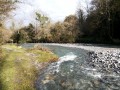
A few kilometres from the centre of Saint-Pé, a small pebble beach is the perfect spot for a refreshing dip in summer and a peaceful picnic break.
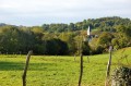
The knitting rabbit is hiding in the tall grass on the neighbouring property!

Details

180978
Creation:
Last update:
Last review:
  • Walking
    Activity: Walking
  • ↔
    Distance: 2.38 mi
  • ◔
    Average duration: 1h 15 
  • ▲
    Difficulty: Easy

  • ⚐
    Back to start: Yes
  • ↗
    Ascent: + 200 ft
  • ↘
    Descent: - 217 ft

  • ▲
    Highest point: 1,165 ft
  • ▼
    Lowest point: 1,079 ft

Photos

Description of the walk

The route starts at the Place des Arcades in Saint-Pé-de-Bigorre.
Please note: almost the entire route follows small tarmac roads, but as soon as you leave the village, you’ll find yourself in the heart of the countryside at the foot of the mountain overlooking Saint-Pé, the Araü, and its summit, the Soum des Toupiettes!

(S/E) Take Rue du Corps Franc Pommiès (Route de Lourdes). After the first junction, turn right onto the narrow lane that runs between the houses, the Passage de la Baylotte. At the end, in the small square in front of the care home, turn left onto Rue Marca, which leads down to Avenue des Pyrénées.
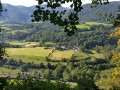
Turn right until you reach a crossroads with several streets, and there, turn right onto a grassy path (not shown on the IGN map) which descends towards the Gave, passing the imposing and remarkable Sembres Baths fountain. Leave it on your right and carry on until you reach the bottom of the tarmac road. Continue straight ahead on the level Allée des Terrasses, which runs alongside the beautiful Saint-Pé houses with views of the mountain range.

(1) Cross the railway line on the left, then the bridge over the Gave (dating from 1878). This takes you to the Bout du Pont neighbourhood.

(2) Leave the Chemin des Grottes road on your right and take the road on the left through the residential area (you’ll take the other bypass on the way back). Admire the wash house on the right, which has been completely renovated by the local residents. At the next junction, in a charming little square (playfully known as ‘Place de l’Apéro’ by the locals), turn left onto the Chemin des Génies.

(3) At the first Fork in the road, take a short detour to the left to admire the Pont du Diable, then return to the junction and turn onto the tarmac road known as the Chemin du Picharrot. Follow this track as it gradually winds its way down into the valley of the Génie Longue stream; the houses become fewer and farther between. Pass the first house on your left, then a second (a former foundry).

(4) Turn left onto the dirt track leading to Cantilerie beach.
The return journey follows the same route in the opposite direction, except at the “Place de l’Apéro”, where you turn left, then head towards the crossroads.

(2) Return to the Place des Arcades in Saint-Pé (S/E) via the reverse route of the outward journey.


Waypoints

  1. S/E : mi 0 - alt. 1,165 ft - Place des Arcades Saint-Pé-de-Bigorre
  2. 1 : mi 0.43 - alt. 1,096 ft - At the level crossing – on the way there, turn left
  3. 2 : mi 0.51 - alt. 1,089 ft - At the fork in the road – Turn left on the way there
  4. 3 : mi 0.69 - alt. 1,109 ft - Pont du Diable – Take the detour
  5. 4 : mi 1.05 - alt. 1,138 ft - At the fork in the road – take the dirt track on the left
  6. S/E : mi 2.38 - alt. 1,165 ft - Place des Arcades Saint-Pé-de-Bigorre

Notes

Water
There is a drinking water point on the route, between WPs (2) and (3) at the wash house in the Bout-du-Pont neighbourhood.

Equipment
In summer, bring the usual equipment for a lowland hike (walking/sports shoes, suitable clothing, rainwear, water, food, etc.).
Whatever the season, bring a map and route description, a GPS device or the Visorando app on your smartphone.

Worth a visit

Reviews and comments

4.1 / 5
Based on 3 reviews

Reliability of the description
4.7 / 5
Ease of following the route
4.3 / 5
Route interest
3.3 / 5
Crikey63
Crikey63
• Edited:

Overall rating : 3.3 / 5

Date of your route : Mar 07, 2021
Reliability of the description : ★★★★★ Very good
Ease of following the route : ★★★★☆ Good
Route interest : ★☆☆☆☆ Very disappointing
Very busy route : No

I don’t see the point in walking along a tarmac road, except for the last 200 metres! It’s also worth noting that there’s drinking water at the restored wash house just before the aperitif spot.

Machine-translated

rando64800
rando64800

Overall rating : 4 / 5

Date of your route : Mar 08, 2018
Reliability of the description : ★★★★☆ Good
Ease of following the route : ★★★★☆ Good
Route interest : ★★★★☆ Good

Nothing in particular.

Machine-translated

MCTOUL
MCTOUL

Overall rating : 5 / 5

Date of your route : Jul 12, 2017
Reliability of the description : ★★★★★ Very good
Ease of following the route : ★★★★★ Very good
Route interest : ★★★★★ Very good

We’ve done it time and time again this summer! It’s still just as lovely!

Machine-translated

Other walks in the area

For more walks, use our search engine .

The GPS track and description are the property of this route's author. Please do not copy them without permission.