Country:

 City:
City:


On leaving Arthez-d’Asson towards Ferrière, 200 metres before the Claria farm, take the road running alongside the castle on the left. After the bridge crossing the Ouzom, take the road on the left and park after the wash house: the Aoûle car park has three spaces available. If there are no spaces left, continue along the Route des Aoûles, then turn right onto the Chemin de l’Arrioulet until you reach a second car park with a few spaces. The walk can also start from this point, saving you a 600-metre walk.
(S) From the first car park, head up the Chemin d’Arrioulet to the right, following the Arriou Sec, until you reach the second car park: a short stop to take off any extra layers if needed and have a drink.
(1) Leave the road and head down the path on the right to cross the Arriou Sec, then climb 300 m up the path, which begins to rise steeply.
(2) At the junction, take a path on the right which climbs steeply and continues to climb steadily for just over 2 km to the hunters’ hut. To begin with, follow the edge of the woodland slightly below and to the left. The path may disappear from time to time under the fallen leaves, but there’s no need to worry if you have a GPS. Climb at a slow, steady pace to conserve your energy and reach the end of the walk without tiring.
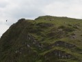
(3) Just before the hunters’ hut, you’ll be level with the Soum de Souste to the north-west. Although there’s no marked path or signposting, it’s possible to climb it, but there’s no proper track and the summit isn’t particularly interesting. A longer break is probably needed at this point. Change direction and continue south-west for about 2 km, towards the Soum d’Arangou. Over these 2 km, there is little elevation gain and no difficulty, provided you take care not to lose the track. You’ll reach a junction of paths.
(4) Turn right, heading due west, to reach the Soum d’Arangou (892), where the ascents end. It’s a lovely spot for a picnic and perhaps a short nap. The Pic du Monbula lies to the east, above you: see § Practical Information.
(5) Turn back towards the pass.
(4) Descend to the right via a series of hairpin bends and head back to the cars parked along the D126 (E).
 Visorando Member
 Difficult
 Very difficult