Country:

 City:
City:


Start from the main car park at the lake, at its eastern end. On the road between Lourdes and Pau, take the small road on the left towards Lac de Lourdes and the golf course, which are clearly signposted. Follow this road, turning left shortly after the housing estate. Park in the very large car park by the lake. Also accessible by bus.
(S/E) Go round the restaurant on the right and head up towards the fitness trail area. Continue along the well-marked path, which is not yet signposted. This path winds its way up the gentle slope to another car park on the edge of the previous housing estate. Cross the car park or go round it on the left to come out onto the Chemin du Lac.
(1) The “Tour du Lac – 6 km” signposting begins here. Follow Chemin du Lac to the left and immediately ignore Chemin Henri IV on the right. Continue along Chemin de Fould, which overlooks the lake. Stay on this small road for a long while, as it offers beautiful scenery, and ignore all side paths. You’ll reach the hamlet of Bouchède, where a large ruin stands on the right amidst overgrown vegetation.
(2) Then turn left onto a narrower road, still following the signs for the lake circuit. Pass through the hamlet of Sapa and continue westwards (with the peat bog on your left). Pass the hamlet of Artigau on your right. The path curves to the left to skirt the western end of the lake.
(3) Turn right and leave the signposted path (tree-pruning work in September 2026).
(4) Pass Lac de la Ferme Larrouy on your right. Continue across the grassy areas until you cross the new 9-hole mini-golf course, then the car park for the restaurant and clubhouse. Follow their access road and you’ll soon rejoin the signposted route.
(5) Follow the small road to the right, leaving the driving range on your left. Cross a stream and walk alongside a wetland area on your left. You’ll come out onto another road; follow it to the left to return immediately to the car park (S/E).
 Visorando Member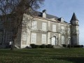
 Difficult
 Moderate