On the Plateau de Ger via the Menhir de Roye

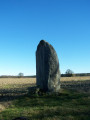
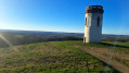
An ideal route for Nordic walking in winter as it is in very open countryside; pleasant in fine weather with magnificent views of the Pyrenees. You’ll pass the menhir on the Plateau de Ger, as well as numerous roe deer, a few does and wild boar. This route takes less than two hours to complete at a brisk pace using Nordic walking poles. Allow three hours for a leisurely walk.

Details

n°30298259
Creation:
Last update:
Last review:
  • Walking
    Activity: Walking
  • ↔
    Distance: 6.12 mi
  • ◔
    Average duration: 2h 55 
  • ▲
    Difficulty: Easy

  • ⚐
    Back to start: Yes
  • ↗
    Ascent: + 141 ft
  • ↘
    Descent: - 148 ft

  • ▲
    Highest point: 1,309 ft
  • ▼
    Lowest point: 1,198 ft
  • ⚐ Country: France
  • ⚐ City: Ibos (65420)
  • ⚑
    Start/End: N 43.245421° / W 0.024378°
  • ❏
    IGN map(s): Ref. 1645SB
  • Hour-by-hour weather

Description of the walk

Take the D817 (Pau road) to the top of the Côte de Ger. After 200 m, turn right onto a track and park behind the art gallery, alongside the woods.

(S/E) Head due north for 600 m, with the woodland on your right and the educational farm (equestrian centre) on your left.

(1) Turn left after Serre Caute and head down towards La Géline.

(2) After the Géline bridge, head left towards La Métairie and climb up to La Borde de Lescloupé (elevation 395).

(3) Turn left, heading north-west, pass by the menhir and then over the Luzerte to reach Lanyou.

(4) Follow the Chemin de Lanyou to the right as far as the altitude 386.

(5) Turn left onto a small path, then, after a left-right turn at Boué Rouy, continue straight on for nearly 450 m, ignoring a path branching off to the left.

(6) Take the next path on the left and follow it to the end.

(7) Turn left again before Pitou onto Chemin de Lasserre and walk for about 500 m.

(8) Turn right onto the Chemin de Marque Debat, then take the first street on the left.

(4) Follow the route back in the opposite direction to the Borde de Lescloupé.

(3) After 25 m, turn left heading due east towards the woods. At the end of the path, turn right and head back down towards the Géline bridge.

(2) Head back up towards Serre Caute along the same path you took on the way there until you reach (S/E).

Waypoints

  1. S/E : mi 0 - alt. 1,306 ft - Art Gallery
  2. 1 : mi 0.33 - alt. 1,306 ft - Fork
  3. 2 : mi 0.76 - alt. 1,201 ft - Géline Bridge - Géline (rivière)
  4. 3 : mi 1.43 - alt. 1,296 ft - Borde de Lescloupé - Menhir de Roye
  5. 4 : mi 1.95 - alt. 1,286 ft - Junction of the circular loop. After the - Uzerte (cours d'eau) - Affluent du Lis
  6. 5 : mi 2.57 - alt. 1,263 ft - Junction
  7. 6 : mi 3.04 - alt. 1,253 ft - Junction, near the - Lis (rivière)
  8. 7 : mi 3.67 - alt. 1,280 ft - Crossroads
  9. 8 : mi 3.96 - alt. 1,289 ft - Marque Debat Path
  10. S/E : mi 6.12 - alt. 1,306 ft - Art Gallery

Reviews and comments

4 / 5
Based on 2 reviews

Reliability of the description
4 / 5
Ease of following the route
4 / 5
Route interest
4 / 5
0316
0316

Overall rating : 4.3 / 5

Date of your route : Feb 17, 2025
Reliability of the description : ★★★★☆ Good
Ease of following the route : ★★★★★ Very good
Route interest : ★★★★☆ Good
Very busy route : No

A gently undulating route with lovely views of the Pyrenees
The menhir was discovered in the 1970s. The Ger plateau is situated in the middle of the Cami Salie, the ‘salt road’ that ran from Salie-de-Béarn to Salie-du-Salat

Machine-translated

jeanmimour
jeanmimour

Sorry, Bernadette, but there’s no mention of a collapsed bridge at marker 7 on this walk.
It’s probably just a bit of confusion with another walk.

Machine-translated

Bernadette.reynaud
Bernadette.reynaud

Overall rating : 3.7 / 5

Date of your route : May 09, 2024
Reliability of the description : ★★★★☆ Good
Ease of following the route : ★★★☆☆ Average
Route interest : ★★★★☆ Good
Very busy route : No

The bridge at marker 7, which had been reported as having collapsed, has been replaced by two large planks.

Machine-translated

Other walks in the area

For more walks, use our search engine .

The GPS track and description are the property of this route's author. Please do not copy them without permission.