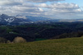
The Chemin Henri IV in Lucgarier

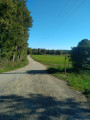
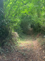
A hilly route through the woods along the Chemin Henri IV. The second part is mainly on a gravel track. There is little tarmac.

Details

61901480
Creation:
Last update:
Last review:
  • Walking
    Activity: Walking
  • ↔
    Distance: 4.34 mi
  • ◔
    Average duration: 2h 20 
  • ▲
    Difficulty: Easy

  • ⚐
    Back to start: Yes
  • ↗
    Ascent: + 410 ft
  • ↘
    Descent: - 397 ft

  • ▲
    Highest point: 1,362 ft
  • ▼
    Lowest point: 1,050 ft
  • ⚐ Country: France
  • ⚐ City: Lucgarier (64420)
  • ⚑
    Start/End: N 43.218253° / W 0.19634°
  • ❏
    IGN map(s): Ref. 1545ET, 1645SB
  • Hour-by-hour weather

Description of the walk

The car park is situated on the edge of the D145, at the top of the hill. There is plenty of space to park several cars.

(S/E) Cross the road towards Nay and immediately take Chemin Henri IV on the left. This track is wide, made of compacted earth with a few stones or branches, but nothing to cause any trouble. It can be used after a spell of rain, provided you avoid the puddles.

(1) Ignore the path branching off to the left – you’ll take that on the way back. Carry straight on along the undulating path until you reach the first junction with a tarmac road.

(2) At this junction, turn left onto this track, which soon turns to gravel. You’ll then begin a steep descent with a few bends. At the bottom, in the right-hand bend, just before the houses, look out for a track on the left.

(3) Take this forest track, which may be muddy after rain and therefore slippery. Continue along this undulating track until you reach the junction with another forest track.

(4) Turn right onto a gravel track, which marks the end of the forest tracks.

(5) Turn right and carry on to the end of this track, where you’ll come to a similar (but wider) track.

(6) Turn left, then further on take a 90° left-hand bend and join a small tarmac road at a place called Grange de Lagarde.

(7) Go straight on and climb to the top of the hill.

(8) Turn left at the right-hand bend to enter the woods and rejoin the Chemin Henri IV.

(1) Turn right to return to the car park where you started (S/E).

Waypoints

  1. S/E : mi 0 - alt. 1,263 ft - Car park
  2. 1 : mi 0.3 - alt. 1,325 ft - Junction on the circular loop
  3. 2 : mi 1 - alt. 1,335 ft - Junction with a tarmac track, on the left
  4. 3 : mi 1.41 - alt. 1,138 ft - Turn left at the fork
  5. 4 : mi 1.99 - alt. 1,145 ft - Junction, on the right
  6. 5 : mi 2.1 - alt. 1,109 ft - Gravel track
  7. 6 : mi 2.69 - alt. 1,073 ft - Junction, on the left
  8. 7 : mi 3.22 - alt. 1,070 ft - Grange de Lagarde
  9. 8 : mi 3.88 - alt. 1,276 ft - Path on the left
  10. S/E : mi 4.34 - alt. 1,263 ft - Car park

Notes

This route has been mapped manually; there may be slight discrepancies at junctions, but the directions should be clear enough.

Reviews and comments

3.5 / 5
Based on 5 reviews

Reliability of the description
3.7 / 5
Ease of following the route
3.8 / 5
Route interest
3 / 5
User 22291126
• Edited:

Overall rating : 3 / 5

Date of your route : Jul 27, 2026
Reliability of the description : Not used / Not applicable
Ease of following the route : Not used / Not applicable
Route interest : ★★★☆☆ Average
Very busy route : No

Please note: there are no signposts; we followed the route using the app. There are no markings, and trees are blocking the paths. The yellow markings are visible from the car park but disappear quickly. Avoid this route if you don’t have a map.

Machine-translated

User 19268598

Overall rating : 3 / 5

Date of your route : Nov 03, 2025
Reliability of the description : ★★★☆☆ Average
Ease of following the route : ★★☆☆☆ Disappointing
Route interest : ★★★★☆ Good
Very busy route : No

We didn't complete the entire walk... Halfway through, we didn't understand where to go, as the sign pointed to the right while the map pointed to the left... We retraced our steps.

Machine-translated

dinezia
dinezia

Overall rating : 4.7 / 5

Date of your route : Apr 10, 2025
Reliability of the description : ★★★★★ Very good
Ease of following the route : ★★★★★ Very good
Route interest : ★★★★☆ Good
Very busy route : Yes

A very pleasant walk

Machine-translated

Le Taurupt
Le Taurupt

Overall rating : 3.5 / 5

Date of your route : Feb 17, 2025
Reliability of the description : Not used / Not applicable
Ease of following the route : ★★★★★ Very good
Route interest : ★★☆☆☆ Disappointing
Very busy route : No

A pleasant stroll for a Sunday afternoon when the weather’s fine. Worth doing once, but not twice!

Machine-translated

Pymarius
Pymarius

Overall rating : 2.7 / 5

Date of your route : Oct 14, 2024
Reliability of the description : ★★★☆☆ Average
Ease of following the route : ★★★☆☆ Average
Route interest : ★★☆☆☆ Disappointing
Very busy route : No

unclear departure information

Machine-translated

Other walks in the area

For more walks, use our search engine .

The GPS track and description are the property of this route's author. Please do not copy them without permission.