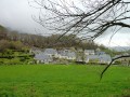
On the slopes of the Béout, via the Mouniquet farm and the Cité Saint-Pierre
This route offers a lovely walk along the wooded slopes of the Béout and ends by passing through the Mouniquet farm – with its remarkably peaceful meadows – and the magnificent grounds of the Cité Saint-Pierre.
Park in front of the Cité Saint-Pierre (or take the Citybus shuttle service run by the Town of Lourdes).
(S/E) Head south along the fence of the Cité Saint-Pierre and go through the large black gate.
(1) Take the stony track leading to the farm, continuing to follow the fence. At the end of the track, go through the gate marked ‘Trail Club’.
(2) Immediately, take the path on your right which leads into the woodland. A few dozen metres further on, a small stream (usually dry) flows in from the left and crosses the path. It feeds into the lake. Walk a few metres uphill over the pebbles and you’ll find, at the foot of the cliff, an artificial fountain and its water source flowing from the rock. Return to the path and begin the ascent, following the fence running alongside the Cité.
(3) After a short but steep climb, and 400 metres from the start of this path, you’ll reach a gate (of the sort found in towns). Enter the grounds of the Cité. Make sure you close the gate properly behind you. Keep well to the left on barely visible tracks through the ferns. Walk round the Mouniquet farm meadow, staying close to the edge, beneath the lime and chestnut trees. Keep well clear of the farm buildings and head into a small meadow on the Turun Esplat plateau. At the end of the plateau, there is a remarkable view of Lourdes. Head straight down to the right and reach a zigzagging cattle gate (in very poor condition as of October 2019). Then take the tarmac road as far as the first buildings. As soon as possible, after the sheepfold on the right and alongside the donkey enclosure, take the unpaved, stony section of the path. Join the road again in front of a large building. Continue the descent and, as soon as possible – after a bench on the right and past the large building, then a large retaining wall – take the unpaved, grassy section of the path. Head towards the exit of the Cité along the private road and reach the starting point (S/E).
Waypoints
S/E : mi 0 - alt. 1,417 ft - Cité Saint-Pierre
1 : mi 0.03 - alt. 1,424 ft - At the bend – Carry straight on along the track
2 : mi 0.24 - alt. 1,453 ft - After the barrier – Take the path on the right
3 : mi 0.75 - alt. 1,722 ft - Go through the barrier
S/E : mi 1.75 - alt. 1,417 ft - Cité Saint-Pierre
Notes
The route passes through part of Secours Catholique’s private property, the Cité Saint-Pierre, but pedestrians are permitted access via rural track No. 29 and onto the property, provided they keep quiet and show consideration for anyone they encounter on the site.
This walk is easy due to its convenient access, the safe nature of the paths used and the numerous opportunities to take a break. However, it is classified as ‘Moderate’ in terms of difficulty because the ascent in the first section is sometimes strenuous and is not suitable for very young children or elderly people. The elevation gain is still quite significant.
It can be undertaken in the height of summer as most of the route is shaded.
There is no shelter available, other than the buildings at Cité Saint-Pierre in the event of an emergency.
Bring the usual equipment for a mid-mountain hike lasting around 2 hours (lightweight walking boots, suitable clothing to protect shins and legs from ticks in summer, rainwear, plenty of water, a small snack, etc.).
Places to visit near the route: - The Cité Saint-Pierre run by Secours Catholique, which is open to visitors. A centre providing support for people living in poverty, enabling them to undertake a pilgrimage at low cost. Run by volunteers. - In particular, within the Cité Saint-Pierre (free entry), the walk around the lake, the picnic tables, etc. - The Gouffre de Lourdes: the former entrance to this remarkable cave, discovered in 1938 by Norbert Casteret and a popular destination in the early 20th century. For further information, see: Lourdes Caves Gouffre de Lourdes Lourdes News Gouffre de Lourdes
Date of your route : May 03, 2021 Reliability of the description : ★★★★☆ Good Ease of following the route : ★★★★☆ Good Route interest : ★★★★☆ Good Very busy route : Yes
We went round in circles before finding our way back at the sign for the ‘Trail Raid de Lourdes’, as there are two signs.
Only the second one says ‘de lourdes’
and you need to turn right after the first one, which simply says ‘Trail Raid’....
To open this route on your smartphone, you must have the Visorando app installed. If not, got to the Apple Store (iPhone) or Google Play Store (Android) to download the app.



 Country:

 City:
City:




 Visorando Member

 Difficult

 Easy
Easy