The Pladi Trail and the Prat dou Rey Hut

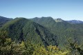
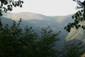
Le Pladi is a mountain pass featuring a small, peaceful clearing. This route, along the Picoulets ridge, offers panoramic views over the Sauguet pastures and the Tres Crouts forest. You can extend the walk by heading to Prat dou Rey in the Batsurguère valley, or head back down the same way.

Details

1069707
Creation:
Last update:
Last review:
  • Walking
    Activity: Walking
  • ↔
    Distance: 7.18 mi
  • ◔
    Average duration: 5h 25 
  • ▲
    Difficulty: Difficult

  • ⚐
    Back to start: Yes
  • ↗
    Ascent: + 2,411 ft
  • ↘
    Descent: - 2,395 ft

  • ▲
    Highest point: 4,160 ft
  • ▼
    Lowest point: 2,011 ft

Photos

Description of the walk

From the Soulas farm to Le Pladi
(Yellow markings)

(S/E) Start at the foot of the Couret farm. Follow the tarmac road uphill for 300 metres.

(1) Enter the nature reserve via a path that climbs to the right.

(2) At the junction by the boundary marker, follow the yellow markings to the right.

(3) You’ll come out onto the Crête des Picoulets; follow it to the left, heading south-east, before entering the beech forest.

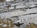
(4) After passing a clearly marked trough, turn off to the right where the path becomes steeper and less defined. Through a narrow passage between the rocks, you’ll reach the Pladi.

From Le Pladi to the Col du Prat dou Rey (Batsurguère Valley)
(Yellow markings)

(5) Cross the meadow and enter the beech forest. The start of the path is inconspicuous, so keep your eyes peeled! Within the beech forest, the path is well marked, but take care on the rocky sections until you emerge from the woods. There’s a view of the ruins below.

Next, the path through the mountain pastures crosses a small ridge and veers to the right. In good weather, the Cabane du Prat dou Rey comes into view: head towards it.

(6) Head back down the path you took on the way up to return to the car park (S/E).

Waypoints

  1. S/E : mi 0 - alt. 2,011 ft - Couret farm car park
  2. 1 : mi 0.15 - alt. 2,106 ft - On the right in the reserve
  3. 2 : mi 0.44 - alt. 2,326 ft - Signpost
  4. 3 : mi 0.85 - alt. 2,779 ft - Picoulets Ridge
  5. 4 : mi 2.1 - alt. 3,717 ft - Talweg (watercourse)
  6. 5 : mi 2.31 - alt. 3,960 ft - Pladi - Le Pladi
  7. 6 : mi 3.59 - alt. 3,960 ft - Cabane du Cot du Prat du Rey (1215m)
  8. S/E : mi 7.18 - alt. 2,011 ft - Couret Farm Car Park

Notes

Winter safety precautions
Some sections of the Picoulets ridge are exposed, whilst others can be slippery in wet weather. This walk should therefore be avoided in winter.

Shelter
The Col du Prat dou Rey hut is open all year round and is unstaffed.

Hiking guide
- A route guide is available from the Saint-Pé-de-Bigorre Tourist Office (route no. 1, Le Pladi) or can be downloaded from saintpedebigorre-tourisme.com.
- The guidebook “De bois en estives” from the Pibeste-Aoulhet Regional Nature Reserve is on sale at the Saint-Pé-de-Bigorre Tourist Office (€9, 100 pages).

Worth a visit

Pibeste-Aoulhet Regional Nature Reserve
The Pibeste-Aoulhet Massif Regional Nature Reserve is the largest regional nature reserve in mainland France, covering 5,110 hectares. It is a true gem of biodiversity, a refuge for hundreds of plant and animal species, including some of the rarest and most endangered in France and Europe, such as the bearded vulture, the Egyptian vulture and Manescau’s erodium… The reserve’s rich flora, fauna and landscapes will delight observant walkers!
''Reminder of the rules within the reserve
It is forbidden to pick plants or disturb animals, to light fires, to camp, to leave rubbish or other waste behind, to bring dogs into the reserve unless they are kept on a lead, or to introduce or destroy plants.”

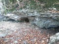
- Ruins of a shepherd’s hut

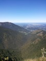
- View over the Génie Valley and the slopes of the Aoulhet

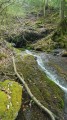
- Natural spring

Reviews and comments

4.5 / 5
Based on 2 reviews

Reliability of the description
5 / 5
Ease of following the route
4.5 / 5
Route interest
4 / 5
User 25838513

Overall rating : 5 / 5

Date of your route : Jul 31, 2025
Reliability of the description : ★★★★★ Very good
Ease of following the route : ★★★★★ Very good
Route interest : ★★★★★ Very good
Very busy route : Yes

A perfect walk where I introduced my 9-year-old son to the great outdoors for the first time.
An easy route for beginners with lovely scenery, and the weather was perfect too.

If you’re planning a short family outing with a picnic at the top, this trail is perfect.

Machine-translated

tuquoquemifili
tuquoquemifili

Overall rating : 4 / 5

Date of your route : Jun 20, 2021
Reliability of the description : ★★★★★ Very good
Ease of following the route : ★★★★☆ Good
Route interest : ★★★☆☆ Average
Very busy route : No

This walk takes place mainly in woodland and should be undertaken in dry weather due to the risk of slipping (the path becomes muddy) and, preferably, on a warm day to enjoy the coolness of the woodland.
As it is at a fairly low altitude, the view over the valley is not very clear, and the Pibeste ridge blocks the view to the south.
From Prat dou Rey, it is very easy to head west along the GR path leading to the Col de la Sède, From there, you can either climb the Soum d’Andorre or head east to follow the ridge (a well-marked, safe path) towards the Pibeste and then descend back to Prat dou Rey after completing this short, circular route, which offers beautiful views of the Pyrenean peaks – a delightful addition to this walk.

Machine-translated

Other walks in the area

For more walks, use our search engine .

The GPS track and description are the property of this route's author. Please do not copy them without permission.