Lengous and Montagnou

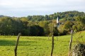
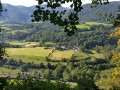
A pleasant walk through the woodland along the banks of the Gave de Pau, passing through Rieulhès, a typical Pyrenean hamlet. You’ll enjoy several remarkable views of the village of Saint-Pé-de-Bigorre.

Details

1068059
Creation:
Last update:
Last review:
  • Walking
    Activity: Walking
  • ↔
    Distance: 3.34 mi
  • ◔
    Average duration: 1h 55 
  • ▲
    Difficulty: Easy

  • ⚐
    Back to start: Yes
  • ↗
    Ascent: + 433 ft
  • ↘
    Descent: - 440 ft

  • ▲
    Highest point: 1,371 ft
  • ▼
    Lowest point: 1,066 ft

Photos

Description of the walk

Park in the Bout-du-Pont neighbourhood.

The trail is marked in yellow with the number 8.

(S/E) From the small square at Bout-du-Pont, follow the yellow No. 8 markings and the tarmac road towards the Cacha farm.

(1) At the three-way junction (Pont du Diable), continue along the left-hand road and cross the bridge. At the next fork in the road, turn left. Ignore a path branching off to the right.

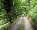
(2) At the next junction, carry on straight ahead along a track. Head into the woodland opposite and stay on the signposted path for about 1 km, ignoring any offshoots to the right (you’ll come across the source of the Lengous along the way).

(3) Follow the D151 road to the left and pass through the hamlet of Rieulhès. Cross the bridge over the Gave de Pau, then cross the railway line at the level crossing. About fifty metres further on, head up to the left under the plane trees until you reach the D937 road.

(4) Cross the road and take the signposted path opposite. Follow the yellow markings as well as the red and white markings ofthe GR®78, the Way of St James. Continue westwards, ignoring any turn-offs to the right.

(5) Below the Poueyté farmstead, take the path on the left to head back down towards the village. Near the D937, turn right onto Rue Desbarrats, then left onto Rue du Pourtalet. Go round the Place des Arcades, then walk past the church on your right.

(6) Turn left onto Rue Jacques Bronson before the chemist’s. At the end, turn right onto Avenue des Pyrénées. At the junction, carry straight on and, at the Fork in the road, take the right-hand fork. Then follow Allée des Terrasses (D152). At the level crossing, turn left, cross the railway line and cross the Gave de Pau again. Take the second left to return to the starting point (S/E).


Waypoints

  1. S/E : mi 0 - alt. 1,106 ft - Quartie du Bout-du-Pont
  2. 1 : mi 0.12 - alt. 1,109 ft - Pont du Diable
  3. 2 : mi 0.77 - alt. 1,152 ft - Lengous Trail
  4. 3 : mi 1.54 - alt. 1,168 ft - Rieulhès. Towards the bridge at - Gave de Pau
  5. 4 : mi 1.89 - alt. 1,171 ft - Crossing the D937
  6. 5 : mi 2.32 - alt. 1,368 ft - Poueyté Farm
  7. 6 : mi 2.85 - alt. 1,155 ft - Rue Jacques Bronson
  8. S/E : mi 3.34 - alt. 1,106 ft - Quartie du Bout-du-Pont

Notes

Route suggested by the Saint-Pé-de-Bigorre Tourist Office, marked in yellow with the number 8.

A route guide is available free of charge from the Saint-Pé-de-Bigorre Tourist Office on Place des Arcades (or can be downloaded from www.saintpedebigorre-tourisme.com).

Worth a visit

- Washhouse and Place du Bout-du-Pont
- Devil’s Bridge
- Washhouse and the hamlet of Rieulhès
- Place des Arcades
- Listed 11th-century church

Always be cautious and plan ahead when you're outdoors. Visorando and the author of this route cannot be held responsible for any accidents occurring on this route.

The GR® and PR® markings are the intellectual property of the Fédération Française de Randonnée Pédestre.

Reviews and comments

4.6 / 5
Based on 3 reviews

Reliability of the description
5 / 5
Ease of following the route
4.7 / 5
Route interest
4 / 5
User 19268598

Difficult start, the explanations were not very clear. Otherwise, a lovely walk...

Machine-translated

jipe12
jipe12

Overall rating : 4.7 / 5

Date of your route : Aug 13, 2024
Reliability of the description : ★★★★★ Very good
Ease of following the route : ★★★★★ Very good
Route interest : ★★★★☆ Good
Very busy route : No

A lovely walk, with lovely views of the Gave and Sant Pe
One downside: too much road, especially in sweltering heat
The route was spot on, as always

Machine-translated

Lejeune pascal
Lejeune pascal

Overall rating : 4.3 / 5

Date of your route : Jul 18, 2024
Reliability of the description : ★★★★★ Very good
Ease of following the route : ★★★★☆ Good
Route interest : ★★★★☆ Good
Very busy route : No

A lovely walk in a beautiful area; the only downside is the section through the small wood where the sign for the Saint-Jacques-de-Conpotelle route is often overgrown and poorly cleared – it’s worth doing or doing again.

Machine-translated

REPLAT17
REPLAT17

Overall rating : 4.7 / 5

Date of your route : Dec 11, 2023
Reliability of the description : ★★★★★ Very good
Ease of following the route : ★★★★★ Very good
Route interest : ★★★★☆ Good
Very busy route : No

A lovely walk with beautiful views of the Gave de Pau and along tree-lined paths. Unfortunately, the weather wasn’t on our side. Definitely one to do again when the weather’s fine, of course....

Machine-translated

Other walks in the area

For more walks, use our search engine .

The GPS track and description are the property of this route's author. Please do not copy them without permission.