Le Montagnou de Saint-Pé

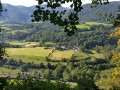
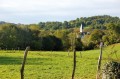
A short walk in the hills above Saint-Pé-de-Bigorre offering breathtaking views of the village and its exceptional heritage: its 11th-century church, the former seminary and Catholic school, and the remarkable streets and houses dating from the 15th to the 18th centuries.
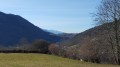
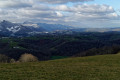
There are also beautiful views of the mountain range to the south, including the Très-Croutz forest and the ridge of the Cirque de Bat dé Haü, stretching from the Toupiettes in the west to the Aülhet in the east.

Details

514416
Creation:
Last update:
Last review:
  • Walking
    Activity: Walking
  • ↔
    Distance: 1.03 mi
  • ◔
    Average duration: 0h 40 
  • ▲
    Difficulty: Easy

  • ⚐
    Back to start: Yes
  • ↗
    Ascent: + 236 ft
  • ↘
    Descent: - 213 ft

  • ▲
    Highest point: 1,378 ft
  • ▼
    Lowest point: 1,165 ft

Photos

Description of the walk

Park on or near the Place des Arcades in the village centre.

(S/E) Take Impasse du Pourtalet, one of the five streets leading off the square, heading east.
Reach Rue Darrets Barrats (sometimes spelt or referred to as Desbarrats) via a ramp accessible to pedestrians and cyclists, near the former hosiery factory.

Continue to the right along Rue Darrets Barrats until you reach a small, shaded square. Opposite, take the narrow street leading uphill, Rue Notre-Dame du Montagnou.
Walk up this lane to its end (near a lodge) and continue along the yellow-marked path, the Chemin du Pouey (GR®®78, also marked as route No. 10 by the Saint-Pé Tourist Office or the Way of St James).

(1) Pass the junction on your left (you’ll take this on the way back).

(2) Carry on to the entrance to Poueyté Farm.

From there, the rest of the walk to the summit of Montagnou has been removed at the request of the owner of Poueyté Farm, who does not wish anyone to enter his land.

Resume the Chemin du Pouey on the descent.

(1) At the fork in the road, turn right towards Notre-Dame-du-Montagnou. Within a few minutes, you’ll reach an esplanade where a statue of the Virgin Mary, Notre-Dame-du-Montagnou, stands watch over the village. The site and the information provided are picturesque and peaceful.

Then follow the same path back to the Place des Arcades (S/E).

Waypoints

  1. S/E : mi 0 - alt. 1,165 ft - Place des Arcades Saint-Pé-de-Bigorre
  2. 1 : mi 0.22 - alt. 1,257 ft - Towards ND-Montagnou – Turn right on the descent
  3. 2 : mi 0.44 - alt. 1,378 ft - Poueyté Farm
  4. S/E : mi 1.03 - alt. 1,165 ft - 1 Rue Darrets Barrats - Place des Arcades Saint-Pé-de-Bigorre

Notes

Warning
The route no longer leads to the summit of Montagnou; since 28 April 2021, the old route – which crossed private property – has been closed at the owners’ request.

Estimated time
I completed this route in 1 hour, including breaks and photo stops. That’s quite a short time. Allow 2 hours if you’re with your family.

Drinking water
There are no water points along the walk. Bring what you need.

Shelter
There is no shelter along the route. However, at both the start and finish, the Place des Arcades offers shelter all year round under its arcades and its huge white canopy.

Equipment
In summer, bring the usual equipment for a lowland hike (hiking or trainers, suitable clothing, rainwear, water, food, etc.).
In all seasons, bring a map, a GPS or the Visorando app on your smartphone.

Footfall
Very low.

Worth a visit

Always be cautious and plan ahead when you're outdoors. Visorando and the author of this route cannot be held responsible for any accidents occurring on this route.

The GR® and PR® markings are the intellectual property of the Fédération Française de Randonnée Pédestre.

Other walks in the area

For more walks, use our search engine .

The GPS track and description are the property of this route's author. Please do not copy them without permission.